Distance between Anta and Martinho
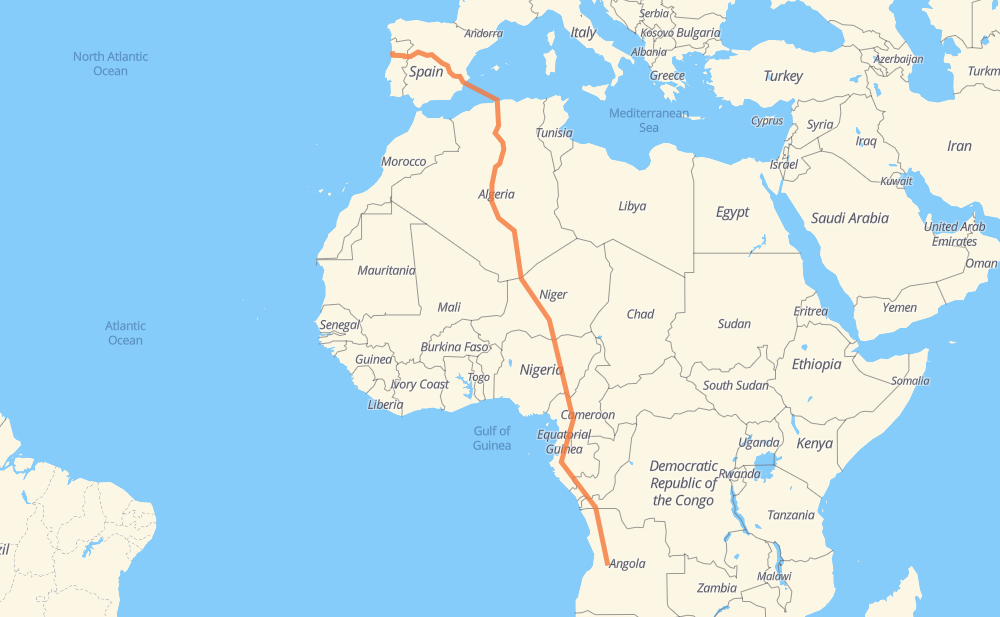
The distance from Anta to Martinho is 9,017 kilometers by road including 1,324 kilometers on motorways. Road takes approximately 123 hours and 50 minutes and goes through Ávila, Algiers, Blida, Medea, Ain Oussara, Djelfa and Laghouat.
| Shortest distance by air | 6,406 km ✈️ |
| Car route length | 9,017 km 🚗 |
| Driving time | 123 h 50 min |
| Fuel amount | 721.4 L |
| Fuel cost | 1,067.6 GBP |
| Point | Distance | Time | Fuel | |
| Nogueira da Regedoura | 0 km | 00 min | 0.0 L | |
|
A 41 A 25 435 km, 3 h 58 min
|
||||
| Ávila | 435 km | 3 h 58 min | 34.4 L | |
|
AV-20 A-31 945 km, 24 h 12 min
|
||||
| Blida | 1,380 km | 28 h 10 min | 110.3 L | |
|
A1 RN 1 25 km, 17 min
|
||||
| Medea | 1,405 km | 28 h 27 min | 111.8 L | |
|
RN 1 126 km, 1 h 31 min
|
||||
| Ain Oussara | 1,531 km | 29 h 59 min | 120.3 L | |
|
RN 1 99 km, 1 h 15 min
|
||||
| Djelfa | 1,630 km | 31 h 15 min | 128.7 L | |
|
RN 1 102 km, 1 h 10 min
|
||||
| Laghouat | 1,733 km | 32 h 25 min | 137.3 L | |
|
RN 1 186 km, 2 h 07 min
|
||||
| Ghardaia | 1,919 km | 34 h 33 min | 152.8 L | |
|
RN 1 2,170 km, 26 h 37 min
|
||||
| Arlit | 4,090 km | 61 h 10 min | 327.1 L | |
|
N 25 240 km, 2 h 30 min
|
||||
| Agadez | 4,330 km | 63 h 41 min | 346.2 L | |
|
N 25 N 11 286 km, 3 h 21 min
|
||||
| Tanout | 4,616 km | 67 h 02 min | 368.8 L | |
|
N 11 151 km, 1 h 53 min
|
||||
| Zinder | 4,767 km | 68 h 55 min | 381.2 L | |
|
N 11 81 km, 1 h 00 min
|
||||
| Magaria | 4,847 km | 69 h 56 min | 385.2 L | |
|
N 11 F.244 162 km, 2 h 00 min
|
||||
| Kano | 5,010 km | 71 h 56 min | 400.7 L | |
|
A2 A3 508 km, 6 h 09 min
|
||||
| Lafia | 5,517 km | 78 h 06 min | 440.7 L | |
|
A3 N6 571 km, 7 h 04 min
|
||||
| Bamenda | 6,089 km | 85 h 11 min | 487.0 L | |
|
N6 77 km, 56 min
|
||||
| Bafoussam | 6,166 km | 86 h 07 min | 493.1 L | |
|
N6 N4 164 km, 2 h 01 min
|
||||
| Bafia | 6,330 km | 88 h 09 min | 505.4 L | |
|
N4 129 km, 1 h 36 min
|
||||
| Yaounde | 6,459 km | 89 h 46 min | 516.2 L | |
|
N1 N2 53 km, 39 min
|
||||
| Mbalmayo | 6,512 km | 90 h 25 min | 519.3 L | |
|
N2 108 km, 1 h 21 min
|
||||
| Ebolowa | 6,621 km | 91 h 47 min | 529.2 L | |
|
N 2 RN2 1,208 km, 14 h 32 min
|
||||
| Dolisie | 7,828 km | 106 h 20 min | 625.5 L | |
|
P2 RN1 435 km, 6 h 17 min
|
||||
| M'banza Congo | 8,263 km | 112 h 37 min | 658.0 L | |
|
EN120 1,004 km, 11 h 12 min
|
||||
| Chipembe | 9,268 km | 123 h 50 min | 741.2 L | |
Frequently Asked Questions
How much does it cost to drive from Anta to Martinho?
Fuel cost: 1,067.6 GBP
This fuel cost is calculated as: (Route length 9,017 km / 100 km) * (Fuel consumption 8 L/100 km) * (Fuel price 1.48 GBP / L)
You can adjust fuel consumption and fuel price here.
How long is a car ride from Anta to Martinho?
Driving time: 123 h 50 min
This time is calculated for driving at the maximum permitted speed, taking into account traffic rules restrictions.
- 701 km with a maximum speed 112 km/h = 6 h 15 min
- 278 km with a maximum speed 100 km/h = 2 h 46 min
- 2,636 km with a maximum speed 96 km/h = 27 h 27 min
- 48 km with a maximum speed 90 km/h = 32 min
- 4,714 km with a maximum speed 80 km/h = 58 h 55 min
- 3 km with a maximum speed 70 km/h = 2 min
- 278 km with a maximum speed 60 km/h = 4 h 37 min
- 238 km with a maximum speed 50 km/h = 4 h 45 min
- 6 km with a maximum speed 40 km/h = 8 min
- 1 km with a maximum speed 30 km/h = 2 min
- 366 km with a maximum speed 20 km/h = 18 h 16 min
The calculated driving time does not take into account intermediate stops and traffic jams.
How far is Anta to Martinho by land?
The distance between Anta and Martinho is 9,017 km by road including 1,324 km on motorways.
Precise satellite coordinates of highways were used for this calculation. The start and finish points are the centers of Anta and Martinho respectively.
How far is Anta to Martinho by plane?
The shortest distance (air line, as the crow flies) between Anta and Martinho is 6,406 km.
This distance is calculated using the Haversine formula as a great-circle distance between two points on the surface of a sphere. The start and finish points are the centers of Anta and Martinho respectively. Actual distance between airports may be different.
How many hours is Anta from Martinho by plane?
Boeing 737 airliner needs 8 h to cover the distance of 6,406 km at a cruising speed of 800 km/h.
Small plane "Cessna 172" needs 29 h 7 min to flight this distance at average speed of 220 km/h.
This time is approximate and do not take into account takeoff and landing times, airport location and other real world factors.
How long is a helicopter ride from Anta to Martinho?
Fast helicopter "Eurocopter AS350" or "Hughes OH-6 Cayuse" need 26 h 41 min to cover the distance of 6,406 km at a cruising speed of 240 km/h.
Popular "Robinson R44" needs 30 h 30 min to flight this distance at average speed of 210 km/h.
This time is approximate and do not take into account takeoff and landing times, aerodrome location and other real world factors.
What city is halfway between Anta and Martinho?
The halfway point between Anta and Martinho is Adérbissinat. It is located about 7 km from the exact midpoint by road.
The distance from Adérbissinat to Anta is 4,502 km and driving will take about 65 h 35 min. The road between Adérbissinat and Martinho has length 4,516 km and will take approximately 58 h 15 min.
The other cities located close to halfway point:
Where is Anta in relation to Martinho?
Anta is located 6,406 km north-west of Martinho.
Anta has geographic coordinates: latitude 41.00786, longitude -8.61878.
Martinho has geographic coordinates: latitude -12.13333, longitude 15.41667.
Which highway goes from Anta to Martinho?
The route from Anta to Martinho follows RN 1, N 25, N 11, RN1, EN120, RN2, A3, N6, N2, A-31, N4, EN100, A-3, A 25, RN 3, F.243, A-62.
Other minor sections pass along the road:
- A-50: 98 km
- P2: 97 km
- F.244: 95 km
- EN230: 87 km
- A2: 86 km
- A236: 86 km
- A4: 82 km
- EN215: 82 km
- EN321: 71 km
- RS107: 53 km
- N 4: 49 km
- EN100A: 44 km
- AP-6: 40 km
- A1: 40 km
- A-6: 36 km
- A 1: 36 km
- N1: 30 km
- RN12: 26 km
- N 2: 25 km
- AP-51: 23 km
- RN 6: 20 km
- RS108: 14 km
- RN15: 13 km
- AV-20: 7 km
- A344: 6 km
- N3: 5 km
- N 1: 4 km
- SA-20: 3 km
- N-620: 3 km
- A 41: 3 km
- ط و 1: 2 km
- RS103: 2 km
- A-66: 2 km
- RP101: 2 km
- RN 11: 2 km
- EN 332: 1 km
- RN 8: 1 km