Distance between Arrayán and Cerro
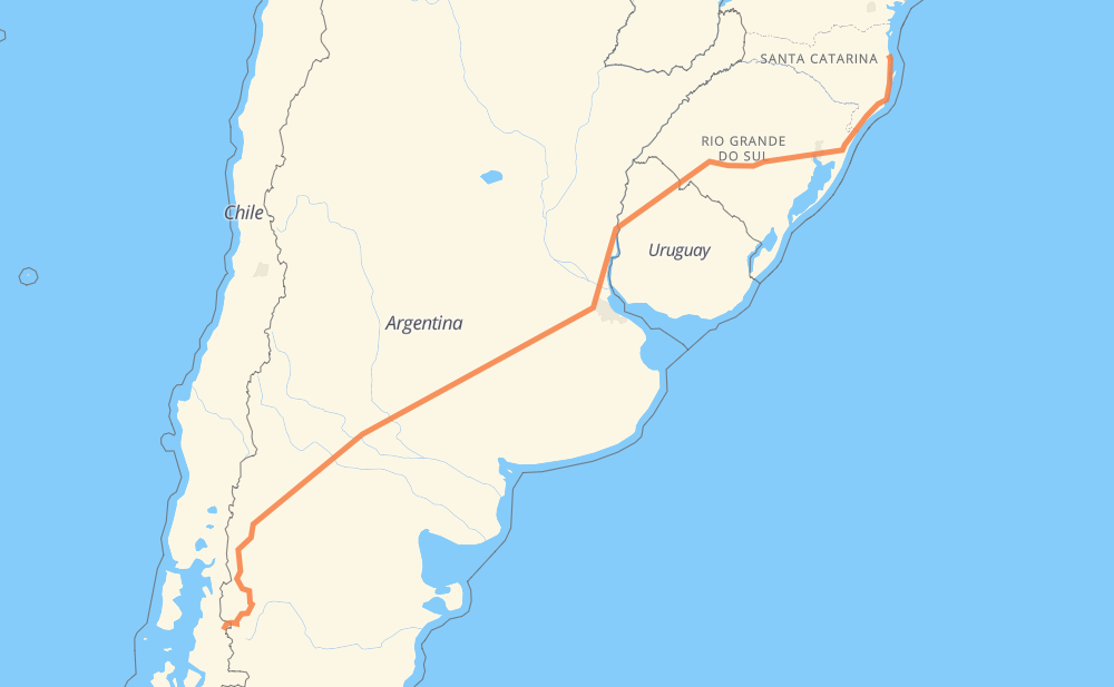
The distance from Arrayán to Cerro is 3,557 kilometers by road including 560 kilometers on motorways. Road takes approximately 38 hours and 54 minutes and goes through San Carlos de Bariloche, Neuquén, Zárate, Tacuarembó and Rivera.
| Shortest distance by air | 2,769 km ✈️ |
| Car route length | 3,557 km 🚗 |
| Driving time | 38 h 54 min |
| Fuel amount | 284.5 L |
| Fuel cost | 421.1 GBP |
| Point | Distance | Time | Fuel | |
| Arrayán | 0 km | 00 min | 0.0 L | |
|
231-CH 46 km, 33 min
|
||||
| Los Cipreses | 46 km | 33 min | 3.3 L | |
|
RN259 17 km, 13 min
|
||||
| Aldea Escolar | 63 km | 46 min | 4.9 L | |
|
RP34 14 km, 11 min
|
||||
| Trevelin | 77 km | 58 min | 5.3 L | |
|
RN259 RN40 307 km, 3 h 19 min
|
||||
| San Carlos de Bariloche | 385 km | 4 h 17 min | 30.3 L | |
|
RP237 RN237 425 km, 4 h 51 min
|
||||
| Neuquén | 810 km | 9 h 08 min | 64.3 L | |
|
RN5 1,156 km, 12 h 29 min
|
||||
| Zárate | 1,966 km | 21 h 38 min | 156.1 L | |
|
RN12 26 462 km, 4 h 59 min
|
||||
| Tacuarembó | 2,428 km | 26 h 38 min | 193.8 L | |
|
26 5 114 km, 1 h 13 min
|
||||
| Rivera | 2,542 km | 27 h 51 min | 203.2 L | |
|
5 BR-290 1,017 km, 11 h 02 min
|
||||
| Cedro | 3,559 km | 38 h 54 min | 284.4 L | |
Frequently Asked Questions
How much does it cost to drive from Arrayán to Cerro?
Fuel cost: 421.1 GBP
This fuel cost is calculated as: (Route length 3,557 km / 100 km) * (Fuel consumption 8 L/100 km) * (Fuel price 1.48 GBP / L)
You can adjust fuel consumption and fuel price here.
How long is a car ride from Arrayán to Cerro?
Driving time: 38 h 54 min
This time is calculated for driving at the maximum permitted speed, taking into account traffic rules restrictions.
- 14 km with a maximum speed 112 km/h = 7 min
- 309 km with a maximum speed 110 km/h = 2 h 48 min
- 170 km with a maximum speed 100 km/h = 1 h 41 min
- 2,348 km with a maximum speed 96 km/h = 24 h 27 min
- 3 km with a maximum speed 90 km/h = 2 min
- 563 km with a maximum speed 80 km/h = 7 h 2 min
- 126 km with a maximum speed 60 km/h = 2 h 5 min
- 14 km with a maximum speed 50 km/h = 16 min
- 2 km with a maximum speed 45 km/h = 3 min
- 8 km with a maximum speed 40 km/h = 12 min
- 1 km with a maximum speed 30 km/h = 2 min
- 1 km with a maximum speed 20 km/h = 4 min
The calculated driving time does not take into account intermediate stops and traffic jams.
How far is Arrayán to Cerro by land?
The distance between Arrayán and Cerro is 3,557 km by road including 560 km on motorways.
Precise satellite coordinates of highways were used for this calculation. The start and finish points are the centers of Arrayán and Cerro respectively.
How far is Arrayán to Cerro by plane?
The shortest distance (air line, as the crow flies) between Arrayán and Cerro is 2,769 km.
This distance is calculated using the Haversine formula as a great-circle distance between two points on the surface of a sphere. The start and finish points are the centers of Arrayán and Cerro respectively. Actual distance between airports may be different.
How many hours is Arrayán from Cerro by plane?
Boeing 737 airliner needs 3 h 27 min to cover the distance of 2,769 km at a cruising speed of 800 km/h.
Small plane "Cessna 172" needs 12 h 35 min to flight this distance at average speed of 220 km/h.
This time is approximate and do not take into account takeoff and landing times, airport location and other real world factors.
How long is a helicopter ride from Arrayán to Cerro?
Fast helicopter "Eurocopter AS350" or "Hughes OH-6 Cayuse" need 11 h 32 min to cover the distance of 2,769 km at a cruising speed of 240 km/h.
Popular "Robinson R44" needs 13 h 11 min to flight this distance at average speed of 210 km/h.
This time is approximate and do not take into account takeoff and landing times, aerodrome location and other real world factors.
What city is halfway between Arrayán and Cerro?
The halfway point between Arrayán and Cerro is Gorostiaga. It is located about 35 km from the exact midpoint by road.
The distance from Gorostiaga to Arrayán is 1,813 km and driving will take about 19 h 58 min. The road between Gorostiaga and Cerro has length 1,744 km and will take approximately 18 h 55 min.
The other cities located close to halfway point:
Where is Arrayán in relation to Cerro?
Arrayán is located 2,769 km south-west of Cerro.
Arrayán has geographic coordinates: latitude -43.35, longitude -72.01668.
Cerro has geographic coordinates: latitude -27.07449, longitude -48.71097.
Which highway goes from Arrayán to Cerro?
The route from Arrayán to Cerro follows RN5, BR-290, BR-101, RN237, RN152, RN40, 26, RP6, RN14, BR-158, 5.
Other minor sections pass along the road:
- RN12: 76 km
- RP1: 70 km
- RN22: 62 km
- RP18: 55 km
- BR-153: 55 km
- RN259: 55 km
- 231-CH: 35 km
- BR-293: 31 km
- 3: 29 km
- RN35: 21 km
- BR-116: 20 km
- RN135: 13 km
- BR-285: 9 km
- Rs-290: 9 km
- RP34: 8 km
- RP237: 6 km
- BR-473: 5 km
- RP71: 2 km
- RN7: 2 km