Distance between Bagueixe and São Pedro de Rio Seco
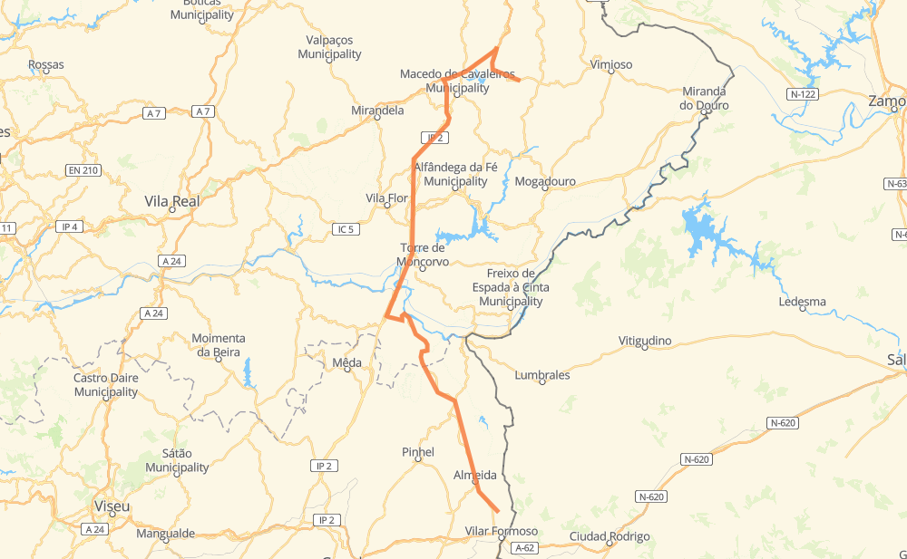
The distance from Bagueixe to São Pedro de Rio Seco is 163 kilometers by road including 15 kilometers on motorways. Road takes approximately 1 hour and 55 minutes and goes through Vila Nova de Foz Côa, Figueira de Castelo Rodrigo, Arrabalde de Santo António, Vinhas, Santa Comba de Rossas, Quintela de Lampaças and Podence.
| Shortest distance by air | 101 km ✈️ |
| Car route length | 163 km 🚗 |
| Driving time | 1 h 55 min |
| Fuel amount | 13 L |
| Fuel cost | 19.4 GBP |
| Point | Distance | Time | Fuel | |
| Bagueixe | 0 km | 00 min | 0.0 L | |
|
4 km, 02 min
|
||||
| Vinhas | 4 km | 02 min | 0.0 L | |
|
EN 317 EN 15-5 11 km, 07 min
|
||||
| Santa Comba de Rossas | 15 km | 10 min | 1.2 L | |
|
A 4 4 km, 02 min
|
||||
| Quintela de Lampaças | 20 km | 12 min | 1.3 L | |
|
A 4 4 km, 02 min
|
||||
| Podence | 24 km | 15 min | 1.9 L | |
|
A 4 4 km, 02 min
|
||||
| Amendoeira | 28 km | 17 min | 1.9 L | |
|
A 4 IP 2 63 km, 44 min
|
||||
| Vila Nova de Foz Côa | 91 km | 1 h 02 min | 6.5 L | |
|
EN 102 EN 222 34 km, 26 min
|
||||
| Figueira de Castelo Rodrigo | 125 km | 1 h 28 min | 9.3 L | |
|
EN 332 21 km, 15 min
|
||||
| Arrabalde de Santo António | 146 km | 1 h 43 min | 11.2 L | |
|
EN 332 17 km, 12 min
|
||||
| São Pedro de Rio Seco | 163 km | 1 h 55 min | 12.9 L | |
Frequently Asked Questions
How much does it cost to drive from Bagueixe to São Pedro de Rio Seco?
Fuel cost: 19.4 GBP
This fuel cost is calculated as: (Route length 163 km / 100 km) * (Fuel consumption 8 L/100 km) * (Fuel price 1.49 GBP / L)
You can adjust fuel consumption and fuel price here.
How long is a car ride from Bagueixe to São Pedro de Rio Seco?
Driving time: 1 h 55 min
This time is calculated for driving at the maximum permitted speed, taking into account traffic rules restrictions.
- 15 km with a maximum speed 112 km/h = 7 min
- 30 km with a maximum speed 96 km/h = 18 min
- 31 km with a maximum speed 90 km/h = 20 min
- 70 km with a maximum speed 80 km/h = 52 min
- 11 km with a maximum speed 70 km/h = 9 min
- 2 km with a maximum speed 60 km/h = 1 min
- 3 km with a maximum speed 50 km/h = 4 min
The calculated driving time does not take into account intermediate stops and traffic jams.
How far is Bagueixe to São Pedro de Rio Seco by land?
The distance between Bagueixe and São Pedro de Rio Seco is 163 km by road including 15 km on motorways.
Precise satellite coordinates of highways were used for this calculation. The start and finish points are the centers of Bagueixe and São Pedro de Rio Seco respectively.
How far is Bagueixe to São Pedro de Rio Seco by plane?
The shortest distance (air line, as the crow flies) between Bagueixe and São Pedro de Rio Seco is 101 km.
This distance is calculated using the Haversine formula as a great-circle distance between two points on the surface of a sphere. The start and finish points are the centers of Bagueixe and São Pedro de Rio Seco respectively. Actual distance between airports may be different.
How many hours is Bagueixe from São Pedro de Rio Seco by plane?
Boeing 737 airliner needs 7 min to cover the distance of 101 km at a cruising speed of 800 km/h.
Small plane "Cessna 172" needs 27 min to flight this distance at average speed of 220 km/h.
This time is approximate and do not take into account takeoff and landing times, airport location and other real world factors.
How long is a helicopter ride from Bagueixe to São Pedro de Rio Seco?
Fast helicopter "Eurocopter AS350" or "Hughes OH-6 Cayuse" need 25 min to cover the distance of 101 km at a cruising speed of 240 km/h.
Popular "Robinson R44" needs 28 min to flight this distance at average speed of 210 km/h.
This time is approximate and do not take into account takeoff and landing times, aerodrome location and other real world factors.
What city is halfway between Bagueixe and São Pedro de Rio Seco?
The halfway point between Bagueixe and São Pedro de Rio Seco is Vila Nova de Foz Côa. It is located about 10 km from the exact midpoint by road.
The distance from Vila Nova de Foz Côa to Bagueixe is 91 km and driving will take about 1 h 2 min. The road between Vila Nova de Foz Côa and São Pedro de Rio Seco has length 72 km and will take approximately 53 min.
The other cities located close to halfway point:
Where is Bagueixe in relation to São Pedro de Rio Seco?
Bagueixe is located 101 km north of São Pedro de Rio Seco.
Bagueixe has geographic coordinates: latitude 41.56481, longitude -6.78094.
São Pedro de Rio Seco has geographic coordinates: latitude 40.66147, longitude -6.84141.