Distance between Benito Juárez and Las Grutas
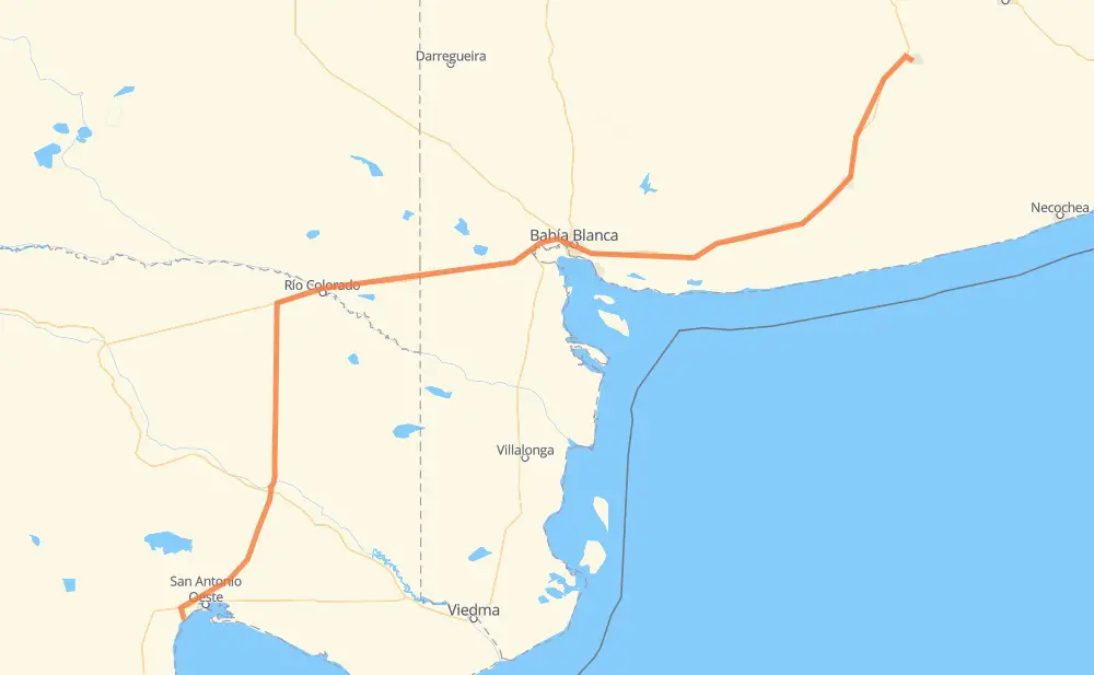
The distance from Benito Juárez to Las Grutas is 712 kilometers by road. Road takes approximately 7 hours and 47 minutes and goes through Bahía Blanca, Adolfo Gonzales Chaves, Tres Arroyos, Pago Chico, Grünbein, Río Colorado and El Empalme.
| Shortest distance by air | 573 km ✈️ |
| Car route length | 712 km 🚗 |
| Driving time | 7 h 47 min |
| Fuel amount | 56.9 L |
| Fuel cost | 84.3 GBP |
| Point | Distance | Time | Fuel | |
| Benito Juárez | 0 km | 00 min | 0.0 L | |
|
RP86 RN3 75 km, 50 min
|
||||
| Adolfo Gonzales Chaves | 75 km | 50 min | 4.4 L | |
|
RN3 25 km, 18 min
|
||||
| Tres Arroyos | 100 km | 1 h 08 min | 7.6 L | |
|
RN3 21 km, 15 min
|
||||
| Micaela Cascallares | 121 km | 1 h 24 min | 8.4 L | |
|
RN3 147 km, 1 h 35 min
|
||||
| Pago Chico | 268 km | 2 h 59 min | 20.8 L | |
|
RN3 13 km, 09 min
|
||||
| Grünbein | 281 km | 3 h 09 min | 22.2 L | |
|
RN3 11 km, 09 min
|
||||
| Bahía Blanca | 292 km | 3 h 18 min | 22.8 L | |
|
RN3 RN22 168 km, 1 h 48 min
|
||||
| Río Colorado | 460 km | 5 h 06 min | 36.8 L | |
|
RN22 RN251 235 km, 2 h 29 min
|
||||
| El Empalme | 695 km | 7 h 36 min | 55.3 L | |
|
RN3 17 km, 11 min
|
||||
| Las Grutas | 712 km | 7 h 47 min | 56.8 L | |
Frequently Asked Questions
How much does it cost to drive from Benito Juárez to Las Grutas?
Fuel cost: 84.3 GBP
This fuel cost is calculated as: (Route length 712 km / 100 km) * (Fuel consumption 8 L/100 km) * (Fuel price 1.48 GBP / L)
You can adjust fuel consumption and fuel price here.
How long is a car ride from Benito Juárez to Las Grutas?
Driving time: 7 h 47 min
This time is calculated for driving at the maximum permitted speed, taking into account traffic rules restrictions.
- 572 km with a maximum speed 96 km/h = 5 h 57 min
- 124 km with a maximum speed 80 km/h = 1 h 32 min
- 6 km with a maximum speed 65 km/h = 5 min
- 8 km with a maximum speed 60 km/h = 7 min
- 2 km with a maximum speed 40 km/h = 2 min
The calculated driving time does not take into account intermediate stops and traffic jams.
How far is Benito Juárez to Las Grutas by land?
The distance between Benito Juárez and Las Grutas is 712 km by road.
Precise satellite coordinates of highways were used for this calculation. The start and finish points are the centers of Benito Juárez and Las Grutas respectively.
How far is Benito Juárez to Las Grutas by plane?
The shortest distance (air line, as the crow flies) between Benito Juárez and Las Grutas is 573 km.
This distance is calculated using the Haversine formula as a great-circle distance between two points on the surface of a sphere. The start and finish points are the centers of Benito Juárez and Las Grutas respectively. Actual distance between airports may be different.
How many hours is Benito Juárez from Las Grutas by plane?
Boeing 737 airliner needs 42 min to cover the distance of 573 km at a cruising speed of 800 km/h.
Small plane "Cessna 172" needs 2 h 36 min to flight this distance at average speed of 220 km/h.
This time is approximate and do not take into account takeoff and landing times, airport location and other real world factors.
How long is a helicopter ride from Benito Juárez to Las Grutas?
Fast helicopter "Eurocopter AS350" or "Hughes OH-6 Cayuse" need 2 h 23 min to cover the distance of 573 km at a cruising speed of 240 km/h.
Popular "Robinson R44" needs 2 h 43 min to flight this distance at average speed of 210 km/h.
This time is approximate and do not take into account takeoff and landing times, aerodrome location and other real world factors.
What city is halfway between Benito Juárez and Las Grutas?
The halfway point between Benito Juárez and Las Grutas is Médanos. It is located about 20 km from the exact midpoint by road.
The distance from Médanos to Benito Juárez is 336 km and driving will take about 3 h 48 min. The road between Médanos and Las Grutas has length 376 km and will take approximately 3 h 58 min.
The other cities located close to halfway point:
Where is Benito Juárez in relation to Las Grutas?
Benito Juárez is located 573 km north-east of Las Grutas.
Benito Juárez has geographic coordinates: latitude -37.67451, longitude -59.8051.
Las Grutas has geographic coordinates: latitude -40.80894, longitude -65.08793.
Which highway goes from Benito Juárez to Las Grutas?
The route from Benito Juárez to Las Grutas follows RN3, RN251, RN22.
Other minor sections pass along the road:
- RP85: 7 km
- RP86: 5 km
- Ex RN3: 3 km