Distance between Brzistew and Neratowitz
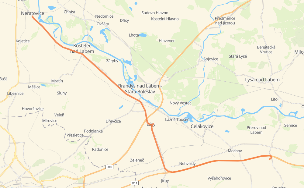
The distance from Brzistew to Neratowitz is 33 kilometers by road including 10 kilometers on motorways. Road takes approximately 25 minutes and goes through Brandeis an der Elbe-Altbunzlau, Lobkovice, Mochow, Nehvizdy, Jirny, Zápy and Kostelec nad Labem.
| Shortest distance by air | 27 km ✈️ |
| Car route length | 33 km 🚗 |
| Driving time | 25 min |
| Fuel amount | 2.7 L |
| Fuel cost | 4 GBP |
| Point | Distance | Time | Fuel | |
| Brzistew | 0 km | 00 min | 0.0 L | |
|
D11 8 km, 04 min
|
||||
| Nehvizdy | 8 km | 04 min | 0.4 L | |
|
D11 3 km, 01 min
|
||||
| Jirny | 11 km | 06 min | 0.8 L | |
|
8 101 3 km, 02 min
|
||||
| Mstětice | 14 km | 08 min | 1.0 L | |
|
101 2 km, 02 min
|
||||
| Zápy | 17 km | 10 min | 1.3 L | |
|
101 5 km, 04 min
|
||||
| Brandeis an der Elbe-Altbunzlau | 22 km | 15 min | 1.5 L | |
|
101 5 km, 03 min
|
||||
| Kostelec nad Labem | 26 km | 19 min | 2.0 L | |
|
101 2 km, 01 min
|
||||
| Jiřice | 28 km | 20 min | 2.2 L | |
|
101 5 km, 04 min
|
||||
| Neratowitz | 33 km | 25 min | 2.3 L | |
Hotels of Neratowitz
Frequently Asked Questions
How much does it cost to drive from Brzistew to Neratowitz?
Fuel cost: 4 GBP
This fuel cost is calculated as: (Route length 33 km / 100 km) * (Fuel consumption 8 L/100 km) * (Fuel price 1.49 GBP / L)
You can adjust fuel consumption and fuel price here.
How long is a car ride from Brzistew to Neratowitz?
Driving time: 25 min
This time is calculated for driving at the maximum permitted speed, taking into account traffic rules restrictions.
- 9 km with a maximum speed 112 km/h = 5 min
- 5 km with a maximum speed 90 km/h = 3 min
- 12 km with a maximum speed 80 km/h = 9 min
- 5 km with a maximum speed 50 km/h = 5 min
- 1 km with a maximum speed 40 km/h = 1 min
The calculated driving time does not take into account intermediate stops and traffic jams.
How far is Brzistew to Neratowitz by land?
The distance between Brzistew and Neratowitz is 33 km by road including 10 km on motorways.
Precise satellite coordinates of highways were used for this calculation. The start and finish points are the centers of Brzistew and Neratowitz respectively.
What city is halfway between Brzistew and Neratowitz?
Where is Brzistew in relation to Neratowitz?
Brzistew is located 27 km south-east of Neratowitz.
Brzistew has geographic coordinates: latitude 50.13393, longitude 14.84174.
Neratowitz has geographic coordinates: latitude 50.25985, longitude 14.51751.
Which highway goes from Brzistew to Neratowitz?
The route from Brzistew to Neratowitz follows 101.
Other minor sections pass along the road:
- D11: 9 km
- 2452: 1 km