Distance between Camapuã and Laguna
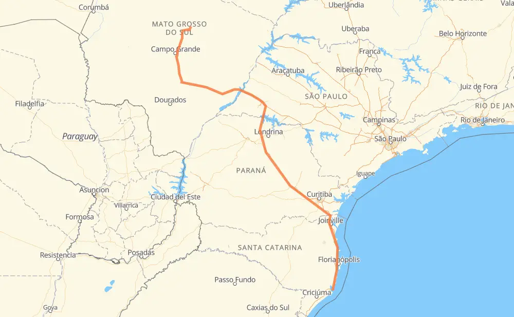
The distance from Camapuã to Laguna is 1,540 kilometers by road including 651 kilometers on motorways. Road takes approximately 16 hours and 55 minutes and goes through Campo Largo, Nova Lima, Moradia do Sol, Chácara das Mansões, Nova Alvorada do Sul, Distrito Industrial II and Bairro Limoeiro.
| Shortest distance by air | 1,130 km ✈️ |
| Car route length | 1,540 km 🚗 |
| Driving time | 16 h 55 min |
| Fuel amount | 123.2 L |
| Fuel cost | 183.6 GBP |
| Point | Distance | Time | Fuel | |
| Camapuã | 0 km | 00 min | 0.0 L | |
|
BR-060 131 km, 1 h 32 min
|
||||
| Nova Lima | 131 km | 1 h 32 min | 10.3 L | |
|
BR-163 24 km, 17 min
|
||||
| Moradia do Sol | 155 km | 1 h 50 min | 12.0 L | |
|
BR-163 19 km, 14 min
|
||||
| Chácara das Mansões | 174 km | 2 h 05 min | 12.8 L | |
|
BR-163 85 km, 55 min
|
||||
| Nova Alvorada do Sul | 259 km | 3 h 01 min | 20.2 L | |
|
BR-267 277 km, 2 h 53 min
|
||||
| Distrito Industrial II | 536 km | 5 h 54 min | 42.6 L | |
|
SP-270 50 km, 29 min
|
||||
| Bairro Limoeiro | 586 km | 6 h 24 min | 46.7 L | |
|
SP-270 PR-170 280 km, 3 h 00 min
|
||||
| Bairro dos França | 866 km | 9 h 24 min | 68.3 L | |
|
BR-376 252 km, 2 h 56 min
|
||||
| Campo Largo | 1,119 km | 12 h 20 min | 88.9 L | |
|
BR-277 BR-101 431 km, 4 h 34 min
|
||||
| Laguna | 1,550 km | 16 h 55 min | 123.5 L | |
Hotels of Laguna
Frequently Asked Questions
How much does it cost to drive from Camapuã to Laguna?
Fuel cost: 183.6 GBP
This fuel cost is calculated as: (Route length 1,540 km / 100 km) * (Fuel consumption 8 L/100 km) * (Fuel price 1.49 GBP / L)
You can adjust fuel consumption and fuel price here.
How long is a car ride from Camapuã to Laguna?
Driving time: 16 h 55 min
This time is calculated for driving at the maximum permitted speed, taking into account traffic rules restrictions.
- 239 km with a maximum speed 110 km/h = 2 h 10 min
- 310 km with a maximum speed 100 km/h = 3 h 6 min
- 676 km with a maximum speed 96 km/h = 7 h 2 min
- 10 km with a maximum speed 90 km/h = 6 min
- 233 km with a maximum speed 80 km/h = 2 h 55 min
- 53 km with a maximum speed 60 km/h = 53 min
- 2 km with a maximum speed 50 km/h = 1 min
- 27 km with a maximum speed 40 km/h = 40 min
The calculated driving time does not take into account intermediate stops and traffic jams.
How far is Camapuã to Laguna by land?
The distance between Camapuã and Laguna is 1,540 km by road including 651 km on motorways.
Precise satellite coordinates of highways were used for this calculation. The start and finish points are the centers of Camapuã and Laguna respectively.
How far is Camapuã to Laguna by plane?
The shortest distance (air line, as the crow flies) between Camapuã and Laguna is 1,130 km.
This distance is calculated using the Haversine formula as a great-circle distance between two points on the surface of a sphere. The start and finish points are the centers of Camapuã and Laguna respectively. Actual distance between airports may be different.
How many hours is Camapuã from Laguna by plane?
Boeing 737 airliner needs 1 h 24 min to cover the distance of 1,130 km at a cruising speed of 800 km/h.
Small plane "Cessna 172" needs 5 h 8 min to flight this distance at average speed of 220 km/h.
This time is approximate and do not take into account takeoff and landing times, airport location and other real world factors.
How long is a helicopter ride from Camapuã to Laguna?
Fast helicopter "Eurocopter AS350" or "Hughes OH-6 Cayuse" need 4 h 42 min to cover the distance of 1,130 km at a cruising speed of 240 km/h.
Popular "Robinson R44" needs 5 h 22 min to flight this distance at average speed of 210 km/h.
This time is approximate and do not take into account takeoff and landing times, aerodrome location and other real world factors.
What city is halfway between Camapuã and Laguna?
The halfway point between Camapuã and Laguna is Bairro dos França. It is located about 96 km from the exact midpoint by road.
The distance from Bairro dos França to Camapuã is 866 km and driving will take about 9 h 24 min. The road between Bairro dos França and Laguna has length 674 km and will take approximately 7 h 31 min.
The other cities located close to halfway point:
Where is Camapuã in relation to Laguna?
Camapuã is located 1,130 km north-west of Laguna.
Camapuã has geographic coordinates: latitude -19.52917, longitude -54.04346.
Laguna has geographic coordinates: latitude -28.48312, longitude -48.7812.
Which highway goes from Camapuã to Laguna?
The route from Camapuã to Laguna follows BR-376, BR-267, BR-101, BR-163, BR-060, SP-270, BR-374.
Other minor sections pass along the road:
- PR-170: 76 km
- BR-277: 67 km
- SP-483: 41 km
- BR-369: 29 km
- BR-262: 15 km
- BR-116: 12 km
- SP-421: 3 km
- PR-090: 3 km
- A-101 F: 3 km