Distance between Casitas and Chihuahua
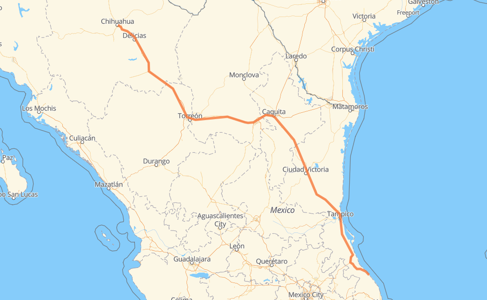
The distance from Casitas to Chihuahua is 1,598 kilometers by road including 599 kilometers on motorways. Road takes approximately 17 hours and 45 minutes and goes through Ciudad Madero, Monterrey, Jiménez, Camargo and Delicias.
| Shortest distance by air | 1,324 km ✈️ |
| Car route length | 1,598 km 🚗 |
| Driving time | 17 h 45 min |
| Fuel amount | 127.8 L |
| Fuel cost | 190.5 GBP |
| Toll roads cost | 967 + ? MXN |
| Point | Distance | Time | Fuel | |
| Casitas | 0 km | 00 min | 0.0 L | |
|
MEX 180 38 km, 28 min
|
||||
| Gutiérrez Zamora | 38 km | 28 min | 3.0 L | |
|
MEX 180 MEX 180D 89 km, 1 h 00 min
|
||||
| Túxpam de Rodríguez Cano | 127 km | 1 h 28 min | 10.1 L | |
|
MEX 132 5 km, 04 min
|
||||
| Alto Lucero | 133 km | 1 h 32 min | 10.3 L | |
|
MEX 132 MEX 180 160 km, 1 h 46 min
|
||||
| Ciudad Madero | 292 km | 3 h 19 min | 23.1 L | |
|
MEX 180 MEX 85 515 km, 6 h 00 min
|
||||
| Monterrey | 807 km | 9 h 20 min | 64.2 L | |
|
410 MEX 40D 605 km, 6 h 15 min
|
||||
| Jiménez | 1,412 km | 15 h 36 min | 110.4 L | |
|
MEX 45D 44 km, 28 min
|
||||
| Camargo | 1,456 km | 16 h 04 min | 116.1 L | |
|
MEX 45 MEX 45D 68 km, 42 min
|
||||
| Delicias | 1,524 km | 16 h 47 min | 121.5 L | |
|
MEX 45 84 km, 57 min
|
||||
| Chihuahua | 1,609 km | 17 h 45 min | 128.2 L | |
Hotels of Chihuahua
Frequently Asked Questions
How many toll booths are there from Casitas to Chihuahua?
There are 16 toll booths between Casitas and Chihuahua: Saucillo, Camargo, Jimenez, Savalza, Ojo Caliente, Torreon, Plan de Ayala, La Cuchilla, San Pedro km 16+830, Periférico, Tampico, Tuxpan, Totomoxtle, Tecolutla, Ceballos and Bermejillo.
How much does the toll booths cost from Casitas to Chihuahua?
Toll roads cost: Tecolutla (24 MXN) + Totomoxtle (46 MXN) + Tuxpan (45 MXN) + Tampico (35 MXN) + Periférico (?) + Ojo Caliente (?) + Torreon (17 MXN) + Plan de Ayala (139 MXN) + La Cuchilla (79 MXN) + San Pedro km 16+830 (?) + Bermejillo (127 MXN) + Ceballos (145 MXN) + Savalza (71 MXN) + Jimenez (97 MXN) + Camargo (71 MXN) + Saucillo (71 MXN) = 967 + ? MXN
How much does it cost to drive from Casitas to Chihuahua?
Fuel cost: 190.5 GBP
This fuel cost is calculated as: (Route length 1,598 km / 100 km) * (Fuel consumption 8 L/100 km) * (Fuel price 1.49 GBP / L)
You can adjust fuel consumption and fuel price here.
Toll roads cost: 967 + ? MXN
How long is a car ride from Casitas to Chihuahua?
Driving time: 17 h 45 min
This time is calculated for driving at the maximum permitted speed, taking into account traffic rules restrictions.
- 176 km with a maximum speed 110 km/h = 1 h 36 min
- 367 km with a maximum speed 100 km/h = 3 h 40 min
- 267 km with a maximum speed 96 km/h = 2 h 47 min
- 328 km with a maximum speed 90 km/h = 3 h 38 min
- 433 km with a maximum speed 80 km/h = 5 h 24 min
- 34 km with a maximum speed 60 km/h = 34 min
- 2 km with a maximum speed 40 km/h = 3 min
The calculated driving time does not take into account intermediate stops and traffic jams.
How far is Casitas to Chihuahua by land?
The distance between Casitas and Chihuahua is 1,598 km by road including 599 km on motorways.
Precise satellite coordinates of highways were used for this calculation. The start and finish points are the centers of Casitas and Chihuahua respectively.
How far is Casitas to Chihuahua by plane?
The shortest distance (air line, as the crow flies) between Casitas and Chihuahua is 1,324 km.
This distance is calculated using the Haversine formula as a great-circle distance between two points on the surface of a sphere. The start and finish points are the centers of Casitas and Chihuahua respectively. Actual distance between airports may be different.
How many hours is Casitas from Chihuahua by plane?
Boeing 737 airliner needs 1 h 39 min to cover the distance of 1,324 km at a cruising speed of 800 km/h.
Small plane "Cessna 172" needs 6 h 1 min to flight this distance at average speed of 220 km/h.
This time is approximate and do not take into account takeoff and landing times, airport location and other real world factors.
How long is a helicopter ride from Casitas to Chihuahua?
Fast helicopter "Eurocopter AS350" or "Hughes OH-6 Cayuse" need 5 h 31 min to cover the distance of 1,324 km at a cruising speed of 240 km/h.
Popular "Robinson R44" needs 6 h 18 min to flight this distance at average speed of 210 km/h.
This time is approximate and do not take into account takeoff and landing times, aerodrome location and other real world factors.
What city is halfway between Casitas and Chihuahua?
The halfway point between Casitas and Chihuahua is Monterrey. It is located about 9 km from the exact midpoint by road.
The distance from Monterrey to Casitas is 807 km and driving will take about 9 h 19 min. The road between Monterrey and Chihuahua has length 790 km and will take approximately 8 h 25 min.
The other cities located close to halfway point:
Where is Casitas in relation to Chihuahua?
Casitas is located 1,324 km south-east of Chihuahua.
Casitas has geographic coordinates: latitude 20.25388, longitude -96.79917.
Chihuahua has geographic coordinates: latitude 28.66057, longitude -106.07498.
Which highway goes from Casitas to Chihuahua?
The route from Casitas to Chihuahua follows MEX 85, MEX 40D, MEX 180, MEX 49D, MEX 45D, MEX 40.
Other minor sections pass along the road:
- MEX 83: 92 km
- MEX 45: 90 km
- MEX 81: 83 km
- MEX 80: 76 km
- MEX 180D: 51 km
- MEX 135D: 45 km
- MEX 49: 36 km
- MEX: 30 km
- MEX 132D: 13 km
- MEX 132: 10 km
- 20: 8 km
- 410: 6 km
- 10: 6 km
- 25: 4 km
- 9: 1 km