Distance between Chengcheng and Gya'gya
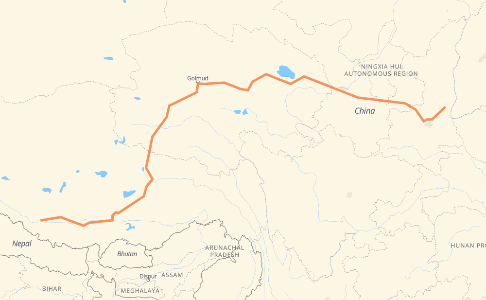
The distance from Chengcheng to Gya'gya is 3,475 kilometers by road including 1,677 kilometers on motorways. Road takes approximately 39 hours and 13 minutes and goes through Jingyang, Liquan, Yongshou, Bin, Changwu, Jingchuan and Pingliang.
| Shortest distance by air | 2,405 km ✈️ |
| Car route length | 3,475 km 🚗 |
| Driving time | 39 h 13 min |
| Fuel amount | 278 L |
| Fuel cost | 414.3 GBP |
| Point | Distance | Time | Fuel | |
| Chengcheng | 0 km | 00 min | 0.0 L | |
|
S202 G5 145 km, 1 h 37 min
|
||||
| Jingyang | 145 km | 1 h 37 min | 11.1 L | |
|
G30N 46 km, 31 min
|
||||
| Liquan | 191 km | 2 h 09 min | 14.6 L | |
|
G70 30 km, 20 min
|
||||
| Yongshou | 221 km | 2 h 30 min | 17.1 L | |
|
G70 53 km, 35 min
|
||||
| Bin | 274 km | 3 h 05 min | 21.4 L | |
|
G70 35 km, 25 min
|
||||
| Changwu | 309 km | 3 h 30 min | 23.7 L | |
|
G70 G312 65 km, 44 min
|
||||
| Jingchuan | 374 km | 4 h 15 min | 28.3 L | |
|
G22 G70 52 km, 38 min
|
||||
| Pingliang | 427 km | 4 h 53 min | 33.8 L | |
|
G22 60 km, 39 min
|
||||
| Longde | 487 km | 5 h 32 min | 38.4 L | |
|
G22 37 km, 27 min
|
||||
| Jingning | 524 km | 5 h 59 min | 41.5 L | |
|
G22 72 km, 50 min
|
||||
| Huining | 596 km | 6 h 49 min | 47.6 L | |
|
G22 257 km, 2 h 56 min
|
||||
| Chuankou | 853 km | 9 h 46 min | 67.8 L | |
|
G6 73 km, 49 min
|
||||
| Haidong | 927 km | 10 h 35 min | 73.8 L | |
|
G6 G0612 80 km, 53 min
|
||||
| Chengguan | 1,007 km | 11 h 29 min | 80.2 L | |
|
G6 97 km, 1 h 05 min
|
||||
| Qabqa | 1,104 km | 12 h 34 min | 86.5 L | |
|
G6 253 km, 2 h 48 min
|
||||
| Chahanwusu | 1,357 km | 15 h 23 min | 102.1 L | |
|
G6 G109 1,044 km, 11 h 38 min
|
||||
| Amdo | 2,401 km | 27 h 01 min | 191.5 L | |
|
G109 136 km, 1 h 32 min
|
||||
| Nagqu | 2,537 km | 28 h 33 min | 202.3 L | |
|
G109 491 km, 5 h 38 min
|
||||
| Shigatse | 3,029 km | 34 h 12 min | 242.1 L | |
|
G318 139 km, 1 h 36 min
|
||||
| Lhatse | 3,168 km | 35 h 48 min | 252.3 L | |
|
G318 G219 67 km, 45 min
|
||||
| Kagar | 3,235 km | 36 h 34 min | 258.5 L | |
|
G219 240 km, 2 h 38 min
|
||||
| Gya'gya | 3,475 km | 39 h 13 min | 276.7 L | |
Frequently Asked Questions
How much does it cost to drive from Chengcheng to Gya'gya?
Fuel cost: 414.3 GBP
This fuel cost is calculated as: (Route length 3,475 km / 100 km) * (Fuel consumption 8 L/100 km) * (Fuel price 1.49 GBP / L)
You can adjust fuel consumption and fuel price here.
How long is a car ride from Chengcheng to Gya'gya?
Driving time: 39 h 13 min
This time is calculated for driving at the maximum permitted speed, taking into account traffic rules restrictions.
- 29 km with a maximum speed 112 km/h = 15 min
- 658 km with a maximum speed 100 km/h = 6 h 34 min
- 1,225 km with a maximum speed 96 km/h = 12 h 45 min
- 1,545 km with a maximum speed 80 km/h = 19 h 18 min
- 16 km with a maximum speed 60 km/h = 16 min
- 2 km with a maximum speed 40 km/h = 2 min
The calculated driving time does not take into account intermediate stops and traffic jams.
How far is Chengcheng to Gya'gya by land?
The distance between Chengcheng and Gya'gya is 3,475 km by road including 1,677 km on motorways.
Precise satellite coordinates of highways were used for this calculation. The start and finish points are the centers of Chengcheng and Gya'gya respectively.
How far is Chengcheng to Gya'gya by plane?
The shortest distance (air line, as the crow flies) between Chengcheng and Gya'gya is 2,405 km.
This distance is calculated using the Haversine formula as a great-circle distance between two points on the surface of a sphere. The start and finish points are the centers of Chengcheng and Gya'gya respectively. Actual distance between airports may be different.
How many hours is Chengcheng from Gya'gya by plane?
Boeing 737 airliner needs 3 h to cover the distance of 2,405 km at a cruising speed of 800 km/h.
Small plane "Cessna 172" needs 10 h 55 min to flight this distance at average speed of 220 km/h.
This time is approximate and do not take into account takeoff and landing times, airport location and other real world factors.
How long is a helicopter ride from Chengcheng to Gya'gya?
Fast helicopter "Eurocopter AS350" or "Hughes OH-6 Cayuse" need 10 h 1 min to cover the distance of 2,405 km at a cruising speed of 240 km/h.
Popular "Robinson R44" needs 11 h 27 min to flight this distance at average speed of 210 km/h.
This time is approximate and do not take into account takeoff and landing times, aerodrome location and other real world factors.
What city is halfway between Chengcheng and Gya'gya?
The halfway point between Chengcheng and Gya'gya is Wushisan Daoban. It is located about 35 km from the exact midpoint by road.
The distance from Wushisan Daoban to Chengcheng is 1,773 km and driving will take about 20 h 19 min. The road between Wushisan Daoban and Gya'gya has length 1,703 km and will take approximately 18 h 54 min.
The other cities located close to halfway point:
Where is Chengcheng in relation to Gya'gya?
Chengcheng is located 2,405 km east of Gya'gya.
Chengcheng has geographic coordinates: latitude 35.18351, longitude 109.93071.
Gya'gya has geographic coordinates: latitude 29.33009, longitude 85.2325.
Which highway goes from Chengcheng to Gya'gya?
The route from Chengcheng to Gya'gya follows G109, G6, G22, G70, G219, G318, S304.
Other minor sections pass along the road:
- G5: 97 km
- G0612: 58 km
- G2201: 56 km
- G30N: 46 km
- G30: 35 km
- G216: 34 km
- G22 G30: 27 km
- G312: 25 km
- S202: 19 km
- G22 G70: 14 km
- S106: 8 km
- G22 / G30: 8 km
- G349: 6 km
- G3021: 3 km