Distance between Clair NB and Edmonton AB
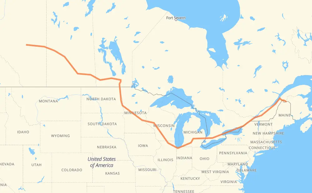
The distance from Clair to Edmonton is 4,623 kilometers by road including 3,088 kilometers on motorways. Road takes approximately 46 hours and 33 minutes and goes through Lévis, Drummondville, Longueuil, Montreal, Cornwall, Brockville and Kingston.
| Shortest distance by air | 3,203 km ✈️ |
| Car route length | 4,623 km 🚗 |
| Driving time | 46 h 33 min |
| Fuel amount | 369.8 L |
| Fuel cost | 547.4 GBP |
| Point | Distance | Time | Fuel | |
| Clair | 0 km | 00 min | 0.0 L | |
|
NB 161 20 263 km, 2 h 47 min
|
||||
| Lévis | 263 km | 2 h 47 min | 20.0 L | |
|
20 160 km, 1 h 35 min
|
||||
| Drummondville | 423 km | 4 h 23 min | 33.4 L | |
|
20 87 km, 52 min
|
||||
| Longueuil | 510 km | 5 h 15 min | 40.7 L | |
|
25 16 km, 12 min
|
||||
| Montreal | 526 km | 5 h 28 min | 40.9 L | |
|
40 401 109 km, 1 h 09 min
|
||||
| Cornwall | 635 km | 6 h 37 min | 50.5 L | |
|
401 92 km, 55 min
|
||||
| Brockville | 727 km | 7 h 32 min | 57.6 L | |
|
401 79 km, 47 min
|
||||
| Kingston | 806 km | 8 h 19 min | 63.0 L | |
|
401 77 km, 45 min
|
||||
| Belleville | 882 km | 9 h 05 min | 69.7 L | |
|
401 126 km, 1 h 15 min
|
||||
| Oshawa | 1,008 km | 10 h 20 min | 80.3 L | |
|
401 15 km, 08 min
|
||||
| Ajax | 1,023 km | 10 h 29 min | 81.6 L | |
|
401 32 km, 19 min
|
||||
| Toronto | 1,055 km | 10 h 48 min | 82.7 L | |
|
401 31 km, 18 min
|
||||
| Mississauga | 1,085 km | 11 h 07 min | 86.1 L | |
|
401 66 km, 39 min
|
||||
| Kitchener | 1,151 km | 11 h 46 min | 91.8 L | |
|
401 42 km, 25 min
|
||||
| Woodstock | 1,193 km | 12 h 11 min | 95.1 L | |
|
401 402 140 km, 1 h 19 min
|
||||
| Sarnia | 1,334 km | 13 h 31 min | 106.0 L | |
|
402 I 69 122 km, 1 h 12 min
|
||||
| Flint | 1,455 km | 14 h 44 min | 116.1 L | |
|
I 69 99 km, 52 min
|
||||
| Lansing | 1,554 km | 15 h 37 min | 124.1 L | |
|
I 69 102 km, 54 min
|
||||
| Kalamazoo | 1,656 km | 16 h 31 min | 132.2 L | |
|
I 94 I 90 409 km, 3 h 50 min
|
||||
| Janesville | 2,065 km | 20 h 21 min | 164.9 L | |
|
I 39 56 km, 30 min
|
||||
| Madison | 2,121 km | 20 h 51 min | 169.0 L | |
|
I 39 I 94 282 km, 2 h 32 min
|
||||
| Eau Claire | 2,404 km | 23 h 24 min | 191.4 L | |
|
I 94 526 km, 4 h 48 min
|
||||
| Fargo | 2,930 km | 28 h 12 min | 233.6 L | |
|
I 29 102 km, 1 h 10 min
|
||||
| Grand Forks | 3,031 km | 29 h 22 min | 240.5 L | |
|
I 29 243 km, 2 h 43 min
|
||||
| Winnipeg | 3,274 km | 32 h 05 min | 261.0 L | |
|
PTH 100 PTH 1 88 km, 56 min
|
||||
| Portage la Prairie | 3,362 km | 33 h 02 min | 268.4 L | |
|
PTH 1 123 km, 1 h 17 min
|
||||
| Brandon | 3,485 km | 34 h 19 min | 278.5 L | |
|
PTH 1 1 362 km, 3 h 55 min
|
||||
| Regina | 3,847 km | 38 h 15 min | 307.4 L | |
|
46 11 253 km, 2 h 40 min
|
||||
| Saskatoon | 4,100 km | 40 h 55 min | 327.3 L | |
|
11 16 162 km, 1 h 45 min
|
||||
| North Battleford | 4,262 km | 42 h 40 min | 338.7 L | |
|
16 109 km, 1 h 10 min
|
||||
| Lloydminster | 4,370 km | 43 h 50 min | 347.4 L | |
|
16 243 km, 2 h 33 min
|
||||
| Sherwood Park | 4,613 km | 46 h 24 min | 369.0 L | |
|
216 12 km, 10 min
|
||||
| Edmonton | 4,626 km | 46 h 34 min | 369.4 L | |
Hotels of Edmonton
Frequently Asked Questions
How much does it cost to drive from Clair to Edmonton?
Fuel cost: 547.4 GBP
This fuel cost is calculated as: (Route length 4,623 km / 100 km) * (Fuel consumption 8 L/100 km) * (Fuel price 1.48 GBP / L)
You can adjust fuel consumption and fuel price here.
How long is a car ride from Clair to Edmonton?
Driving time: 46 h 33 min
This time is calculated for driving at the maximum permitted speed, taking into account traffic rules restrictions.
- 1,365 km with a maximum speed 112 km/h = 12 h 11 min
- 103 km with a maximum speed 110 km/h = 56 min
- 30 km with a maximum speed 105 km/h = 17 min
- 1,287 km with a maximum speed 100 km/h = 12 h 52 min
- 50 km with a maximum speed 97 km/h = 31 min
- 1,306 km with a maximum speed 96 km/h = 13 h 36 min
- 21 km with a maximum speed 90 km/h = 14 min
- 30 km with a maximum speed 89 km/h = 20 min
- 2 km with a maximum speed 80 km/h = 1 min
- 374 km with a maximum speed 80 km/h = 4 h 40 min
- 3 km with a maximum speed 72 km/h = 2 min
- 28 km with a maximum speed 70 km/h = 24 min
- 3 km with a maximum speed 65 km/h = 2 min
- 10 km with a maximum speed 60 km/h = 9 min
- 12 km with a maximum speed 50 km/h = 13 min
The calculated driving time does not take into account intermediate stops and traffic jams.
How far is Clair to Edmonton by land?
The distance between Clair and Edmonton is 4,623 km by road including 3,088 km on motorways.
Precise satellite coordinates of highways were used for this calculation. The start and finish points are the centers of Clair and Edmonton respectively.
How far is Clair to Edmonton by plane?
The shortest distance (air line, as the crow flies) between Clair and Edmonton is 3,203 km.
This distance is calculated using the Haversine formula as a great-circle distance between two points on the surface of a sphere. The start and finish points are the centers of Clair and Edmonton respectively. Actual distance between airports may be different.
How many hours is Clair from Edmonton by plane?
Boeing 737 airliner needs 4 h to cover the distance of 3,203 km at a cruising speed of 800 km/h.
Small plane "Cessna 172" needs 14 h 33 min to flight this distance at average speed of 220 km/h.
This time is approximate and do not take into account takeoff and landing times, airport location and other real world factors.
How long is a helicopter ride from Clair to Edmonton?
Fast helicopter "Eurocopter AS350" or "Hughes OH-6 Cayuse" need 13 h 20 min to cover the distance of 3,203 km at a cruising speed of 240 km/h.
Popular "Robinson R44" needs 15 h 15 min to flight this distance at average speed of 210 km/h.
This time is approximate and do not take into account takeoff and landing times, aerodrome location and other real world factors.
What city is halfway between Clair and Edmonton?
The halfway point between Clair and Edmonton is Millston. It is located about 12 km from the exact midpoint by road.
The distance from Millston to Clair is 2,300 km and driving will take about 22 h 26 min. The road between Millston and Edmonton has length 2,323 km and will take approximately 24 h 6 min.
The other cities located close to halfway point:
Where is Clair in relation to Edmonton?
Clair is located 3,203 km east of Edmonton.
Clair has geographic coordinates: latitude 47.25265, longitude -68.60337.
Edmonton has geographic coordinates: latitude 53.53541, longitude -113.508.
Which highway goes from Clair to Edmonton?
The route from Clair to Edmonton follows I 94, 401, 16, 20, I 90, PTH 1, I 69, 11, I 29, 1, US 81, I 39, 402.
Other minor sections pass along the road:
- PTH 75: 94 km
- 289: 93 km
- 40: 52 km
- I 694: 46 km
- 55: 35 km
- US 51: 30 km
- 46: 22 km
- US 41: 22 km
- PTH 100: 19 km
- US 59: 17 km
- 120: 15 km
- 2: 11 km
- US 12: 9 km
- 11A: 9 km
- 47: 8 km
- 25: 8 km
- I 96: 8 km
- PTH 83: 7 km
- MN 95: 7 km
- PR 254: 5 km
- MN 210: 5 km
- 116: 5 km
- US 31: 5 km
- US 10: 5 km
- 674: 5 km
- US 52: 4 km
- PR 241: 4 km
- WI 35: 4 km
- PR 250: 4 km
- 6: 3 km
- 21: 3 km
- US 20: 3 km
- WI 11: 3 km
- Route 42: 3 km
- 161: 3 km
- 15: 2 km
- PR 427: 2 km
- 30: 2 km
- NB 161: 2 km
- PR 334: 2 km
- 201: 2 km
- 12: 2 km
- PTH 10: 2 km
- 8: 1 km
- 675: 1 km
- 4: 1 km