Distance between Curvelo and Sapezal
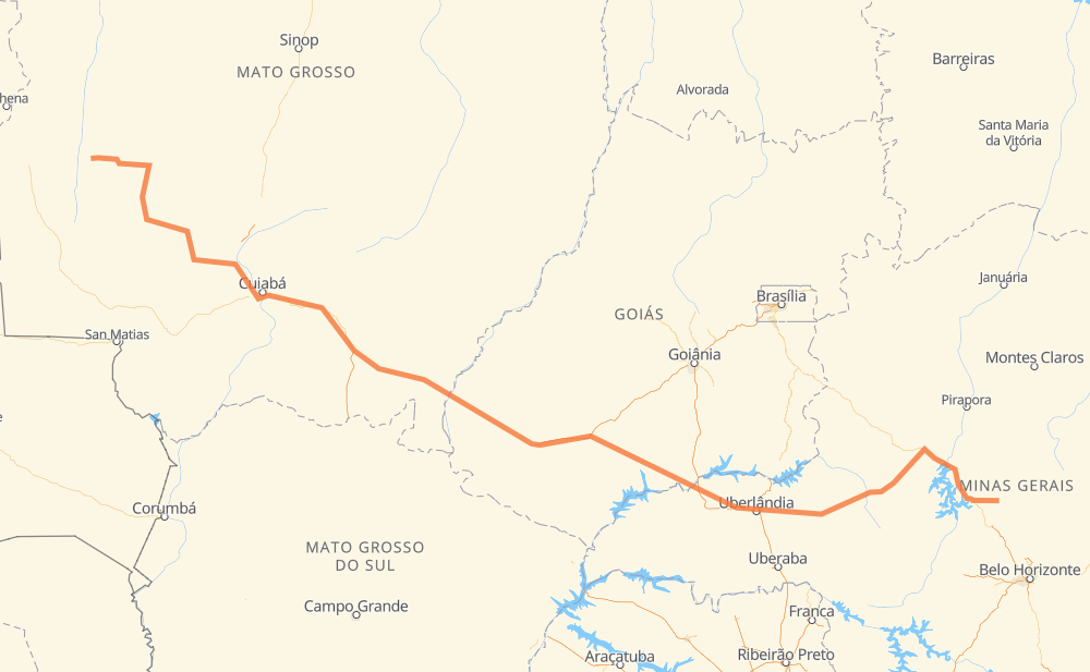
The distance from Curvelo to Sapezal is 2,060 kilometers by road including 132 kilometers on motorways. Road takes approximately 22 hours and 20 minutes and goes through Distrito Industrial I, Tocantins, Dona Zulmira, Tupaciguara, Vila Goulart, Jaciara and Novo Mundo.
| Shortest distance by air | 1,641 km ✈️ |
| Car route length | 2,060 km 🚗 |
| Driving time | 22 h 20 min |
| Fuel amount | 164.8 L |
| Fuel cost | 245.5 GBP |
| Point | Distance | Time | Fuel | |
| Curvelo | 0 km | 00 min | 0.0 L | |
|
BR-259 BR-040 311 km, 3 h 21 min
|
||||
| Distrito Industrial I | 311 km | 3 h 21 min | 24.8 L | |
|
BR-365 231 km, 2 h 24 min
|
||||
| Tocantins | 542 km | 5 h 46 min | 42.5 L | |
|
BR-365 MG-452 48 km, 30 min
|
||||
| Tupaciguara | 590 km | 6 h 17 min | 46.0 L | |
|
BR-452 216 km, 2 h 31 min
|
||||
| Lagoa do Bauzinho | 806 km | 8 h 49 min | 64.1 L | |
|
BR-452 BR-364 542 km, 5 h 49 min
|
||||
| Vila Goulart | 1,348 km | 14 h 38 min | 107.7 L | |
|
BR-364 BR-163 93 km, 1 h 04 min
|
||||
| Jaciara | 1,441 km | 15 h 43 min | 113.6 L | |
|
BR-163 139 km, 1 h 31 min
|
||||
| Novo Mundo | 1,580 km | 17 h 14 min | 126.0 L | |
|
BR-364 MT-358 484 km, 5 h 06 min
|
||||
| Sapezal | 2,064 km | 22 h 20 min | 163.4 L | |
Frequently Asked Questions
How much does it cost to drive from Curvelo to Sapezal?
Fuel cost: 245.5 GBP
This fuel cost is calculated as: (Route length 2,060 km / 100 km) * (Fuel consumption 8 L/100 km) * (Fuel price 1.49 GBP / L)
You can adjust fuel consumption and fuel price here.
How long is a car ride from Curvelo to Sapezal?
Driving time: 22 h 20 min
This time is calculated for driving at the maximum permitted speed, taking into account traffic rules restrictions.
- 44 km with a maximum speed 110 km/h = 24 min
- 69 km with a maximum speed 100 km/h = 41 min
- 1,543 km with a maximum speed 96 km/h = 16 h 4 min
- 394 km with a maximum speed 80 km/h = 4 h 55 min
- 9 km with a maximum speed 60 km/h = 9 min
- 4 km with a maximum speed 40 km/h = 5 min
The calculated driving time does not take into account intermediate stops and traffic jams.
How far is Curvelo to Sapezal by land?
The distance between Curvelo and Sapezal is 2,060 km by road including 132 km on motorways.
Precise satellite coordinates of highways were used for this calculation. The start and finish points are the centers of Curvelo and Sapezal respectively.
How far is Curvelo to Sapezal by plane?
The shortest distance (air line, as the crow flies) between Curvelo and Sapezal is 1,641 km.
This distance is calculated using the Haversine formula as a great-circle distance between two points on the surface of a sphere. The start and finish points are the centers of Curvelo and Sapezal respectively. Actual distance between airports may be different.
How many hours is Curvelo from Sapezal by plane?
Boeing 737 airliner needs 2 h 3 min to cover the distance of 1,641 km at a cruising speed of 800 km/h.
Small plane "Cessna 172" needs 7 h 27 min to flight this distance at average speed of 220 km/h.
This time is approximate and do not take into account takeoff and landing times, airport location and other real world factors.
How long is a helicopter ride from Curvelo to Sapezal?
Fast helicopter "Eurocopter AS350" or "Hughes OH-6 Cayuse" need 6 h 50 min to cover the distance of 1,641 km at a cruising speed of 240 km/h.
Popular "Robinson R44" needs 7 h 48 min to flight this distance at average speed of 210 km/h.
This time is approximate and do not take into account takeoff and landing times, aerodrome location and other real world factors.
What city is halfway between Curvelo and Sapezal?
The halfway point between Curvelo and Sapezal is Lagoa do Bauzinho. It is located about 224 km from the exact midpoint by road.
The distance from Lagoa do Bauzinho to Curvelo is 806 km and driving will take about 8 h 49 min. The road between Lagoa do Bauzinho and Sapezal has length 1,254 km and will take approximately 13 h 31 min.
The other cities located close to halfway point:
Where is Curvelo in relation to Sapezal?
Curvelo is located 1,641 km south-east of Sapezal.
Curvelo has geographic coordinates: latitude -18.7572, longitude -44.4306.
Sapezal has geographic coordinates: latitude -13.5498, longitude -58.81555.
Which highway goes from Curvelo to Sapezal?
The route from Curvelo to Sapezal follows BR-364, BR-365, BR-452, BR-163, MT-358, BR-040.
Other minor sections pass along the road:
- BR-060: 96 km
- BR-070: 87 km
- MT-246: 81 km
- MG-452: 73 km
- MT-255: 54 km
- MT-235: 51 km
- BR-259: 43 km
- MGC-259: 43 km
- MT-343: 24 km
- MT-344: 22 km
- MT-407: 16 km
- BR-153: 7 km
- MT-100: 7 km
- BR-158: 5 km
- BR-050: 5 km
- MGC-452: 2 km