Distance between Emirgazi and Aktaş
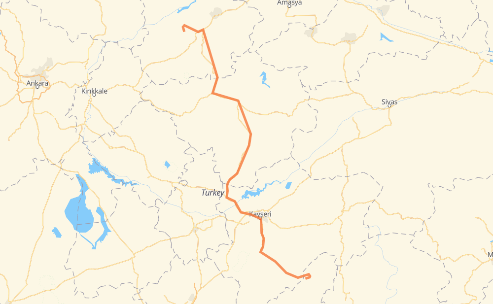
The distance from Emirgazi to Aktaş is 416 kilometers by road. Road takes approximately 5 hours and 26 minutes and goes through Kayseri, Kıranardı, 30 Ağustos Mah., Boğazlıyan, Sarıkaya, Sorgun and Alaca.
| Shortest distance by air | 280 km ✈️ |
| Car route length | 416 km 🚗 |
| Driving time | 5 h 26 min |
| Fuel amount | 33.3 L |
| Fuel cost | 49.6 GBP |
| Point | Distance | Time | Fuel | |
| Emirgazi | 0 km | 00 min | 0.0 L | |
|
38-32 107 km, 1 h 18 min
|
||||
| Kıranardı | 107 km | 1 h 18 min | 8.6 L | |
|
38-29 11 km, 07 min
|
||||
| Kayseri | 118 km | 1 h 25 min | 9.3 L | |
|
9 km, 06 min
|
||||
| 30 Ağustos Mah. | 127 km | 1 h 31 min | 9.9 L | |
|
260-10 72 km, 51 min
|
||||
| Boğazlıyan | 199 km | 2 h 22 min | 15.7 L | |
|
D805 55 km, 40 min
|
||||
| Sarıkaya | 253 km | 3 h 02 min | 18.6 L | |
|
D805 28 km, 20 min
|
||||
| Sorgun | 281 km | 3 h 23 min | 22.0 L | |
|
D200 D795 60 km, 44 min
|
||||
| Alaca | 341 km | 4 h 07 min | 26.5 L | |
|
D795 55 km, 44 min
|
||||
| Karaosmanlı | 396 km | 4 h 52 min | 31.5 L | |
|
20 km, 33 min
|
||||
| Aktaş | 416 km | 5 h 25 min | 33.0 L | |
Frequently Asked Questions
How much does it cost to drive from Emirgazi to Aktaş?
Fuel cost: 49.6 GBP
This fuel cost is calculated as: (Route length 416 km / 100 km) * (Fuel consumption 8 L/100 km) * (Fuel price 1.49 GBP / L)
You can adjust fuel consumption and fuel price here.
How long is a car ride from Emirgazi to Aktaş?
Driving time: 5 h 26 min
This time is calculated for driving at the maximum permitted speed, taking into account traffic rules restrictions.
- 98 km with a maximum speed 96 km/h = 1 h 1 min
- 286 km with a maximum speed 80 km/h = 3 h 34 min
- 26 km with a maximum speed 50 km/h = 30 min
- 6 km with a maximum speed 20 km/h = 19 min
The calculated driving time does not take into account intermediate stops and traffic jams.
How far is Emirgazi to Aktaş by land?
The distance between Emirgazi and Aktaş is 416 km by road.
Precise satellite coordinates of highways were used for this calculation. The start and finish points are the centers of Emirgazi and Aktaş respectively.
How far is Emirgazi to Aktaş by plane?
The shortest distance (air line, as the crow flies) between Emirgazi and Aktaş is 280 km.
This distance is calculated using the Haversine formula as a great-circle distance between two points on the surface of a sphere. The start and finish points are the centers of Emirgazi and Aktaş respectively. Actual distance between airports may be different.
How many hours is Emirgazi from Aktaş by plane?
Boeing 737 airliner needs 21 min to cover the distance of 280 km at a cruising speed of 800 km/h.
Small plane "Cessna 172" needs 1 h 16 min to flight this distance at average speed of 220 km/h.
This time is approximate and do not take into account takeoff and landing times, airport location and other real world factors.
How long is a helicopter ride from Emirgazi to Aktaş?
Fast helicopter "Eurocopter AS350" or "Hughes OH-6 Cayuse" need 1 h 10 min to cover the distance of 280 km at a cruising speed of 240 km/h.
Popular "Robinson R44" needs 1 h 20 min to flight this distance at average speed of 210 km/h.
This time is approximate and do not take into account takeoff and landing times, aerodrome location and other real world factors.
What city is halfway between Emirgazi and Aktaş?
The halfway point between Emirgazi and Aktaş is Yapalak. It is located about 4 km from the exact midpoint by road.
The distance from Yapalak to Emirgazi is 212 km and driving will take about 2 h 31 min. The road between Yapalak and Aktaş has length 205 km and will take approximately 2 h 54 min.
The other cities located close to halfway point:
Where is Emirgazi in relation to Aktaş?
Emirgazi is located 280 km south-east of Aktaş.
Emirgazi has geographic coordinates: latitude 38.16164, longitude 36.02035.
Aktaş has geographic coordinates: latitude 40.41978, longitude 34.59174.