Distance between Iguala and 9 de Diciembre
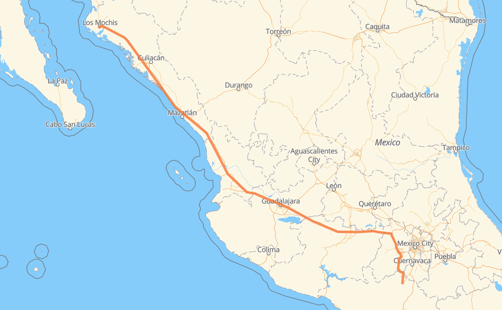
The distance from Iguala to 9 de Diciembre is 1,515 kilometers by road including 1,353 kilometers on motorways. Road takes approximately 16 hours and 31 minutes and goes through Toluca, Tonalá, Tepic, Dimas (Estación Dimas), Gabriel Leyva Solano and Los Mochis.
| Shortest distance by air | 1,278 km ✈️ |
| Car route length | 1,515 km 🚗 |
| Driving time | 16 h 31 min |
| Fuel amount | 121.2 L |
| Fuel cost | 179.3 GBP |
| Toll roads cost | 1,955 + ? MXN |
| Point | Distance | Time | Fuel | |
| Iguala | 0 km | 00 min | 0.0 L | |
|
MEX 95 37 km, 28 min
|
||||
| Taxco | 37 km | 28 min | 2.3 L | |
|
MEX 95 MEX 55 62 km, 46 min
|
||||
| Ixtapan de la Sal | 100 km | 1 h 14 min | 7.9 L | |
|
Vialidad Metepec 64 km, 43 min
|
||||
| Toluca | 164 km | 1 h 57 min | 12.8 L | |
|
MEX 55 MEX 15D 452 km, 5 h 00 min
|
||||
| Tonalá | 616 km | 6 h 58 min | 48.6 L | |
|
MEX 15D 222 km, 2 h 17 min
|
||||
| Tepic | 837 km | 9 h 15 min | 66.3 L | |
|
MEX 15D 333 km, 3 h 21 min
|
||||
| Dimas (Estación Dimas) | 1,171 km | 12 h 37 min | 92.6 L | |
|
MEX 15D 289 km, 3 h 10 min
|
||||
| Gabriel Leyva Solano | 1,460 km | 15 h 47 min | 115.8 L | |
|
MEX 15D 48 km, 35 min
|
||||
| Los Mochis | 1,507 km | 16 h 22 min | 120.0 L | |
|
MEX 15D 8 km, 07 min
|
||||
| 9 de Diciembre | 1,515 km | 16 h 30 min | 121.1 L | |
Frequently Asked Questions
How many toll booths are there from Iguala to 9 de Diciembre?
There are 26 toll booths between Iguala and 9 de Diciembre: Sinaloa, Las Brisas, San Pedro km 197+100, Costa Rica, Marmol, El Rosario, Acaponeta, Ruiz, Trapichillo, Santa Maria del Oro, Plan de Barrancas, La Joya, Ocotlán, Zinapecuaro, Contepec, Panindicuaro, Ecuandureo, Taxco, La Finca, Villa Guerrero, Tenango, El Dorado, Atlacomulco — Maravatio, Atlacomulco, Arenal and El Pisal.
How much does the toll booths cost from Iguala to 9 de Diciembre?
Toll roads cost: Taxco (16 MXN) + La Finca (?) + Villa Guerrero (?) + Tenango (?) + El Dorado (?) + Atlacomulco (?) + Atlacomulco — Maravatio (50 MXN) + Contepec (?) + Zinapecuaro (161 MXN) + Panindicuaro (?) + Ecuandureo (111 MXN) + Ocotlán (226 MXN) + La Joya (?) + Arenal (131 MXN) + Plan de Barrancas (195 MXN) + Santa Maria del Oro (115 MXN) + Trapichillo (80 MXN) + Ruiz (?) + Acaponeta (240 MXN) + El Rosario (140 MXN) + Marmol (131 MXN) + Costa Rica (152 MXN) + San Pedro km 197+100 (34 MXN) + El Pisal (73 MXN) + Las Brisas (76 MXN) + Sinaloa (24 MXN) = 1,955 + ? MXN
How much does it cost to drive from Iguala to 9 de Diciembre?
Fuel cost: 179.3 GBP
This fuel cost is calculated as: (Route length 1,515 km / 100 km) * (Fuel consumption 8 L/100 km) * (Fuel price 1.48 GBP / L)
You can adjust fuel consumption and fuel price here.
Toll roads cost: 1,955 + ? MXN
How long is a car ride from Iguala to 9 de Diciembre?
Driving time: 16 h 31 min
This time is calculated for driving at the maximum permitted speed, taking into account traffic rules restrictions.
- 66 km with a maximum speed 112 km/h = 35 min
- 173 km with a maximum speed 110 km/h = 1 h 34 min
- 654 km with a maximum speed 100 km/h = 6 h 32 min
- 19 km with a maximum speed 96 km/h = 11 min
- 55 km with a maximum speed 90 km/h = 36 min
- 514 km with a maximum speed 80 km/h = 6 h 25 min
- 12 km with a maximum speed 70 km/h = 10 min
- 16 km with a maximum speed 60 km/h = 15 min
- 2 km with a maximum speed 50 km/h = 2 min
- 3 km with a maximum speed 40 km/h = 4 min
- 1 km with a maximum speed 30 km/h = 1 min
The calculated driving time does not take into account intermediate stops and traffic jams.
How far is Iguala to 9 de Diciembre by land?
The distance between Iguala and 9 de Diciembre is 1,515 km by road including 1,353 km on motorways.
Precise satellite coordinates of highways were used for this calculation. The start and finish points are the centers of Iguala and 9 de Diciembre respectively.
How far is Iguala to 9 de Diciembre by plane?
The shortest distance (air line, as the crow flies) between Iguala and 9 de Diciembre is 1,278 km.
This distance is calculated using the Haversine formula as a great-circle distance between two points on the surface of a sphere. The start and finish points are the centers of Iguala and 9 de Diciembre respectively. Actual distance between airports may be different.
How many hours is Iguala from 9 de Diciembre by plane?
Boeing 737 airliner needs 1 h 35 min to cover the distance of 1,278 km at a cruising speed of 800 km/h.
Small plane "Cessna 172" needs 5 h 48 min to flight this distance at average speed of 220 km/h.
This time is approximate and do not take into account takeoff and landing times, airport location and other real world factors.
How long is a helicopter ride from Iguala to 9 de Diciembre?
Fast helicopter "Eurocopter AS350" or "Hughes OH-6 Cayuse" need 5 h 19 min to cover the distance of 1,278 km at a cruising speed of 240 km/h.
Popular "Robinson R44" needs 6 h 5 min to flight this distance at average speed of 210 km/h.
This time is approximate and do not take into account takeoff and landing times, aerodrome location and other real world factors.
What city is halfway between Iguala and 9 de Diciembre?
The halfway point between Iguala and 9 de Diciembre is Santo Tomás. It is located about 35 km from the exact midpoint by road.
The distance from Santo Tomás to Iguala is 723 km and driving will take about 8 h 7 min. The road between Santo Tomás and 9 de Diciembre has length 792 km and will take approximately 8 h 23 min.
The other cities located close to halfway point:
Where is Iguala in relation to 9 de Diciembre?
Iguala is located 1,278 km south-east of 9 de Diciembre.
Iguala has geographic coordinates: latitude 18.3438, longitude -99.53722.
9 de Diciembre has geographic coordinates: latitude 25.75004, longitude -109.02984.
Which highway goes from Iguala to 9 de Diciembre?
The route from Iguala to 9 de Diciembre follows MEX 15D.
Other minor sections pass along the road:
- MEX 55: 53 km
- MEX 55D: 47 km
- MEX 95: 46 km
- MEX 70: 33 km
- MEX 90: 33 km
- MEX 80D: 17 km
- MEX 80: 12 km
- MEX 23: 8 km
- MEX 092D: 8 km
- Vialidad Metepec: 4 km