Distance between Itapaci and Cravinhos
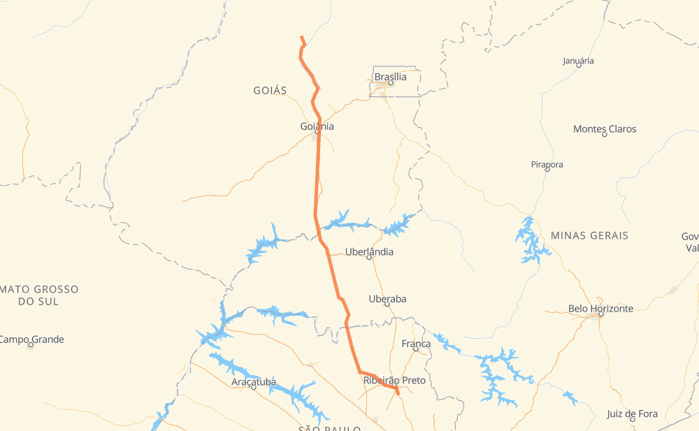
The distance from Itapaci to Cravinhos is 836 kilometers by road including 409 kilometers on motorways. Road takes approximately 8 hours and 45 minutes and goes through Goiânia, Chácara Bom Retiro, Granjas Reunidas Nossa Senhora de Lourdes, Centralina, Prata, Planura and Cohab Pedro de Felício.
| Shortest distance by air | 736 km ✈️ |
| Car route length | 836 km 🚗 |
| Driving time | 8 h 45 min |
| Fuel amount | 66.9 L |
| Fuel cost | 99.7 GBP |
| Point | Distance | Time | Fuel | |
| -14.95223, -49.55112 | 0 km | 00 min | 0.0 L | |
|
GO-336 33 km, 22 min
|
||||
| Jardim Paulista | 33 km | 22 min | 3.2 L | |
|
BR-153 GO-080 167 km, 1 h 49 min
|
||||
| Chácara Bom Retiro | 200 km | 2 h 12 min | 16.7 L | |
|
GO-080 21 km, 15 min
|
||||
| Goiânia | 221 km | 2 h 27 min | 19.1 L | |
|
BR-153 8 km, 05 min
|
||||
| Granjas Reunidas Nossa Senhora de Lourdes | 229 km | 2 h 33 min | 19.8 L | |
|
BR-153 226 km, 2 h 15 min
|
||||
| Centralina | 455 km | 4 h 48 min | 37.2 L | |
|
BR-153 82 km, 48 min
|
||||
| Prata | 536 km | 5 h 37 min | 44.0 L | |
|
BR-153 113 km, 1 h 11 min
|
||||
| Planura | 649 km | 6 h 49 min | 53.2 L | |
|
BR-364 SP-326 120 km, 1 h 10 min
|
||||
| Cohab Pedro de Felício | 768 km | 8 h 00 min | 62.8 L | |
|
SP-322 49 km, 29 min
|
||||
| Jardim Nova Aliança | 818 km | 8 h 29 min | 66.9 L | |
|
SP-322 22 km, 15 min
|
||||
| Cravinhos | 839 km | 8 h 45 min | 68.0 L | |
Hotels of Cravinhos
Frequently Asked Questions
How much does it cost to drive from Itapaci to Cravinhos?
Fuel cost: 99.7 GBP
This fuel cost is calculated as: (Route length 836 km / 100 km) * (Fuel consumption 8 L/100 km) * (Fuel price 1.49 GBP / L)
You can adjust fuel consumption and fuel price here.
How long is a car ride from Itapaci to Cravinhos?
Driving time: 8 h 45 min
This time is calculated for driving at the maximum permitted speed, taking into account traffic rules restrictions.
- 300 km with a maximum speed 110 km/h = 2 h 43 min
- 36 km with a maximum speed 100 km/h = 21 min
- 351 km with a maximum speed 96 km/h = 3 h 39 min
- 10 km with a maximum speed 90 km/h = 6 min
- 124 km with a maximum speed 80 km/h = 1 h 33 min
- 5 km with a maximum speed 70 km/h = 4 min
- 4 km with a maximum speed 60 km/h = 4 min
- 2 km with a maximum speed 50 km/h = 2 min
- 7 km with a maximum speed 40 km/h = 9 min
The calculated driving time does not take into account intermediate stops and traffic jams.
How far is Itapaci to Cravinhos by land?
The distance between Itapaci and Cravinhos is 836 km by road including 409 km on motorways.
Precise satellite coordinates of highways were used for this calculation. The start and finish points are the centers of Itapaci and Cravinhos respectively.
How far is Itapaci to Cravinhos by plane?
The shortest distance (air line, as the crow flies) between Itapaci and Cravinhos is 736 km.
This distance is calculated using the Haversine formula as a great-circle distance between two points on the surface of a sphere. The start and finish points are the centers of Itapaci and Cravinhos respectively. Actual distance between airports may be different.
How many hours is Itapaci from Cravinhos by plane?
Boeing 737 airliner needs 55 min to cover the distance of 736 km at a cruising speed of 800 km/h.
Small plane "Cessna 172" needs 3 h 20 min to flight this distance at average speed of 220 km/h.
This time is approximate and do not take into account takeoff and landing times, airport location and other real world factors.
How long is a helicopter ride from Itapaci to Cravinhos?
Fast helicopter "Eurocopter AS350" or "Hughes OH-6 Cayuse" need 3 h 4 min to cover the distance of 736 km at a cruising speed of 240 km/h.
Popular "Robinson R44" needs 3 h 30 min to flight this distance at average speed of 210 km/h.
This time is approximate and do not take into account takeoff and landing times, aerodrome location and other real world factors.
What city is halfway between Itapaci and Cravinhos?
The halfway point between Itapaci and Cravinhos is Centralina. It is located about 37 km from the exact midpoint by road.
The distance from Centralina to Itapaci is 455 km and driving will take about 4 h 48 min. The road between Centralina and Cravinhos has length 381 km and will take approximately 3 h 56 min.
The other cities located close to halfway point:
Where is Itapaci in relation to Cravinhos?
Itapaci is located 736 km north-west of Cravinhos.
Itapaci has geographic coordinates: latitude -14.95223, longitude -49.55112.
Cravinhos has geographic coordinates: latitude -21.34028, longitude -47.72944.
Which highway goes from Itapaci to Cravinhos?
The route from Itapaci to Cravinhos follows BR-153, GO-080.
Other minor sections pass along the road:
- SP-326: 89 km
- SP-322: 80 km
- BR-364: 47 km
- BR-455: 30 km
- LMG-810: 24 km
- GO-336: 19 km
- BR-262: 13 km
- SP-330: 10 km
- BR-050: 10 km
- SP-333: 9 km
- MGC-455: 3 km
- SPA 307/330: 3 km