Distance between Jaciara and Setubinha
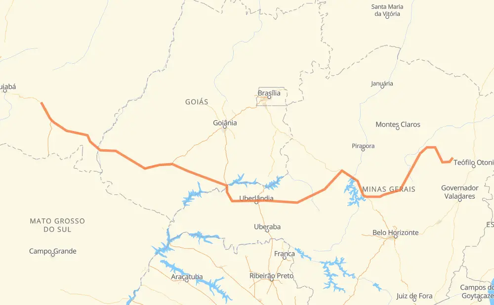
The distance from Jaciara to Setubinha is 1,860 kilometers by road including 235 kilometers on motorways. Road takes approximately 20 hours and 41 minutes and goes through Vila Goulart, Centralina, Monte Alegre de Minas, Tocantins, Dona Zulmira, Distrito Industrial I and Curvelo.
| Shortest distance by air | 1,377 km ✈️ |
| Car route length | 1,860 km 🚗 |
| Driving time | 20 h 41 min |
| Fuel amount | 148.8 L |
| Fuel cost | 221.8 GBP |
| Point | Distance | Time | Fuel | |
| Jaciara | 0 km | 00 min | 0.0 L | |
|
BR-163 76 km, 51 min
|
||||
| Vila Goulart | 76 km | 51 min | 5.9 L | |
|
BR-364 707 km, 7 h 42 min
|
||||
| Centralina | 783 km | 8 h 33 min | 61.8 L | |
|
BR-153 61 km, 33 min
|
||||
| Monte Alegre de Minas | 844 km | 9 h 07 min | 65.4 L | |
|
BR-365 53 km, 29 min
|
||||
| Tocantins | 897 km | 9 h 36 min | 71.6 L | |
|
BR-365 3 km, 02 min
|
||||
| Dona Zulmira | 900 km | 9 h 38 min | 71.9 L | |
|
BR-365 221 km, 2 h 20 min
|
||||
| Distrito Industrial I | 1,121 km | 11 h 58 min | 89.6 L | |
|
BR-365 BR-040 291 km, 3 h 07 min
|
||||
| Curvelo | 1,412 km | 15 h 06 min | 110.9 L | |
|
BR-259 63 km, 43 min
|
||||
| Vila Alexandre Mascarenhas | 1,475 km | 15 h 50 min | 118.0 L | |
|
BR-259 BR-367 385 km, 4 h 51 min
|
||||
| Setubinha | 1,860 km | 20 h 41 min | 148.4 L | |
Frequently Asked Questions
How much does it cost to drive from Jaciara to Setubinha?
Fuel cost: 221.8 GBP
This fuel cost is calculated as: (Route length 1,860 km / 100 km) * (Fuel consumption 8 L/100 km) * (Fuel price 1.49 GBP / L)
You can adjust fuel consumption and fuel price here.
How long is a car ride from Jaciara to Setubinha?
Driving time: 20 h 41 min
This time is calculated for driving at the maximum permitted speed, taking into account traffic rules restrictions.
- 180 km with a maximum speed 110 km/h = 1 h 38 min
- 46 km with a maximum speed 100 km/h = 27 min
- 1,017 km with a maximum speed 96 km/h = 10 h 35 min
- 576 km with a maximum speed 80 km/h = 7 h 11 min
- 18 km with a maximum speed 60 km/h = 17 min
- 14 km with a maximum speed 50 km/h = 17 min
- 8 km with a maximum speed 40 km/h = 12 min
The calculated driving time does not take into account intermediate stops and traffic jams.
How far is Jaciara to Setubinha by land?
The distance between Jaciara and Setubinha is 1,860 km by road including 235 km on motorways.
Precise satellite coordinates of highways were used for this calculation. The start and finish points are the centers of Jaciara and Setubinha respectively.
How far is Jaciara to Setubinha by plane?
The shortest distance (air line, as the crow flies) between Jaciara and Setubinha is 1,377 km.
This distance is calculated using the Haversine formula as a great-circle distance between two points on the surface of a sphere. The start and finish points are the centers of Jaciara and Setubinha respectively. Actual distance between airports may be different.
How many hours is Jaciara from Setubinha by plane?
Boeing 737 airliner needs 1 h 43 min to cover the distance of 1,377 km at a cruising speed of 800 km/h.
Small plane "Cessna 172" needs 6 h 15 min to flight this distance at average speed of 220 km/h.
This time is approximate and do not take into account takeoff and landing times, airport location and other real world factors.
How long is a helicopter ride from Jaciara to Setubinha?
Fast helicopter "Eurocopter AS350" or "Hughes OH-6 Cayuse" need 5 h 44 min to cover the distance of 1,377 km at a cruising speed of 240 km/h.
Popular "Robinson R44" needs 6 h 33 min to flight this distance at average speed of 210 km/h.
This time is approximate and do not take into account takeoff and landing times, aerodrome location and other real world factors.
What city is halfway between Jaciara and Setubinha?
The halfway point between Jaciara and Setubinha is Dona Zulmira. It is located about 30 km from the exact midpoint by road.
The distance from Dona Zulmira to Jaciara is 900 km and driving will take about 9 h 38 min. The road between Dona Zulmira and Setubinha has length 960 km and will take approximately 11 h 3 min.
The other cities located close to halfway point:
Where is Jaciara in relation to Setubinha?
Jaciara is located 1,377 km west of Setubinha.
Jaciara has geographic coordinates: latitude -15.95201, longitude -54.97621.
Setubinha has geographic coordinates: latitude -17.59951, longitude -42.16167.
Which highway goes from Jaciara to Setubinha?
The route from Jaciara to Setubinha follows BR-364, BR-365, BR-367, MGC-367, BR-452, BR-259, BR-040.
Other minor sections pass along the road:
- BR-060: 96 km
- MG-308: 94 km
- BR-163: 74 km
- BR-153: 57 km
- MGC-259: 43 km
- LMG-721: 26 km
- MGC-451: 25 km
- BR-451: 25 km
- BR-120: 7 km
- MT-100: 7 km
- BR-158: 5 km
- MGC-120: 5 km
- BR-050: 5 km
- CMG-120: 2 km