Distance between Las Cabras and Chile
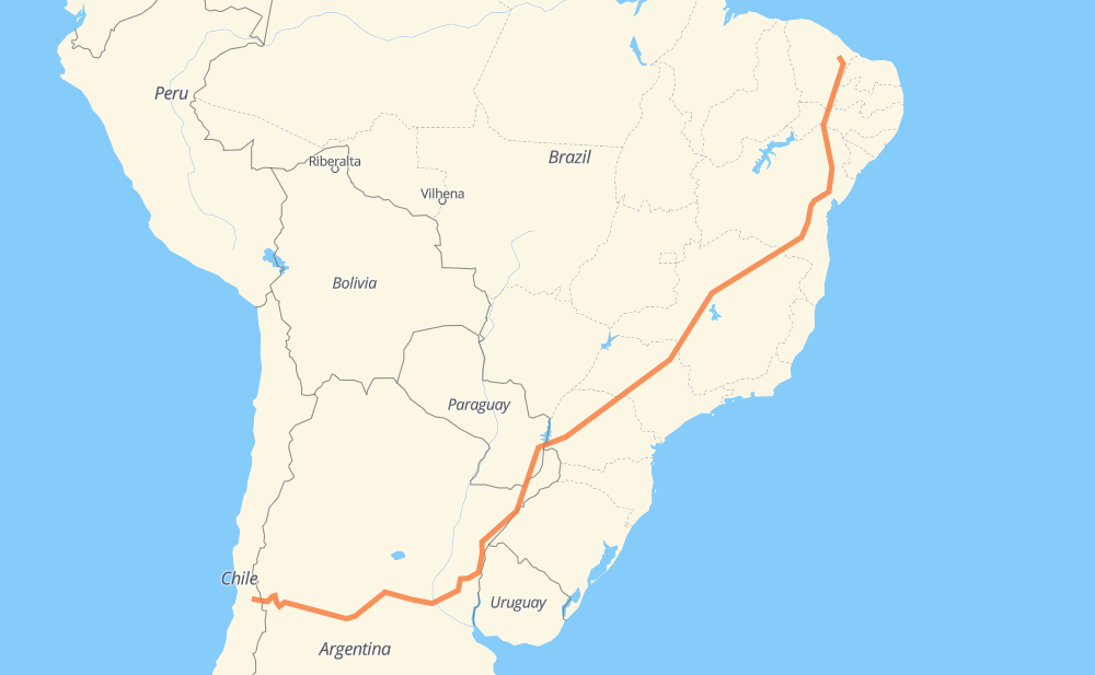
The distance from Las Cabras to Chile is 5,960 kilometers by road including 717 kilometers on motorways. Road takes approximately 66 hours and 27 minutes and goes through San Felipe, Los Andes, San Luis, Río Cuarto, Villa María, Rosario and Alvear.
| Shortest distance by air | 4,554 km ✈️ |
| Car route length | 5,960 km 🚗 |
| Driving time | 66 h 27 min |
| Fuel amount | 476.8 L |
| Fuel cost | 710.4 GBP |
| Point | Distance | Time | Fuel | |
| Las Cabras | 0 km | 00 min | 0.0 L | |
|
E-715 145 km, 1 h 50 min
|
||||
| Los Andes | 145 km | 1 h 50 min | 0.1 L | |
|
E-765 RN7 604 km, 6 h 56 min
|
||||
| San Luis | 749 km | 8 h 47 min | 59.5 L | |
|
RN7 RN8 213 km, 2 h 18 min
|
||||
| Río Cuarto | 962 km | 11 h 05 min | 76.3 L | |
|
RN8 RN158 140 km, 1 h 47 min
|
||||
| Villa María | 1,102 km | 12 h 53 min | 88.0 L | |
|
RP2 RN9 251 km, 2 h 16 min
|
||||
| Rosario | 1,352 km | 15 h 10 min | 107.5 L | |
|
RNA008 RN14 686 km, 7 h 17 min
|
||||
| Alvear | 2,038 km | 22 h 27 min | 162.8 L | |
|
RN14 235 km, 2 h 51 min
|
||||
| Posadas | 2,273 km | 25 h 19 min | 181.7 L | |
|
RN105 9 km, 07 min
|
||||
| Encarnacion | 2,281 km | 25 h 26 min | 182.2 L | |
|
PY01 PY06 254 km, 3 h 07 min
|
||||
| Minga Guazú | 2,536 km | 28 h 34 min | 201.4 L | |
|
PY02 23 km, 18 min
|
||||
| Ciudad del Este | 2,558 km | 28 h 52 min | 204.3 L | |
|
PY02 BR-277 144 km, 1 h 45 min
|
||||
| Cascavel | 2,703 km | 30 h 38 min | 215.8 L | |
|
BR-277 BR-369 493 km, 5 h 33 min
|
||||
| Assis | 3,195 km | 36 h 11 min | 253.7 L | |
|
SP-333 585 km, 6 h 07 min
|
||||
| Araxá | 3,780 km | 42 h 18 min | 302.4 L | |
|
BR-116 2,395 km, 26 h 40 min
|
||||
| -4.88926, -38.43730 | 6,175 km | 68 h 59 min | 494.0 L | |
Frequently Asked Questions
How much does it cost to drive from Las Cabras to Chile?
Fuel cost: 710.4 GBP
This fuel cost is calculated as: (Route length 5,960 km / 100 km) * (Fuel consumption 8 L/100 km) * (Fuel price 1.49 GBP / L)
You can adjust fuel consumption and fuel price here.
How long is a car ride from Las Cabras to Chile?
Driving time: 66 h 27 min
This time is calculated for driving at the maximum permitted speed, taking into account traffic rules restrictions.
- 257 km with a maximum speed 112 km/h = 2 h 17 min
- 264 km with a maximum speed 110 km/h = 2 h 23 min
- 92 km with a maximum speed 100 km/h = 55 min
- 3,703 km with a maximum speed 96 km/h = 38 h 34 min
- 2 km with a maximum speed 90 km/h = 1 min
- 1,378 km with a maximum speed 80 km/h = 17 h 13 min
- 31 km with a maximum speed 70 km/h = 26 min
- 178 km with a maximum speed 60 km/h = 2 h 57 min
- 5 km with a maximum speed 50 km/h = 5 min
- 2 km with a maximum speed 45 km/h = 2 min
- 52 km with a maximum speed 40 km/h = 1 h 18 min
- 1 km with a maximum speed 30 km/h = 1 min
- 3 km with a maximum speed 20 km/h = 8 min
The calculated driving time does not take into account intermediate stops and traffic jams.
How far is Las Cabras to Chile by land?
The distance between Las Cabras and Chile is 5,960 km by road including 717 km on motorways.
Precise satellite coordinates of highways were used for this calculation. The start and finish points are the centers of Las Cabras and Chile respectively.
How far is Las Cabras to Chile by plane?
The shortest distance (air line, as the crow flies) between Las Cabras and Chile is 4,554 km.
This distance is calculated using the Haversine formula as a great-circle distance between two points on the surface of a sphere. The start and finish points are the centers of Las Cabras and Chile respectively. Actual distance between airports may be different.
How many hours is Las Cabras from Chile by plane?
Boeing 737 airliner needs 5 h 41 min to cover the distance of 4,554 km at a cruising speed of 800 km/h.
Small plane "Cessna 172" needs 20 h 42 min to flight this distance at average speed of 220 km/h.
This time is approximate and do not take into account takeoff and landing times, airport location and other real world factors.
How long is a helicopter ride from Las Cabras to Chile?
Fast helicopter "Eurocopter AS350" or "Hughes OH-6 Cayuse" need 18 h 58 min to cover the distance of 4,554 km at a cruising speed of 240 km/h.
Popular "Robinson R44" needs 21 h 41 min to flight this distance at average speed of 210 km/h.
This time is approximate and do not take into account takeoff and landing times, aerodrome location and other real world factors.
What city is halfway between Las Cabras and Chile?
The halfway point between Las Cabras and Chile is Parque Cidade Industrial. It is located about 18 km from the exact midpoint by road.
The distance from Parque Cidade Industrial to Las Cabras is 2,962 km and driving will take about 33 h 30 min. The road between Parque Cidade Industrial and Chile has length 2,998 km and will take approximately 32 h 56 min.
The other cities located close to halfway point:
Where is Las Cabras in relation to Chile?
Las Cabras is located 4,554 km south-west of Chile.
Las Cabras has geographic coordinates: latitude -32.73395, longitude -70.6291.
Chile has geographic coordinates: latitude -4.88926, longitude -38.4373.
Which highway goes from Las Cabras to Chile?
The route from Las Cabras to Chile follows BR-116, RN14, RN7, BR-365, SP-333, BR-251, PY06, RN9, BR-369, SP-334, BR-277, BR-146, RN158, E-765, RN8, RN18, MG-428.
Other minor sections pass along the road:
- 60-CH: 74 km
- PR-317: 64 km
- RP6: 63 km
- RN174: 61 km
- PR-323: 59 km
- RN105: 48 km
- RN12: 48 km
- E-85: 47 km
- RP26: 40 km
- PR-444: 39 km
- BA-262: 35 km
- E-735: 34 km
- BR-158: 28 km
- PY02: 27 km
- CE-265: 24 km
- CE-138: 22 km
- RN40: 21 km
- BR-376: 21 km
- BR-122: 19 km
- LMG-653: 16 km
- PR-445: 14 km
- SP-328: 13 km
- RP2: 13 km
- BR-230: 13 km
- E-777: 12 km
- CE-284: 11 km
- PR-986: 10 km
- MGC-251: 9 km
- MGC-122: 9 km
- RNA008: 9 km
- CMG-122: 9 km
- CMG-251: 9 km
- SP-322: 9 km
- BR-153: 7 km
- PY01: 6 km
- RP11: 4 km
- BR-030: 3 km
- BR-374: 3 km
- SP-270: 3 km
- BR-050: 2 km
- SP-330: 2 km
- CMG-135: 2 km
- BR-135: 2 km
- RN40 RN7: 2 km
- E-779: 2 km
- PY18: 1 km
- SP-294: 1 km
- E-715: 1 km