Distance between Las Flores and El Calambre
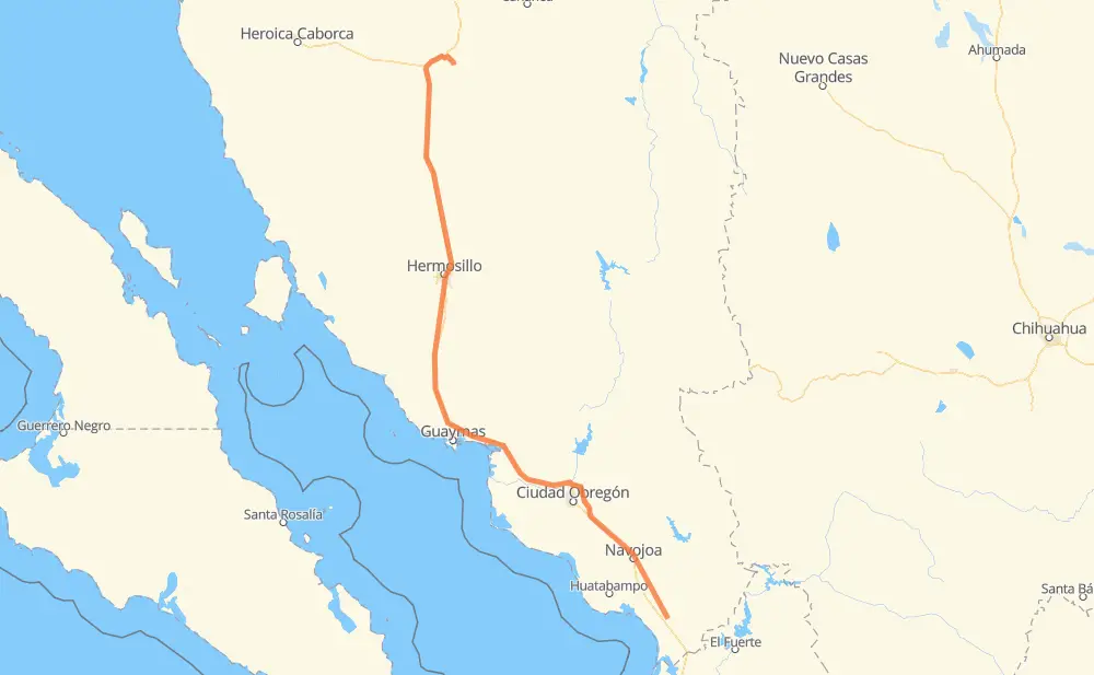
The distance from Las Flores to El Calambre is 584 kilometers by road including 471 kilometers on motorways. Road takes approximately 6 hours and 21 minutes and goes through Navojoa, Hermosillo, Vicam, Santa Ana and Magdalena de Kino.
| Shortest distance by air | 467 km ✈️ |
| Car route length | 584 km 🚗 |
| Driving time | 6 h 21 min |
| Fuel amount | 46.7 L |
| Fuel cost | 69.2 GBP |
| Toll roads cost | 308 + ? MXN |
| Point | Distance | Time | Fuel | |
| Las Flores | 0 km | 00 min | 0.0 L | |
|
MEX 15D 13 km, 10 min
|
||||
| Guadalupe Estrella (Kilometro 107) | 13 km | 10 min | 0.9 L | |
|
MEX 15D 18 km, 12 min
|
||||
| El Crucero | 31 km | 23 min | 1.5 L | |
|
MEX 15D 15 km, 11 min
|
||||
| Tres Jitos (Los Carrazco) | 45 km | 34 min | 3.4 L | |
|
MEX 15D 17 km, 12 min
|
||||
| Navojoa | 62 km | 46 min | 4.6 L | |
|
MEX 15D 7 km, 05 min
|
||||
| Porcina Pedro | 69 km | 52 min | 5.5 L | |
|
MEX 15D 112 km, 1 h 16 min
|
||||
| Vicam | 182 km | 2 h 08 min | 14.4 L | |
|
MEX 15D 203 km, 2 h 02 min
|
||||
| Hermosillo | 385 km | 4 h 10 min | 30.6 L | |
|
MEX 15 MEX 15D 169 km, 1 h 43 min
|
||||
| Santa Ana | 554 km | 5 h 54 min | 44.2 L | |
|
MEX 15D MEX 2 20 km, 17 min
|
||||
| Magdalena de Kino | 574 km | 6 h 12 min | 45.8 L | |
|
MEX 15D SON 54 11 km, 09 min
|
||||
| 30.55600, -110.88883 | 584 km | 6 h 21 min | 46.7 L | |
Frequently Asked Questions
How many toll booths are there from Las Flores to El Calambre?
There are 5 toll booths between Las Flores and El Calambre: Hermosillo, Guaymas, Libramiento Cd Obregon, Fundicion and Estacion Don La Jaula.
How much does the toll booths cost from Las Flores to El Calambre?
Toll roads cost: Estacion Don La Jaula (90 MXN) + Fundicion (90 MXN) + Libramiento Cd Obregon (?) + Guaymas (38 MXN) + Hermosillo (90 MXN) = 308 + ? MXN
How much does it cost to drive from Las Flores to El Calambre?
Fuel cost: 69.2 GBP
This fuel cost is calculated as: (Route length 584 km / 100 km) * (Fuel consumption 8 L/100 km) * (Fuel price 1.48 GBP / L)
You can adjust fuel consumption and fuel price here.
Toll roads cost: 308 + ? MXN
How long is a car ride from Las Flores to El Calambre?
Driving time: 6 h 21 min
This time is calculated for driving at the maximum permitted speed, taking into account traffic rules restrictions.
- 216 km with a maximum speed 110 km/h = 1 h 58 min
- 118 km with a maximum speed 100 km/h = 1 h 10 min
- 17 km with a maximum speed 96 km/h = 10 min
- 53 km with a maximum speed 90 km/h = 35 min
- 144 km with a maximum speed 80 km/h = 1 h 48 min
- 28 km with a maximum speed 60 km/h = 28 min
- 6 km with a maximum speed 50 km/h = 7 min
- 1 km with a maximum speed 20 km/h = 2 min
The calculated driving time does not take into account intermediate stops and traffic jams.
How far is Las Flores to El Calambre by land?
The distance between Las Flores and El Calambre is 584 km by road including 471 km on motorways.
Precise satellite coordinates of highways were used for this calculation. The start and finish points are the centers of Las Flores and El Calambre respectively.
How far is Las Flores to El Calambre by plane?
The shortest distance (air line, as the crow flies) between Las Flores and El Calambre is 467 km.
This distance is calculated using the Haversine formula as a great-circle distance between two points on the surface of a sphere. The start and finish points are the centers of Las Flores and El Calambre respectively. Actual distance between airports may be different.
How many hours is Las Flores from El Calambre by plane?
Boeing 737 airliner needs 35 min to cover the distance of 467 km at a cruising speed of 800 km/h.
Small plane "Cessna 172" needs 2 h 7 min to flight this distance at average speed of 220 km/h.
This time is approximate and do not take into account takeoff and landing times, airport location and other real world factors.
How long is a helicopter ride from Las Flores to El Calambre?
Fast helicopter "Eurocopter AS350" or "Hughes OH-6 Cayuse" need 1 h 56 min to cover the distance of 467 km at a cruising speed of 240 km/h.
Popular "Robinson R44" needs 2 h 13 min to flight this distance at average speed of 210 km/h.
This time is approximate and do not take into account takeoff and landing times, aerodrome location and other real world factors.
What city is halfway between Las Flores and El Calambre?
The halfway point between Las Flores and El Calambre is La Bandera Uno. It is located about 4 km from the exact midpoint by road.
The distance from La Bandera Uno to Las Flores is 296 km and driving will take about 3 h 16 min. The road between La Bandera Uno and El Calambre has length 288 km and will take approximately 3 h 5 min.
The other cities located close to halfway point:
Where is Las Flores in relation to El Calambre?
Las Flores is located 467 km south-east of El Calambre.
Las Flores has geographic coordinates: latitude 26.6395, longitude -109.17117.
El Calambre has geographic coordinates: latitude 30.556, longitude -110.88883.
Which highway goes from Las Flores to El Calambre?
The route from Las Flores to El Calambre follows MEX 15D.
Other minor sections pass along the road:
- MEX 15: 36 km
- MEX 2: 19 km
- SON 54: 8 km
- MEX 15d: 3 km