Distance between Lino Lakes MN and Big Spring TX
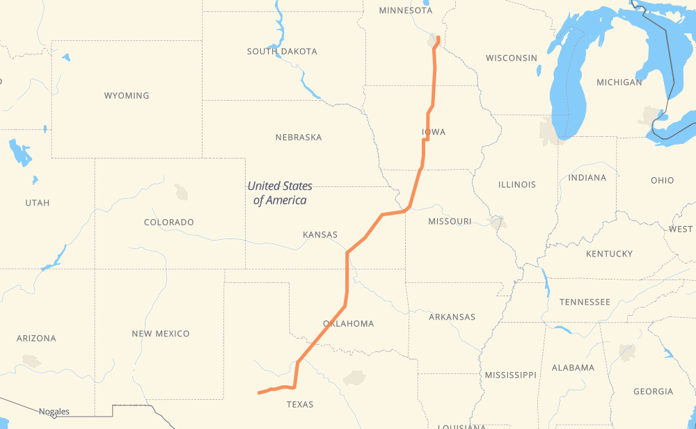
The distance from Lino Lakes to Big Spring is 1,929 kilometers by road including 1,696 kilometers on motorways. Road takes approximately 18 hours and 28 minutes and goes through Saint Paul, Ames, Kansas City, Kansas City, Lawrence, Topeka and Edmond.
| Shortest distance by air | 1,608 km ✈️ |
| Car route length | 1,929 km 🚗 |
| Driving time | 18 h 28 min |
| Fuel amount | 154.3 L |
| Fuel cost | 229.9 GBP |
| Point | Distance | Time | Fuel | |
| Lino Lakes | 0 km | 00 min | 0.0 L | |
|
CR 34 I 35E 29 km, 19 min
|
||||
| Saint Paul | 29 km | 19 min | 2.0 L | |
|
CR 37 I 35 342 km, 3 h 05 min
|
||||
| Ames | 372 km | 3 h 25 min | 29.6 L | |
|
I 35 352 km, 3 h 11 min
|
||||
| Kansas City | 724 km | 6 h 37 min | 57.4 L | |
|
I 35 I 635 24 km, 13 min
|
||||
| Kansas City | 748 km | 6 h 51 min | 59.6 L | |
|
I 70 49 km, 26 min
|
||||
| Lawrence | 797 km | 7 h 17 min | 63.3 L | |
|
I 70 34 km, 17 min
|
||||
| Topeka | 831 km | 7 h 35 min | 66.0 L | |
|
I 470 I 35 440 km, 3 h 56 min
|
||||
| Edmond | 1,270 km | 11 h 31 min | 101.1 L | |
|
I 35 28 km, 16 min
|
||||
| Oklahoma City | 1,299 km | 11 h 47 min | 102.1 L | |
|
I 44 136 km, 1 h 15 min
|
||||
| Lawton | 1,435 km | 13 h 03 min | 114.5 L | |
|
I 44 US 277 326 km, 3 h 38 min
|
||||
| Abilene | 1,761 km | 16 h 41 min | 140.3 L | |
|
I 20 168 km, 1 h 46 min
|
||||
| Big Spring | 1,929 km | 18 h 28 min | 153.4 L | |
Hotels of Big Spring
Frequently Asked Questions
How much does it cost to drive from Lino Lakes to Big Spring?
Fuel cost: 229.9 GBP
This fuel cost is calculated as: (Route length 1,929 km / 100 km) * (Fuel consumption 8 L/100 km) * (Fuel price 1.49 GBP / L)
You can adjust fuel consumption and fuel price here.
How long is a car ride from Lino Lakes to Big Spring?
Driving time: 18 h 28 min
This time is calculated for driving at the maximum permitted speed, taking into account traffic rules restrictions.
- 1,350 km with a maximum speed 112 km/h = 12 h 3 min
- 76 km with a maximum speed 105 km/h = 43 min
- 122 km with a maximum speed 100 km/h = 1 h 13 min
- 59 km with a maximum speed 97 km/h = 36 min
- 75 km with a maximum speed 96 km/h = 46 min
- 14 km with a maximum speed 89 km/h = 9 min
- 5 km with a maximum speed 80 km/h = 3 min
- 224 km with a maximum speed 80 km/h = 2 h 48 min
- 1 km with a maximum speed 56 km/h = 1 min
- 2 km with a maximum speed 50 km/h = 2 min
The calculated driving time does not take into account intermediate stops and traffic jams.
How far is Lino Lakes to Big Spring by land?
The distance between Lino Lakes and Big Spring is 1,929 km by road including 1,696 km on motorways.
Precise satellite coordinates of highways were used for this calculation. The start and finish points are the centers of Lino Lakes and Big Spring respectively.
How far is Lino Lakes to Big Spring by plane?
The shortest distance (air line, as the crow flies) between Lino Lakes and Big Spring is 1,608 km.
This distance is calculated using the Haversine formula as a great-circle distance between two points on the surface of a sphere. The start and finish points are the centers of Lino Lakes and Big Spring respectively. Actual distance between airports may be different.
How many hours is Lino Lakes from Big Spring by plane?
Boeing 737 airliner needs 2 h to cover the distance of 1,608 km at a cruising speed of 800 km/h.
Small plane "Cessna 172" needs 7 h 18 min to flight this distance at average speed of 220 km/h.
This time is approximate and do not take into account takeoff and landing times, airport location and other real world factors.
How long is a helicopter ride from Lino Lakes to Big Spring?
Fast helicopter "Eurocopter AS350" or "Hughes OH-6 Cayuse" need 6 h 42 min to cover the distance of 1,608 km at a cruising speed of 240 km/h.
Popular "Robinson R44" needs 7 h 39 min to flight this distance at average speed of 210 km/h.
This time is approximate and do not take into account takeoff and landing times, aerodrome location and other real world factors.
What city is halfway between Lino Lakes and Big Spring?
The halfway point between Lino Lakes and Big Spring is Cassoday. It is located about 14 km from the exact midpoint by road.
The distance from Cassoday to Lino Lakes is 978 km and driving will take about 8 h 53 min. The road between Cassoday and Big Spring has length 951 km and will take approximately 9 h 35 min.
The other cities located close to halfway point:
Where is Lino Lakes in relation to Big Spring?
Lino Lakes is located 1,608 km north-east of Big Spring.
Lino Lakes has geographic coordinates: latitude 45.16024, longitude -93.08883.
Big Spring has geographic coordinates: latitude 32.2504, longitude -101.47874.
Which highway goes from Lino Lakes to Big Spring?
The route from Lino Lakes to Big Spring follows I 35, US 277, I 44, I 20.
Other minor sections pass along the road:
- I 335: 82 km
- I 70: 82 km
- US 82: 72 km
- MO 110: 66 km
- US 84: 64 km
- US 281: 60 km
- I 35E: 44 km
- IA 27: 44 km
- US 83: 36 km
- OK 66: 23 km
- US 62: 22 km
- I 80: 22 km
- US 77: 18 km
- US 183: 18 km
- US 283: 18 km
- US 24: 18 km
- US 40: 18 km
- OK 3: 12 km
- I 635: 12 km
- US 64: 12 km
- I 470: 11 km
- US 69: 8 km
- US 10: 8 km
- US 71: 5 km
- I 29: 5 km
- US 287: 5 km
- OK 37: 4 km
- US 18: 4 km
- TX 70: 4 km
- I 20-G Business: 3 km
- CR 37: 3 km
- CR 34: 3 km
- CR 21: 3 km
- TX 208: 2 km