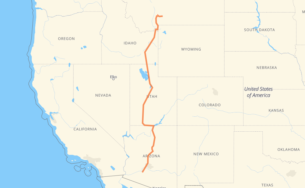
Distance between Livingston MT and Gila Bend AZ
The distance from Livingston to Gila Bend is 1,860 kilometers by road including 1,055 kilometers on motorways. Road takes approximately 18 hours and 46 minutes and goes through Bozeman, Idaho Falls, Pocatello, Ogden, Salt Lake City, Provo and Flagstaff.
| Shortest distance by air | 1,426 km ✈️ |
| Car route length | 1,860 km 🚗 |
| Driving time | 18 h 46 min |
| Fuel amount | 148.8 L |
| Fuel cost | 221.8 GBP |
| Point | Distance | Time | Fuel | |
| Livingston | 0 km | 00 min | 0.0 L | |
|
US 191 I 90 47 km, 28 min
|
||||
| Bozeman | 47 km | 28 min | 3.6 L | |
|
I 90 Business US 20 315 km, 3 h 29 min
|
||||
| Idaho Falls | 362 km | 3 h 57 min | 28.5 L | |
|
US 20 I 15 83 km, 53 min
|
||||
| Pocatello | 445 km | 4 h 51 min | 35.0 L | |
|
I 15 203 km, 1 h 56 min
|
||||
| Ogden | 648 km | 6 h 48 min | 51.6 L | |
|
I 15 54 km, 28 min
|
||||
| Salt Lake City | 702 km | 7 h 17 min | 55.7 L | |
|
I 15 74 km, 39 min
|
||||
| Provo | 775 km | 7 h 57 min | 61.4 L | |
|
I 15 US 89 763 km, 7 h 44 min
|
||||
| Flagstaff | 1,538 km | 15 h 42 min | 122.1 L | |
|
I 17 187 km, 1 h 41 min
|
||||
| Phoenix | 1,725 km | 17 h 23 min | 136.9 L | |
|
I 17 18 km, 10 min
|
||||
| Peoria | 1,743 km | 17 h 33 min | 139.0 L | |
|
AZ 303 Loop 23 km, 12 min
|
||||
| Surprise | 1,766 km | 17 h 46 min | 140.8 L | |
|
AZ 303 Loop AZ 85 95 km, 59 min
|
||||
| Gila Bend | 1,860 km | 18 h 46 min | 147.0 L | |
Hotels of Gila Bend
Frequently Asked Questions
How much does it cost to drive from Livingston to Gila Bend?
Fuel cost: 221.8 GBP
This fuel cost is calculated as: (Route length 1,860 km / 100 km) * (Fuel consumption 8 L/100 km) * (Fuel price 1.49 GBP / L)
You can adjust fuel consumption and fuel price here.
How long is a car ride from Livingston to Gila Bend?
Driving time: 18 h 46 min
This time is calculated for driving at the maximum permitted speed, taking into account traffic rules restrictions.
- 754 km with a maximum speed 112 km/h = 6 h 43 min
- 77 km with a maximum speed 105 km/h = 44 min
- 125 km with a maximum speed 100 km/h = 1 h 14 min
- 7 km with a maximum speed 97 km/h = 4 min
- 614 km with a maximum speed 96 km/h = 6 h 23 min
- 97 km with a maximum speed 89 km/h = 1 h 5 min
- 8 km with a maximum speed 80 km/h = 6 min
- 132 km with a maximum speed 80 km/h = 1 h 38 min
- 24 km with a maximum speed 72 km/h = 19 min
- 4 km with a maximum speed 64 km/h = 4 min
- 13 km with a maximum speed 56 km/h = 14 min
- 3 km with a maximum speed 50 km/h = 3 min
- 2 km with a maximum speed 40 km/h = 3 min
The calculated driving time does not take into account intermediate stops and traffic jams.
How far is Livingston to Gila Bend by land?
The distance between Livingston and Gila Bend is 1,860 km by road including 1,055 km on motorways.
Precise satellite coordinates of highways were used for this calculation. The start and finish points are the centers of Livingston and Gila Bend respectively.
How far is Livingston to Gila Bend by plane?
The shortest distance (air line, as the crow flies) between Livingston and Gila Bend is 1,426 km.
This distance is calculated using the Haversine formula as a great-circle distance between two points on the surface of a sphere. The start and finish points are the centers of Livingston and Gila Bend respectively. Actual distance between airports may be different.
How many hours is Livingston from Gila Bend by plane?
Boeing 737 airliner needs 1 h 46 min to cover the distance of 1,426 km at a cruising speed of 800 km/h.
Small plane "Cessna 172" needs 6 h 28 min to flight this distance at average speed of 220 km/h.
This time is approximate and do not take into account takeoff and landing times, airport location and other real world factors.
How long is a helicopter ride from Livingston to Gila Bend?
Fast helicopter "Eurocopter AS350" or "Hughes OH-6 Cayuse" need 5 h 56 min to cover the distance of 1,426 km at a cruising speed of 240 km/h.
Popular "Robinson R44" needs 6 h 47 min to flight this distance at average speed of 210 km/h.
This time is approximate and do not take into account takeoff and landing times, aerodrome location and other real world factors.
What city is halfway between Livingston and Gila Bend?
The halfway point between Livingston and Gila Bend is Meadow. It is located about 8 km from the exact midpoint by road.
The distance from Meadow to Livingston is 938 km and driving will take about 9 h 23 min. The road between Meadow and Gila Bend has length 922 km and will take approximately 9 h 23 min.
The other cities located close to halfway point:
Where is Livingston in relation to Gila Bend?
Livingston is located 1,426 km north of Gila Bend.
Livingston has geographic coordinates: latitude 45.66244, longitude -110.56104.
Gila Bend has geographic coordinates: latitude 32.94783, longitude -112.71682.
Which highway goes from Livingston to Gila Bend?
The route from Livingston to Gila Bend follows I 15, US 89, I 17, US 20, US 191.
Other minor sections pass along the road:
- I 84: 61 km
- AZ 85: 58 km
- AZ 303 Loop: 56 km
- US 91: 49 km
- I 90: 41 km
- US 26: 37 km
- UT 20: 33 km
- US 30: 31 km
- US 6: 19 km
- I 10: 17 km
- US 50: 15 km
- MT 84: 10 km
- UT 30: 8 km
- US 191 US 287: 7 km
- I 40: 7 km
- US 287: 6 km
- I 80: 3 km
- AZ 89A: 3 km
- I 90 Business: 2 km
- I 8 BL: 2 km