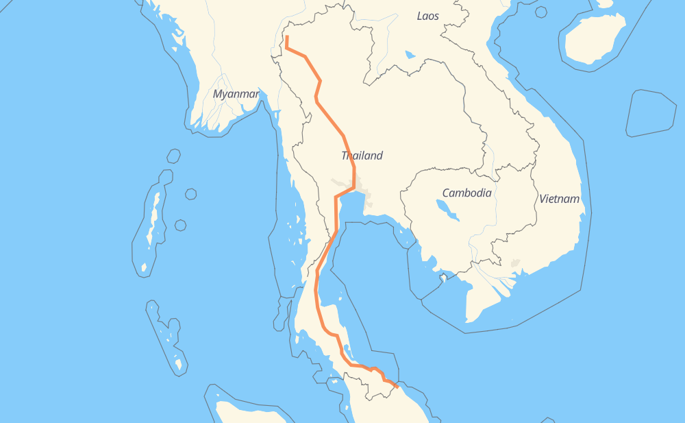
Distance between Mae Hong Son and Kota Bharu
The distance from Mae Hong Son to Kota Bharu is 2,075 kilometers by road including 62 kilometers on motorways. Road takes approximately 24 hours and 21 minutes and goes through Bangkok, Khun Yuam, Mae Chaem, Li, Tak, Wang Chao and Ban Pak Dong.
| Shortest distance by air | 1,537 km ✈️ |
| Car route length | 2,075 km 🚗 |
| Driving time | 24 h 21 min |
| Fuel amount | 166 L |
| Fuel cost | 247.3 GBP |
| Point | Distance | Time | Fuel | |
| Mae Hong Son | 0 km | 00 min | 0.0 L | |
|
108 1263 171 km, 2 h 00 min
|
||||
| Mae Chaem | 171 km | 2 h 00 min | 12.4 L | |
|
1192 106 139 km, 1 h 49 min
|
||||
| Li | 310 km | 3 h 49 min | 24.8 L | |
|
106 1 145 km, 1 h 39 min
|
||||
| Tak | 455 km | 5 h 28 min | 36.0 L | |
|
1 30 km, 19 min
|
||||
| Wang Chao | 486 km | 5 h 48 min | 38.6 L | |
|
1 53 km, 36 min
|
||||
| Ban Pak Dong | 538 km | 6 h 24 min | 42.7 L | |
|
1 29 km, 19 min
|
||||
| Ban Khong Wilai | 567 km | 6 h 43 min | 45.1 L | |
|
1 152 km, 1 h 38 min
|
||||
| In Buri | 720 km | 8 h 21 min | 57.0 L | |
|
32 159 km, 1 h 46 min
|
||||
| Bangkok | 879 km | 10 h 08 min | 68.6 L | |
|
35 4 1,196 km, 14 h 13 min
|
||||
| Kota Bharu | 2,075 km | 24 h 21 min | 165.7 L | |
Hotels of Kota Bharu
Frequently Asked Questions
How much does it cost to drive from Mae Hong Son to Kota Bharu?
Fuel cost: 247.3 GBP
This fuel cost is calculated as: (Route length 2,075 km / 100 km) * (Fuel consumption 8 L/100 km) * (Fuel price 1.49 GBP / L)
You can adjust fuel consumption and fuel price here.
How long is a car ride from Mae Hong Son to Kota Bharu?
Driving time: 24 h 21 min
This time is calculated for driving at the maximum permitted speed, taking into account traffic rules restrictions.
- 32 km with a maximum speed 100 km/h = 18 min
- 772 km with a maximum speed 96 km/h = 8 h 2 min
- 1,257 km with a maximum speed 80 km/h = 15 h 42 min
- 13 km with a maximum speed 50 km/h = 15 min
- 1 km with a maximum speed 20 km/h = 1 min
The calculated driving time does not take into account intermediate stops and traffic jams.
How far is Mae Hong Son to Kota Bharu by land?
The distance between Mae Hong Son and Kota Bharu is 2,075 km by road including 62 km on motorways.
Precise satellite coordinates of highways were used for this calculation. The start and finish points are the centers of Mae Hong Son and Kota Bharu respectively.
How far is Mae Hong Son to Kota Bharu by plane?
The shortest distance (air line, as the crow flies) between Mae Hong Son and Kota Bharu is 1,537 km.
This distance is calculated using the Haversine formula as a great-circle distance between two points on the surface of a sphere. The start and finish points are the centers of Mae Hong Son and Kota Bharu respectively. Actual distance between airports may be different.
How many hours is Mae Hong Son from Kota Bharu by plane?
Boeing 737 airliner needs 1 h 55 min to cover the distance of 1,537 km at a cruising speed of 800 km/h.
Small plane "Cessna 172" needs 6 h 59 min to flight this distance at average speed of 220 km/h.
This time is approximate and do not take into account takeoff and landing times, airport location and other real world factors.
How long is a helicopter ride from Mae Hong Son to Kota Bharu?
Fast helicopter "Eurocopter AS350" or "Hughes OH-6 Cayuse" need 6 h 24 min to cover the distance of 1,537 km at a cruising speed of 240 km/h.
Popular "Robinson R44" needs 7 h 19 min to flight this distance at average speed of 210 km/h.
This time is approximate and do not take into account takeoff and landing times, aerodrome location and other real world factors.
What city is halfway between Mae Hong Son and Kota Bharu?
The halfway point between Mae Hong Son and Kota Bharu is Cha-am. It is located about 1 km from the exact midpoint by road.
The distance from Cha-am to Mae Hong Son is 1,036 km and driving will take about 11 h 56 min. The road between Cha-am and Kota Bharu has length 1,039 km and will take approximately 12 h 25 min.
The other cities located close to halfway point:
Where is Mae Hong Son in relation to Kota Bharu?
Mae Hong Son is located 1,537 km north-west of Kota Bharu.
Mae Hong Son has geographic coordinates: latitude 19.30073, longitude 97.96492.
Kota Bharu has geographic coordinates: latitude 6.12561, longitude 102.23935.
Which highway goes from Mae Hong Son to Kota Bharu?
The route from Mae Hong Son to Kota Bharu follows 4, 41, 1, 42, 32, 106.
Other minor sections pass along the road:
- 43: 94 km
- 35: 81 km
- 1263: 66 km
- 108: 64 km
- 37: 48 km
- 1009: 38 km
- 1088: 34 km
- 347: 32 km
- 1192: 21 km
- 134: 20 km
- 122: 13 km
- ลพ.5034: 9 km
- ลพ.3004: 7 km
- 12: 7 km
- 4327: 4 km
- ชม.3003: 4 km
- ลพ.3003: 2 km
- 4084: 2 km