Distance between Monterrey and Tijuana
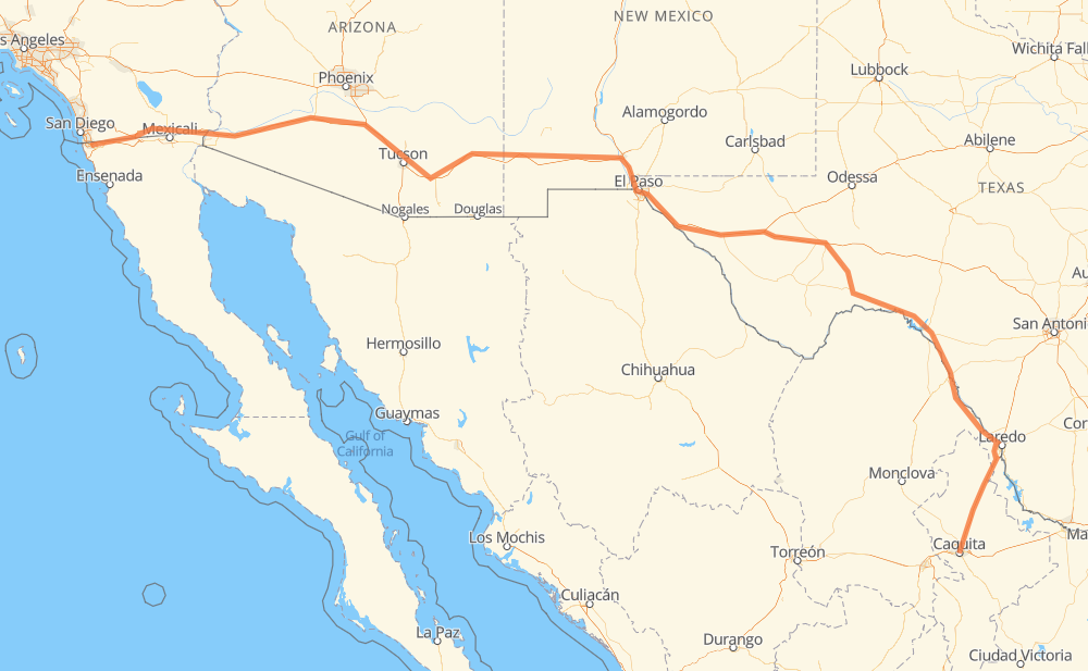
The distance from Monterrey to Tijuana is 2,326 kilometers by road including 1,641 kilometers on motorways. Road takes approximately 23 hours and 20 minutes and goes through Piedras Negras, Eagle Pass, Del Rio, El Paso, Tucson, Yuma and El Centro.
| Shortest distance by air | 1,785 km ✈️ |
| Car route length | 2,326 km 🚗 |
| Driving time | 23 h 20 min |
| Fuel amount | 186.1 L |
| Fuel cost | 277.2 GBP |
| Toll roads cost | 303 + ? MXN |
| Point | Distance | Time | Fuel | |
| Monterrey | 0 km | 00 min | 0.0 L | |
|
15 11 km, 09 min
|
||||
| San Nicolás de los Garza | 11 km | 09 min | 0.6 L | |
|
MEX 85 MEX 2 381 km, 3 h 59 min
|
||||
| Piedras Negras | 392 km | 4 h 09 min | 31.0 L | |
|
7 km, 05 min
|
||||
| Eagle Pass | 399 km | 4 h 15 min | 31.7 L | |
|
US 277-N Business US 277 84 km, 58 min
|
||||
| Del Rio | 483 km | 5 h 13 min | 38.6 L | |
|
Loop 79 I 10 691 km, 6 h 53 min
|
||||
| El Paso | 1,174 km | 12 h 06 min | 93.5 L | |
|
Loop 375 I 10 501 km, 5 h 00 min
|
||||
| Tucson | 1,676 km | 17 h 07 min | 132.2 L | |
|
I 10 I 8 394 km, 3 h 35 min
|
||||
| Yuma | 2,070 km | 20 h 43 min | 164.9 L | |
|
I 8 89 km, 47 min
|
||||
| El Centro | 2,159 km | 21 h 31 min | 172.4 L | |
|
I 8 167 km, 1 h 49 min
|
||||
| Tijuana | 2,326 km | 23 h 20 min | 185.7 L | |
Hotels of Tijuana
Frequently Asked Questions
How many toll booths are there from Monterrey to Tijuana?
There are 3 toll booths between Monterrey and Tijuana: Tijuana-Tecate, Piedras Negras and Sabinas.
How much does the toll booths cost from Monterrey to Tijuana?
Toll roads cost: Sabinas (273 MXN) + Piedras Negras (30 MXN) + Tijuana-Tecate (?) = 303 + ? MXN
How much does it cost to drive from Monterrey to Tijuana?
Fuel cost: 277.2 GBP
This fuel cost is calculated as: (Route length 2,326 km / 100 km) * (Fuel consumption 8 L/100 km) * (Fuel price 1.49 GBP / L)
You can adjust fuel consumption and fuel price here.
Toll roads cost: 303 + ? MXN
How long is a car ride from Monterrey to Tijuana?
Driving time: 23 h 20 min
This time is calculated for driving at the maximum permitted speed, taking into account traffic rules restrictions.
- 1,007 km with a maximum speed 112 km/h = 8 h 59 min
- 102 km with a maximum speed 110 km/h = 55 min
- 112 km with a maximum speed 105 km/h = 1 h 4 min
- 234 km with a maximum speed 100 km/h = 2 h 20 min
- 19 km with a maximum speed 97 km/h = 12 min
- 321 km with a maximum speed 96 km/h = 3 h 20 min
- 180 km with a maximum speed 90 km/h = 1 h 59 min
- 331 km with a maximum speed 80 km/h = 4 h 7 min
- 2 km with a maximum speed 70 km/h = 1 min
- 15 km with a maximum speed 60 km/h = 14 min
- 2 km with a maximum speed 50 km/h = 1 min
The calculated driving time does not take into account intermediate stops and traffic jams.
How far is Monterrey to Tijuana by land?
The distance between Monterrey and Tijuana is 2,326 km by road including 1,641 km on motorways.
Precise satellite coordinates of highways were used for this calculation. The start and finish points are the centers of Monterrey and Tijuana respectively.
How far is Monterrey to Tijuana by plane?
The shortest distance (air line, as the crow flies) between Monterrey and Tijuana is 1,785 km.
This distance is calculated using the Haversine formula as a great-circle distance between two points on the surface of a sphere. The start and finish points are the centers of Monterrey and Tijuana respectively. Actual distance between airports may be different.
How many hours is Monterrey from Tijuana by plane?
Boeing 737 airliner needs 2 h 13 min to cover the distance of 1,785 km at a cruising speed of 800 km/h.
Small plane "Cessna 172" needs 8 h 6 min to flight this distance at average speed of 220 km/h.
This time is approximate and do not take into account takeoff and landing times, airport location and other real world factors.
How long is a helicopter ride from Monterrey to Tijuana?
Fast helicopter "Eurocopter AS350" or "Hughes OH-6 Cayuse" need 7 h 26 min to cover the distance of 1,785 km at a cruising speed of 240 km/h.
Popular "Robinson R44" needs 8 h 30 min to flight this distance at average speed of 210 km/h.
This time is approximate and do not take into account takeoff and landing times, aerodrome location and other real world factors.
What city is halfway between Monterrey and Tijuana?
The halfway point between Monterrey and Tijuana is El Paso. It is located about 11 km from the exact midpoint by road.
The distance from El Paso to Monterrey is 1,174 km and driving will take about 12 h 6 min. The road between El Paso and Tijuana has length 1,151 km and will take approximately 11 h 14 min.
The other cities located close to halfway point:
Where is Monterrey in relation to Tijuana?
Monterrey is located 1,785 km south-east of Tijuana.
Monterrey has geographic coordinates: latitude 25.66966, longitude -100.31782.
Tijuana has geographic coordinates: latitude 32.50086, longitude -116.96417.
Which highway goes from Monterrey to Tijuana?
The route from Monterrey to Tijuana follows I 10, I 8, MEX 2, US 90, US 70, US 180, MEX 85D, US 285.
Other minor sections pass along the road:
- US 277: 76 km
- MEX 85: 71 km
- CA 94: 42 km
- Loop 375: 33 km
- US 191: 32 km
- MEX 2D: 26 km
- US 85: 21 km
- Loop 79: 19 km
- US 67: 16 km
- 15: 7 km
- 17: 4 km
- US 277-N Business: 4 km
- TX 17: 3 km
- CA 188: 3 km
- TX 18: 2 km
- I 10-G Business: 1 km