Distance between Motozintla de Mendoza and Tenabo
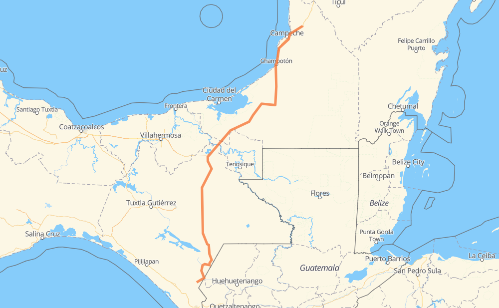
The distance from Motozintla de Mendoza to Tenabo is 767 kilometers by road including 39 kilometers on motorways. Road takes approximately 8 hours and 54 minutes and goes through Comitán de Dominguez, Frontera Comalapa, Ocosingo, Palenque, Francisco Escarcega and Champotón.
| Shortest distance by air | 562 km ✈️ |
| Car route length | 767 km 🚗 |
| Driving time | 8 h 54 min |
| Fuel amount | 61.3 L |
| Fuel cost | 90.8 GBP |
| Toll roads cost | 101 MXN |
| Point | Distance | Time | Fuel | |
| Motozintla de Mendoza | 0 km | 00 min | 0.0 L | |
|
MEX 211 21 km, 16 min
|
||||
| Amantenango | 21 km | 16 min | 0.9 L | |
|
MEX 211 33 km, 24 min
|
||||
| Frontera Comalapa | 54 km | 41 min | 3.1 L | |
|
MEX 211 MEX 190 63 km, 46 min
|
||||
| La Trinitaria | 116 km | 1 h 28 min | 7.2 L | |
|
MEX 190 32 km, 25 min
|
||||
| Comitán de Dominguez | 149 km | 1 h 53 min | 11.4 L | |
|
97 km, 1 h 05 min
|
||||
| Ocosingo | 246 km | 2 h 59 min | 19.2 L | |
|
MEX 199 120 km, 1 h 25 min
|
||||
| Palenque | 366 km | 4 h 25 min | 29.0 L | |
|
MEX 199 MEX 186 226 km, 2 h 30 min
|
||||
| Francisco Escarcega | 592 km | 6 h 55 min | 44.2 L | |
|
MEX 261 75 km, 54 min
|
||||
| Champotón | 667 km | 7 h 50 min | 52.6 L | |
|
MEX 180 100 km, 1 h 04 min
|
||||
| Tenabo | 767 km | 8 h 54 min | 61.2 L | |
Frequently Asked Questions
How many toll booths are there from Motozintla de Mendoza to Tenabo?
There are 2 toll booths between Motozintla de Mendoza and Tenabo: Usumacinta and Seybaplaya.
How much does the toll booths cost from Motozintla de Mendoza to Tenabo?
Toll roads cost: Usumacinta (24 MXN) + Seybaplaya (77 MXN) = 101 MXN
How much does it cost to drive from Motozintla de Mendoza to Tenabo?
Fuel cost: 90.8 GBP
This fuel cost is calculated as: (Route length 767 km / 100 km) * (Fuel consumption 8 L/100 km) * (Fuel price 1.48 GBP / L)
You can adjust fuel consumption and fuel price here.
Toll roads cost: 101 MXN
How long is a car ride from Motozintla de Mendoza to Tenabo?
Driving time: 8 h 54 min
This time is calculated for driving at the maximum permitted speed, taking into account traffic rules restrictions.
- 38 km with a maximum speed 110 km/h = 20 min
- 223 km with a maximum speed 96 km/h = 2 h 19 min
- 129 km with a maximum speed 90 km/h = 1 h 26 min
- 338 km with a maximum speed 80 km/h = 4 h 13 min
- 23 km with a maximum speed 70 km/h = 19 min
- 12 km with a maximum speed 60 km/h = 12 min
- 2 km with a maximum speed 50 km/h = 2 min
The calculated driving time does not take into account intermediate stops and traffic jams.
How far is Motozintla de Mendoza to Tenabo by land?
The distance between Motozintla de Mendoza and Tenabo is 767 km by road including 39 km on motorways.
Precise satellite coordinates of highways were used for this calculation. The start and finish points are the centers of Motozintla de Mendoza and Tenabo respectively.
How far is Motozintla de Mendoza to Tenabo by plane?
The shortest distance (air line, as the crow flies) between Motozintla de Mendoza and Tenabo is 562 km.
This distance is calculated using the Haversine formula as a great-circle distance between two points on the surface of a sphere. The start and finish points are the centers of Motozintla de Mendoza and Tenabo respectively. Actual distance between airports may be different.
How many hours is Motozintla de Mendoza from Tenabo by plane?
Boeing 737 airliner needs 42 min to cover the distance of 562 km at a cruising speed of 800 km/h.
Small plane "Cessna 172" needs 2 h 33 min to flight this distance at average speed of 220 km/h.
This time is approximate and do not take into account takeoff and landing times, airport location and other real world factors.
How long is a helicopter ride from Motozintla de Mendoza to Tenabo?
Fast helicopter "Eurocopter AS350" or "Hughes OH-6 Cayuse" need 2 h 20 min to cover the distance of 562 km at a cruising speed of 240 km/h.
Popular "Robinson R44" needs 2 h 40 min to flight this distance at average speed of 210 km/h.
This time is approximate and do not take into account takeoff and landing times, aerodrome location and other real world factors.
What city is halfway between Motozintla de Mendoza and Tenabo?
The halfway point between Motozintla de Mendoza and Tenabo is Palenque. It is located about 18 km from the exact midpoint by road.
The distance from Palenque to Motozintla de Mendoza is 366 km and driving will take about 4 h 25 min. The road between Palenque and Tenabo has length 401 km and will take approximately 4 h 29 min.
The other cities located close to halfway point:
Where is Motozintla de Mendoza in relation to Tenabo?
Motozintla de Mendoza is located 562 km south-west of Tenabo.
Motozintla de Mendoza has geographic coordinates: latitude 15.3652, longitude -92.24775.
Tenabo has geographic coordinates: latitude 20.04001, longitude -90.22579.
Which highway goes from Motozintla de Mendoza to Tenabo?
The route from Motozintla de Mendoza to Tenabo follows MEX 186, MEX 199.
Other minor sections pass along the road:
- MEX 261: 80 km
- MEX 190: 75 km
- MEX 180: 66 km
- MEX 211: 65 km
- MEX 180D: 39 km
- 186: 1 km