Distance between Mucuri and Dores do Turvo
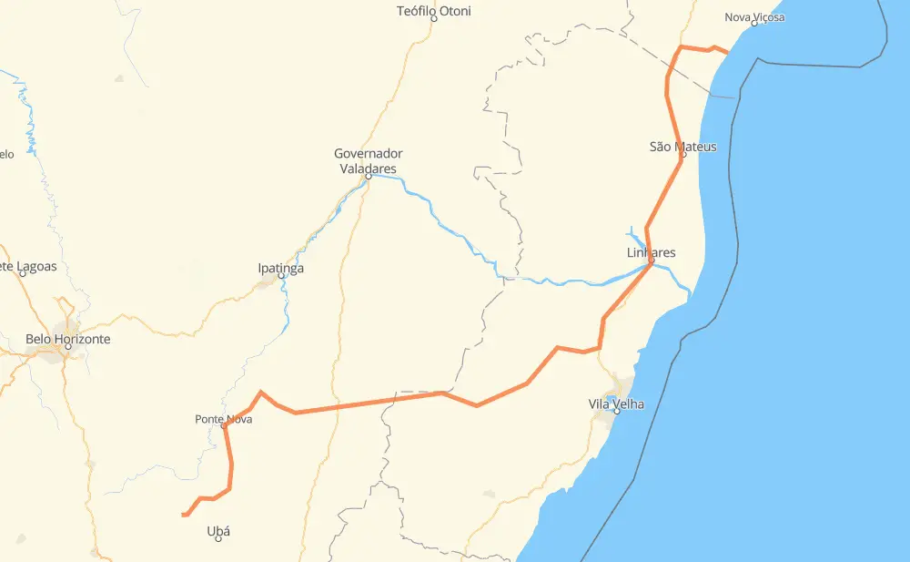
The distance from Mucuri to Dores do Turvo is 763 kilometers by road. Road takes approximately 9 hours and 5 minutes and goes through Vista Alegre, Cobraice, Litorâneo, Vale do Sol, Santa Cruz, Lagoa do Meio and Aviso.
| Shortest distance by air | 499 km ✈️ |
| Car route length | 763 km 🚗 |
| Driving time | 9 h 5 min |
| Fuel amount | 61 L |
| Fuel cost | 90.3 GBP |
| Point | Distance | Time | Fuel | |
| Mucuri | 0 km | 00 min | 0.0 L | |
|
BA-698 BR-101 65 km, 44 min
|
||||
| Vista Alegre | 65 km | 44 min | 4.9 L | |
|
BR-101 15 km, 11 min
|
||||
| Cobraice | 80 km | 55 min | 5.7 L | |
|
BR-101 36 km, 23 min
|
||||
| Litorâneo | 116 km | 1 h 19 min | 9.2 L | |
|
BR-101 61 km, 38 min
|
||||
| Vale do Sol | 177 km | 1 h 57 min | 14.0 L | |
|
BR-101 19 km, 12 min
|
||||
| Santa Cruz | 196 km | 2 h 10 min | 15.7 L | |
|
BR-101 4 km, 02 min
|
||||
| Lagoa do Meio | 200 km | 2 h 12 min | 16.0 L | |
|
BR-101 4 km, 02 min
|
||||
| Aviso | 204 km | 2 h 15 min | 16.3 L | |
|
BR-101 27 km, 18 min
|
||||
| São José | 232 km | 2 h 33 min | 18.3 L | |
|
BR-101 BR-262 531 km, 6 h 31 min
|
||||
| Dores do Turvo | 763 km | 9 h 04 min | 61.0 L | |
Frequently Asked Questions
How much does it cost to drive from Mucuri to Dores do Turvo?
Fuel cost: 90.3 GBP
This fuel cost is calculated as: (Route length 763 km / 100 km) * (Fuel consumption 8 L/100 km) * (Fuel price 1.48 GBP / L)
You can adjust fuel consumption and fuel price here.
How long is a car ride from Mucuri to Dores do Turvo?
Driving time: 9 h 5 min
This time is calculated for driving at the maximum permitted speed, taking into account traffic rules restrictions.
- 441 km with a maximum speed 96 km/h = 4 h 35 min
- 244 km with a maximum speed 80 km/h = 3 h 3 min
- 46 km with a maximum speed 60 km/h = 46 min
- 26 km with a maximum speed 50 km/h = 30 min
- 5 km with a maximum speed 40 km/h = 7 min
- 1 km with a maximum speed 30 km/h = 1 min
The calculated driving time does not take into account intermediate stops and traffic jams.
How far is Mucuri to Dores do Turvo by land?
The distance between Mucuri and Dores do Turvo is 763 km by road.
Precise satellite coordinates of highways were used for this calculation. The start and finish points are the centers of Mucuri and Dores do Turvo respectively.
How far is Mucuri to Dores do Turvo by plane?
The shortest distance (air line, as the crow flies) between Mucuri and Dores do Turvo is 499 km.
This distance is calculated using the Haversine formula as a great-circle distance between two points on the surface of a sphere. The start and finish points are the centers of Mucuri and Dores do Turvo respectively. Actual distance between airports may be different.
How many hours is Mucuri from Dores do Turvo by plane?
Boeing 737 airliner needs 37 min to cover the distance of 499 km at a cruising speed of 800 km/h.
Small plane "Cessna 172" needs 2 h 16 min to flight this distance at average speed of 220 km/h.
This time is approximate and do not take into account takeoff and landing times, airport location and other real world factors.
How long is a helicopter ride from Mucuri to Dores do Turvo?
Fast helicopter "Eurocopter AS350" or "Hughes OH-6 Cayuse" need 2 h 4 min to cover the distance of 499 km at a cruising speed of 240 km/h.
Popular "Robinson R44" needs 2 h 22 min to flight this distance at average speed of 210 km/h.
This time is approximate and do not take into account takeoff and landing times, aerodrome location and other real world factors.
What city is halfway between Mucuri and Dores do Turvo?
The halfway point between Mucuri and Dores do Turvo is Vila Nova. It is located about 45 km from the exact midpoint by road.
The distance from Vila Nova to Mucuri is 336 km and driving will take about 3 h 53 min. The road between Vila Nova and Dores do Turvo has length 427 km and will take approximately 5 h 12 min.
The other cities located close to halfway point:
Where is Mucuri in relation to Dores do Turvo?
Mucuri is located 499 km north-east of Dores do Turvo.
Mucuri has geographic coordinates: latitude -18.07875, longitude -39.54706.
Dores do Turvo has geographic coordinates: latitude -20.97528, longitude -43.18889.
Which highway goes from Mucuri to Dores do Turvo?
The route from Mucuri to Dores do Turvo follows BR-101, BR-262.
Other minor sections pass along the road:
- ES-261: 46 km
- MG-329: 42 km
- BR-120: 41 km
- MG-280: 39 km
- BA-698: 36 km
- ES-264: 16 km
- ES-355: 8 km
- ES-165: 8 km
- ES-484: 8 km
- MG-111: 5 km
- MG-108: 5 km
- ES-185: 3 km