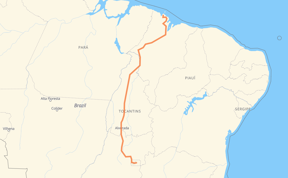
Distance between Núcleo Rural Rajadinha II and Lago
The distance from Núcleo Rural Rajadinha II to Lago is 2,197 kilometers by road including 12 kilometers on motorways. Road takes approximately 25 hours and 2 minutes and goes through Açailândia, Rajadinha, Condominio Novo Horizonte, Vila Weslian Roriz, Setor Noroeste, Setor Militar Urbano and Brazlândia.
| Shortest distance by air | 1,598 km ✈️ |
| Car route length | 2,197 km 🚗 |
| Driving time | 25 h 2 min |
| Fuel amount | 175.7 L |
| Fuel cost | 261.9 GBP |
| Point | Distance | Time | Fuel | |
| Núcleo Rural Rajadinha II | 0 km | 00 min | 0.0 L | |
|
DF-130 BR-479 11 km, 09 min
|
||||
| Condominio Novo Horizonte | 11 km | 09 min | 0.4 L | |
|
BR-479 DF-005 24 km, 20 min
|
||||
| Vila Weslian Roriz | 35 km | 30 min | 2.5 L | |
|
DF-003 5 km, 03 min
|
||||
| Setor Militar Urbano | 40 km | 34 min | 3.1 L | |
|
DF-003 BR-070 39 km, 29 min
|
||||
| Brazlândia | 79 km | 1 h 03 min | 5.9 L | |
|
BR-080 DF-180 18 km, 13 min
|
||||
| Núcleo Rural Curralinho | 97 km | 1 h 17 min | 7.1 L | |
|
BR-080 53 km, 34 min
|
||||
| Setor Oeste | 150 km | 1 h 52 min | 11.9 L | |
|
BR-080 48 km, 32 min
|
||||
| Dois Irmãos | 199 km | 2 h 24 min | 14.7 L | |
|
BR-080 BR-153 1,269 km, 13 h 47 min
|
||||
| Açailândia | 1,467 km | 16 h 11 min | 116.4 L | |
|
BR-010 BR-222 729 km, 8 h 50 min
|
||||
| Lago | 2,197 km | 25 h 01 min | 175.7 L | |
Frequently Asked Questions
How much does it cost to drive from Núcleo Rural Rajadinha II to Lago?
Fuel cost: 261.9 GBP
This fuel cost is calculated as: (Route length 2,197 km / 100 km) * (Fuel consumption 8 L/100 km) * (Fuel price 1.49 GBP / L)
You can adjust fuel consumption and fuel price here.
How long is a car ride from Núcleo Rural Rajadinha II to Lago?
Driving time: 25 h 2 min
This time is calculated for driving at the maximum permitted speed, taking into account traffic rules restrictions.
- 1,257 km with a maximum speed 96 km/h = 13 h 5 min
- 903 km with a maximum speed 80 km/h = 11 h 17 min
- 26 km with a maximum speed 60 km/h = 26 min
- 10 km with a maximum speed 50 km/h = 11 min
- 1 km with a maximum speed 40 km/h = 1 min
The calculated driving time does not take into account intermediate stops and traffic jams.
How far is Núcleo Rural Rajadinha II to Lago by land?
The distance between Núcleo Rural Rajadinha II and Lago is 2,197 km by road including 12 km on motorways.
Precise satellite coordinates of highways were used for this calculation. The start and finish points are the centers of Núcleo Rural Rajadinha II and Lago respectively.
How far is Núcleo Rural Rajadinha II to Lago by plane?
The shortest distance (air line, as the crow flies) between Núcleo Rural Rajadinha II and Lago is 1,598 km.
This distance is calculated using the Haversine formula as a great-circle distance between two points on the surface of a sphere. The start and finish points are the centers of Núcleo Rural Rajadinha II and Lago respectively. Actual distance between airports may be different.
How many hours is Núcleo Rural Rajadinha II from Lago by plane?
Boeing 737 airliner needs 1 h 59 min to cover the distance of 1,598 km at a cruising speed of 800 km/h.
Small plane "Cessna 172" needs 7 h 15 min to flight this distance at average speed of 220 km/h.
This time is approximate and do not take into account takeoff and landing times, airport location and other real world factors.
How long is a helicopter ride from Núcleo Rural Rajadinha II to Lago?
Fast helicopter "Eurocopter AS350" or "Hughes OH-6 Cayuse" need 6 h 39 min to cover the distance of 1,598 km at a cruising speed of 240 km/h.
Popular "Robinson R44" needs 7 h 36 min to flight this distance at average speed of 210 km/h.
This time is approximate and do not take into account takeoff and landing times, aerodrome location and other real world factors.
What city is halfway between Núcleo Rural Rajadinha II and Lago?
The halfway point between Núcleo Rural Rajadinha II and Lago is Ponta do Asfalto. It is located about 95 km from the exact midpoint by road.
The distance from Ponta do Asfalto to Núcleo Rural Rajadinha II is 1,193 km and driving will take about 13 h 4 min. The road between Ponta do Asfalto and Lago has length 1,004 km and will take approximately 11 h 57 min.
The other cities located close to halfway point:
Where is Núcleo Rural Rajadinha II in relation to Lago?
Núcleo Rural Rajadinha II is located 1,598 km south of Lago.
Núcleo Rural Rajadinha II has geographic coordinates: latitude -15.75028, longitude -47.66472.
Lago has geographic coordinates: latitude -1.60083, longitude -45.14254.
Which highway goes from Núcleo Rural Rajadinha II to Lago?
The route from Núcleo Rural Rajadinha II to Lago follows BR-153, BR-222, BR-080, BR-010, MA-014.
Other minor sections pass along the road:
- BR-226: 99 km
- MA-006: 66 km
- MA-303: 54 km
- BR-251: 41 km
- BR-414: 35 km
- MA-006 / BR-308: 31 km
- DF-180: 20 km
- BR-479: 14 km
- DF-250: 14 km
- DF-095: 12 km
- BR-070: 12 km
- MA-106: 12 km
- DF-005: 10 km
- BR-316: 10 km
- DF-240: 10 km
- DF-003: 8 km
- DF-001: 8 km
- BR-080,GO-424: 7 km
- DF-015: 4 km
- GO-080: 4 km
- BR-230: 2 km
- DF-130: 2 km
- DF-009: 2 km