Distance between Nepomuceno and Santa Mariana
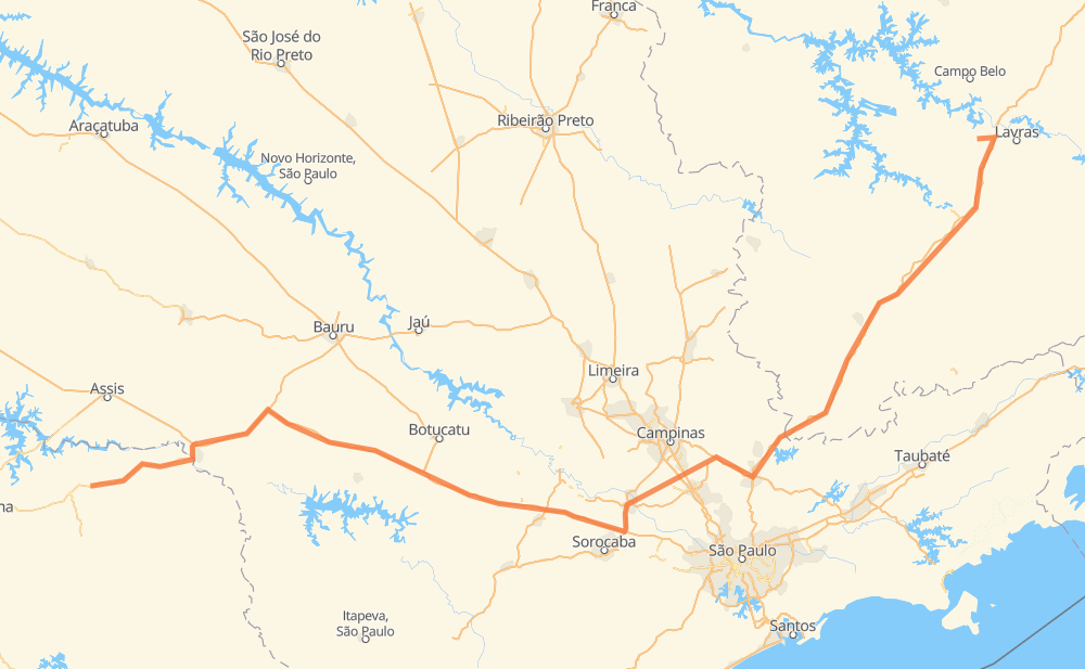
The distance from Nepomuceno to Santa Mariana is 797 kilometers by road including 688 kilometers on motorways. Road takes approximately 7 hours and 51 minutes and goes through Atibaia, Itatiba, Itu and Ourinhos.
| Shortest distance by air | 585 km ✈️ |
| Car route length | 797 km 🚗 |
| Driving time | 7 h 51 min |
| Fuel amount | 63.8 L |
| Fuel cost | 95 GBP |
| Point | Distance | Time | Fuel | |
| Nepomuceno | 0 km | 00 min | 0.0 L | |
|
BR-265 BR-381 42 km, 27 min
|
||||
| Carmo da Cachoeira | 42 km | 27 min | 3.0 L | |
|
BR-381 73 km, 42 min
|
||||
| Nova Era | 115 km | 1 h 09 min | 8.9 L | |
|
BR-381 82 km, 46 min
|
||||
| Estiva | 197 km | 1 h 55 min | 15.1 L | |
|
BR-381 11 km, 06 min
|
||||
| Congonhal | 208 km | 2 h 01 min | 16.4 L | |
|
BR-381 99 km, 58 min
|
||||
| Atibaia | 307 km | 3 h 00 min | 23.5 L | |
|
SP-065 30 km, 17 min
|
||||
| Itatiba | 336 km | 3 h 18 min | 26.3 L | |
|
SP-063 SP-300 68 km, 44 min
|
||||
| Itu | 404 km | 4 h 03 min | 32.1 L | |
|
SP-300 BR-374 317 km, 2 h 57 min
|
||||
| Ourinhos | 721 km | 7 h 00 min | 57.4 L | |
|
BR-153 BR-369 77 km, 50 min
|
||||
| Santa Mariana | 798 km | 7 h 50 min | 63.1 L | |
Frequently Asked Questions
How much does it cost to drive from Nepomuceno to Santa Mariana?
Fuel cost: 95 GBP
This fuel cost is calculated as: (Route length 797 km / 100 km) * (Fuel consumption 8 L/100 km) * (Fuel price 1.49 GBP / L)
You can adjust fuel consumption and fuel price here.
How long is a car ride from Nepomuceno to Santa Mariana?
Driving time: 7 h 51 min
This time is calculated for driving at the maximum permitted speed, taking into account traffic rules restrictions.
- 229 km with a maximum speed 112 km/h = 2 h 2 min
- 301 km with a maximum speed 110 km/h = 2 h 44 min
- 113 km with a maximum speed 100 km/h = 1 h 7 min
- 63 km with a maximum speed 96 km/h = 39 min
- 13 km with a maximum speed 90 km/h = 8 min
- 59 km with a maximum speed 80 km/h = 44 min
- 10 km with a maximum speed 60 km/h = 9 min
- 9 km with a maximum speed 40 km/h = 13 min
The calculated driving time does not take into account intermediate stops and traffic jams.
How far is Nepomuceno to Santa Mariana by land?
The distance between Nepomuceno and Santa Mariana is 797 km by road including 688 km on motorways.
Precise satellite coordinates of highways were used for this calculation. The start and finish points are the centers of Nepomuceno and Santa Mariana respectively.
How far is Nepomuceno to Santa Mariana by plane?
The shortest distance (air line, as the crow flies) between Nepomuceno and Santa Mariana is 585 km.
This distance is calculated using the Haversine formula as a great-circle distance between two points on the surface of a sphere. The start and finish points are the centers of Nepomuceno and Santa Mariana respectively. Actual distance between airports may be different.
How many hours is Nepomuceno from Santa Mariana by plane?
Boeing 737 airliner needs 43 min to cover the distance of 585 km at a cruising speed of 800 km/h.
Small plane "Cessna 172" needs 2 h 39 min to flight this distance at average speed of 220 km/h.
This time is approximate and do not take into account takeoff and landing times, airport location and other real world factors.
How long is a helicopter ride from Nepomuceno to Santa Mariana?
Fast helicopter "Eurocopter AS350" or "Hughes OH-6 Cayuse" need 2 h 26 min to cover the distance of 585 km at a cruising speed of 240 km/h.
Popular "Robinson R44" needs 2 h 47 min to flight this distance at average speed of 210 km/h.
This time is approximate and do not take into account takeoff and landing times, aerodrome location and other real world factors.
What city is halfway between Nepomuceno and Santa Mariana?
The halfway point between Nepomuceno and Santa Mariana is Itu. It is located about 5 km from the exact midpoint by road.
The distance from Itu to Nepomuceno is 404 km and driving will take about 4 h 2 min. The road between Itu and Santa Mariana has length 393 km and will take approximately 3 h 48 min.
The other cities located close to halfway point:
Where is Nepomuceno in relation to Santa Mariana?
Nepomuceno is located 585 km north-east of Santa Mariana.
Nepomuceno has geographic coordinates: latitude -21.23224, longitude -45.23478.
Santa Mariana has geographic coordinates: latitude -23.14994, longitude -50.51996.
Which highway goes from Nepomuceno to Santa Mariana?
The route from Nepomuceno to Santa Mariana follows BR-381, BR-374, SP-280, BR-369.
Other minor sections pass along the road:
- SP-300: 46 km
- SP-010: 36 km
- SP-327: 33 km
- SP-065: 27 km
- SP-360: 20 km
- SP-225: 19 km
- SP-075: 16 km
- BR-265: 12 km
- BR-153: 10 km
- SP-063: 9 km
- PR-855: 8 km