Distance between Norway House MB and Port Neville BC
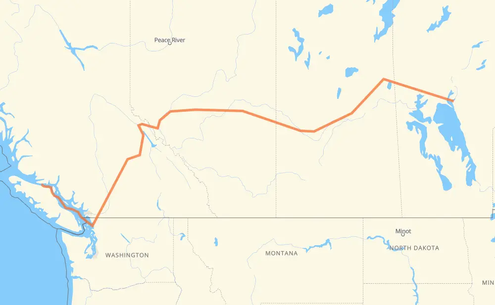
The distance from Norway House to Port Neville is 2,919 kilometers by road including 362 kilometers on motorways. Road takes approximately 45 hours and 46 minutes and goes through Flin Flon, Prince Albert, North Battleford, Lloydminster, Edmonton, Spruce Grove and Merritt.
| Shortest distance by air | 1,950 km ✈️ |
| Car route length | 2,919 km 🚗 |
| Driving time | 45 h 46 min |
| Fuel amount | 233.5 L |
| Fuel cost | 347.9 GBP |
| Point | Distance | Time | Fuel | |
| Norway House | 0 km | 00 min | 0.0 L | |
|
PR 373 461 km, 4 h 57 min
|
||||
| Flin Flon | 461 km | 4 h 57 min | 36.3 L | |
|
106 398 km, 4 h 11 min
|
||||
| Prince Albert | 860 km | 9 h 08 min | 67.7 L | |
|
55 40 224 km, 2 h 21 min
|
||||
| North Battleford | 1,084 km | 11 h 29 min | 83.9 L | |
|
16 117 km, 1 h 14 min
|
||||
| Lloydminster | 1,200 km | 12 h 44 min | 93.8 L | |
|
16 254 km, 2 h 41 min
|
||||
| Edmonton | 1,455 km | 15 h 25 min | 115.4 L | |
|
16 27 km, 17 min
|
||||
| Spruce Grove | 1,482 km | 15 h 42 min | 118.0 L | |
|
16 865 km, 9 h 16 min
|
||||
| Merritt | 2,347 km | 24 h 59 min | 186.7 L | |
|
5 158 km, 1 h 27 min
|
||||
| Chilliwack | 2,504 km | 26 h 27 min | 199.1 L | |
|
1 25 km, 15 min
|
||||
| Abbotsford | 2,529 km | 26 h 42 min | 201.5 L | |
|
1 WA 9 49 km, 38 min
|
||||
| Bellingham | 2,578 km | 27 h 21 min | 205.7 L | |
|
I 5 373 km, 18 h 24 min
|
||||
| 50.48333, -126.08333 | 2,952 km | 45 h 46 min | 236.1 L | |
Frequently Asked Questions
How much does it cost to drive from Norway House to Port Neville?
Fuel cost: 347.9 GBP
This fuel cost is calculated as: (Route length 2,919 km / 100 km) * (Fuel consumption 8 L/100 km) * (Fuel price 1.49 GBP / L)
You can adjust fuel consumption and fuel price here.
How long is a car ride from Norway House to Port Neville?
Driving time: 45 h 46 min
This time is calculated for driving at the maximum permitted speed, taking into account traffic rules restrictions.
- 179 km with a maximum speed 112 km/h = 1 h 35 min
- 48 km with a maximum speed 110 km/h = 26 min
- 110 km with a maximum speed 100 km/h = 1 h 6 min
- 6 km with a maximum speed 97 km/h = 3 min
- 1,881 km with a maximum speed 96 km/h = 19 h 35 min
- 111 km with a maximum speed 90 km/h = 1 h 13 min
- 5 km with a maximum speed 89 km/h = 3 min
- 20 km with a maximum speed 80 km/h = 14 min
- 153 km with a maximum speed 80 km/h = 1 h 54 min
- 39 km with a maximum speed 70 km/h = 33 min
- 2 km with a maximum speed 64 km/h = 1 min
- 9 km with a maximum speed 60 km/h = 8 min
- 5 km with a maximum speed 56 km/h = 5 min
- 15 km with a maximum speed 50 km/h = 18 min
- 1 km with a maximum speed 40 km/h = 1 min
- 367 km with a maximum speed 20 km/h = 18 h 21 min
The calculated driving time does not take into account intermediate stops and traffic jams.
How far is Norway House to Port Neville by land?
The distance between Norway House and Port Neville is 2,919 km by road including 362 km on motorways.
Precise satellite coordinates of highways were used for this calculation. The start and finish points are the centers of Norway House and Port Neville respectively.
How far is Norway House to Port Neville by plane?
The shortest distance (air line, as the crow flies) between Norway House and Port Neville is 1,950 km.
This distance is calculated using the Haversine formula as a great-circle distance between two points on the surface of a sphere. The start and finish points are the centers of Norway House and Port Neville respectively. Actual distance between airports may be different.
How many hours is Norway House from Port Neville by plane?
Boeing 737 airliner needs 2 h 26 min to cover the distance of 1,950 km at a cruising speed of 800 km/h.
Small plane "Cessna 172" needs 8 h 51 min to flight this distance at average speed of 220 km/h.
This time is approximate and do not take into account takeoff and landing times, airport location and other real world factors.
How long is a helicopter ride from Norway House to Port Neville?
Fast helicopter "Eurocopter AS350" or "Hughes OH-6 Cayuse" need 8 h 7 min to cover the distance of 1,950 km at a cruising speed of 240 km/h.
Popular "Robinson R44" needs 9 h 17 min to flight this distance at average speed of 210 km/h.
This time is approximate and do not take into account takeoff and landing times, aerodrome location and other real world factors.
What city is halfway between Norway House and Port Neville?
The halfway point between Norway House and Port Neville is Edmonton. It is located about 5 km from the exact midpoint by road.
The distance from Edmonton to Norway House is 1,455 km and driving will take about 15 h 25 min. The road between Edmonton and Port Neville has length 1,464 km and will take approximately 30 h 20 min.
The other cities located close to halfway point:
Where is Norway House in relation to Port Neville?
Norway House is located 1,950 km east of Port Neville.
Norway House has geographic coordinates: latitude 53.96667, longitude -97.83333.
Port Neville has geographic coordinates: latitude 50.48333, longitude -126.08333.
Which highway goes from Norway House to Port Neville?
The route from Norway House to Port Neville follows 16, 5, 106, PR 373, PTH 39, 40, 55.
Other minor sections pass along the road:
- 1: 89 km
- PTH 10: 61 km
- 3: 52 km
- PTH 6: 30 km
- WA 9: 12 km
- 97: 11 km
- 22: 8 km
- WA 542: 8 km
- 2: 7 km
- WA 544: 6 km
- I 5: 6 km
- 674: 5 km
- 11: 4 km
- 21: 3 km
- PTH 10A: 3 km
- 167: 2 km
- WA 11: 2 km
- 675: 1 km
- 4: 1 km