Distance between Puerto Domínguez and Punta del Cobre
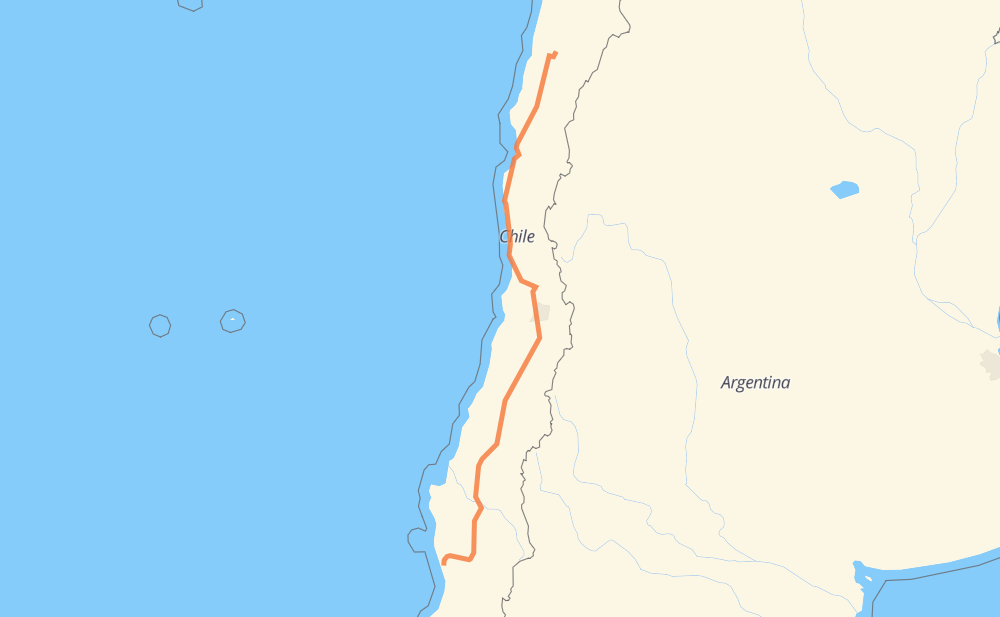
The distance from Puerto Domínguez to Punta del Cobre is 1,572 kilometers by road including 1,440 kilometers on motorways. Road takes approximately 15 hours and 23 minutes and goes through Temuco, Los Ángeles, Chillán, Linares, Talca, Curicó and San Fernando.
| Shortest distance by air | 1,298 km ✈️ |
| Car route length | 1,572 km 🚗 |
| Driving time | 15 h 23 min |
| Fuel amount | 125.8 L |
| Fuel cost | 187.4 GBP |
| Point | Distance | Time | Fuel | |
| Puerto Domínguez | 0 km | 00 min | 0.0 L | |
|
S-46 S-40 67 km, 52 min
|
||||
| Temuco | 67 km | 52 min | 4.2 L | |
|
S-40 5 195 km, 1 h 53 min
|
||||
| Los Ángeles | 262 km | 2 h 46 min | 18.9 L | |
|
5 104 km, 56 min
|
||||
| Chillán | 366 km | 3 h 42 min | 28.9 L | |
|
5 101 km, 54 min
|
||||
| Linares | 467 km | 4 h 37 min | 36.9 L | |
|
5 49 km, 26 min
|
||||
| Talca | 516 km | 5 h 03 min | 40.6 L | |
|
5 144 km, 1 h 17 min
|
||||
| Curicó | 660 km | 6 h 21 min | 51.7 L | |
|
5 60 km, 33 min
|
||||
| San Fernando | 720 km | 6 h 55 min | 56.9 L | |
|
5 47 km, 25 min
|
||||
| Rancagua | 767 km | 7 h 20 min | 61.0 L | |
|
5 65 km, 36 min
|
||||
| San Bernardo | 832 km | 7 h 56 min | 65.8 L | |
|
5 74 47 km, 29 min
|
||||
| Colina | 879 km | 8 h 25 min | 69.5 L | |
|
5 331 km, 3 h 01 min
|
||||
| Ovalle | 1,210 km | 11 h 27 min | 92.8 L | |
|
5 79 km, 43 min
|
||||
| Coquimbo | 1,289 km | 12 h 10 min | 100.8 L | |
|
5 47 km, 30 min
|
||||
| La Serena | 1,337 km | 12 h 41 min | 105.5 L | |
|
5 160 km, 1 h 42 min
|
||||
| Vallenar | 1,496 km | 14 h 24 min | 112.9 L | |
|
5 121 km, 1 h 17 min
|
||||
| Copiapó | 1,617 km | 15 h 42 min | 126.5 L | |
|
5 C-33 42 km, 28 min
|
||||
| Punta del Cobre | 1,660 km | 16 h 10 min | 132.3 L | |
Frequently Asked Questions
How much does it cost to drive from Puerto Domínguez to Punta del Cobre?
Fuel cost: 187.4 GBP
This fuel cost is calculated as: (Route length 1,572 km / 100 km) * (Fuel consumption 8 L/100 km) * (Fuel price 1.49 GBP / L)
You can adjust fuel consumption and fuel price here.
How long is a car ride from Puerto Domínguez to Punta del Cobre?
Driving time: 15 h 23 min
This time is calculated for driving at the maximum permitted speed, taking into account traffic rules restrictions.
- 1,018 km with a maximum speed 112 km/h = 9 h 5 min
- 310 km with a maximum speed 100 km/h = 3 h 6 min
- 4 km with a maximum speed 90 km/h = 2 min
- 201 km with a maximum speed 80 km/h = 2 h 30 min
- 15 km with a maximum speed 70 km/h = 12 min
- 16 km with a maximum speed 60 km/h = 15 min
- 7 km with a maximum speed 50 km/h = 8 min
The calculated driving time does not take into account intermediate stops and traffic jams.
How far is Puerto Domínguez to Punta del Cobre by land?
The distance between Puerto Domínguez and Punta del Cobre is 1,572 km by road including 1,440 km on motorways.
Precise satellite coordinates of highways were used for this calculation. The start and finish points are the centers of Puerto Domínguez and Punta del Cobre respectively.
How far is Puerto Domínguez to Punta del Cobre by plane?
The shortest distance (air line, as the crow flies) between Puerto Domínguez and Punta del Cobre is 1,298 km.
This distance is calculated using the Haversine formula as a great-circle distance between two points on the surface of a sphere. The start and finish points are the centers of Puerto Domínguez and Punta del Cobre respectively. Actual distance between airports may be different.
How many hours is Puerto Domínguez from Punta del Cobre by plane?
Boeing 737 airliner needs 1 h 37 min to cover the distance of 1,298 km at a cruising speed of 800 km/h.
Small plane "Cessna 172" needs 5 h 54 min to flight this distance at average speed of 220 km/h.
This time is approximate and do not take into account takeoff and landing times, airport location and other real world factors.
How long is a helicopter ride from Puerto Domínguez to Punta del Cobre?
Fast helicopter "Eurocopter AS350" or "Hughes OH-6 Cayuse" need 5 h 24 min to cover the distance of 1,298 km at a cruising speed of 240 km/h.
Popular "Robinson R44" needs 6 h 10 min to flight this distance at average speed of 210 km/h.
This time is approximate and do not take into account takeoff and landing times, aerodrome location and other real world factors.
What city is halfway between Puerto Domínguez and Punta del Cobre?
The halfway point between Puerto Domínguez and Punta del Cobre is San Francisco de Mostazal. It is located about 3 km from the exact midpoint by road.
The distance from San Francisco de Mostazal to Puerto Domínguez is 789 km and driving will take about 7 h 32 min. The road between San Francisco de Mostazal and Punta del Cobre has length 782 km and will take approximately 7 h 51 min.
The other cities located close to halfway point:
Where is Puerto Domínguez in relation to Punta del Cobre?
Puerto Domínguez is located 1,298 km south of Punta del Cobre.
Puerto Domínguez has geographic coordinates: latitude -38.89768, longitude -73.25605.
Punta del Cobre has geographic coordinates: latitude -27.5, longitude -70.26668.
Which highway goes from Puerto Domínguez to Punta del Cobre?
The route from Puerto Domínguez to Punta del Cobre follows 5.
Other minor sections pass along the road:
- S-40: 55 km
- S-46: 26 km
- C-411: 24 km
- 74: 24 km
- C-33: 5 km