Distance between Punta Mejillón and Lobería
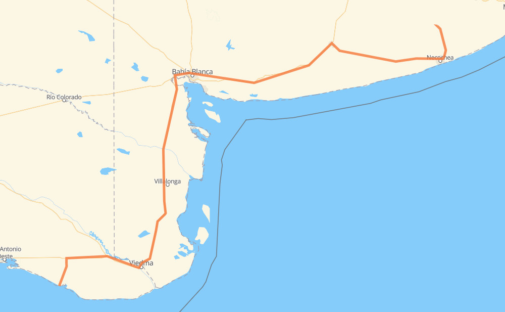
The distance from Punta Mejillón to Lobería is 788 kilometers by road. Road takes approximately 8 hours and 46 minutes and goes through Bahía Blanca, Carmen de Patagones, Juan A. Pradere, Lago Parque "La Salada", Villa Bordeu, Grünbein and Pago Chico.
| Shortest distance by air | 559 km ✈️ |
| Car route length | 788 km 🚗 |
| Driving time | 8 h 46 min |
| Fuel amount | 63.1 L |
| Fuel cost | 93.9 GBP |
| Point | Distance | Time | Fuel | |
| Punta Mejillón | 0 km | 00 min | 0.0 L | |
|
RP52 RN3 132 km, 1 h 35 min
|
||||
| Carmen de Patagones | 132 km | 1 h 35 min | 10.4 L | |
|
RN3 144 km, 1 h 30 min
|
||||
| Juan A. Pradere | 277 km | 3 h 06 min | 21.9 L | |
|
RN3 15 km, 10 min
|
||||
| Lago Parque "La Salada" | 292 km | 3 h 16 min | 23.1 L | |
|
RN3 115 km, 1 h 20 min
|
||||
| Bahía Blanca | 407 km | 4 h 36 min | 31.8 L | |
|
RN33 13 km, 11 min
|
||||
| Grünbein | 420 km | 4 h 48 min | 33.3 L | |
|
RN3 13 km, 09 min
|
||||
| Pago Chico | 433 km | 4 h 57 min | 33.9 L | |
|
RN3 169 km, 1 h 51 min
|
||||
| Tres Arroyos | 602 km | 6 h 49 min | 47.7 L | |
|
RP85 RN228 146 km, 1 h 32 min
|
||||
| Quequén | 748 km | 8 h 21 min | 59.8 L | |
|
076-09 RP227 45 km, 28 min
|
||||
| Lobería | 793 km | 8 h 50 min | 63.2 L | |
Frequently Asked Questions
How much does it cost to drive from Punta Mejillón to Lobería?
Fuel cost: 93.9 GBP
This fuel cost is calculated as: (Route length 788 km / 100 km) * (Fuel consumption 8 L/100 km) * (Fuel price 1.49 GBP / L)
You can adjust fuel consumption and fuel price here.
How long is a car ride from Punta Mejillón to Lobería?
Driving time: 8 h 46 min
This time is calculated for driving at the maximum permitted speed, taking into account traffic rules restrictions.
- 575 km with a maximum speed 96 km/h = 5 h 59 min
- 194 km with a maximum speed 80 km/h = 2 h 25 min
- 3 km with a maximum speed 65 km/h = 2 min
- 6 km with a maximum speed 60 km/h = 6 min
- 10 km with a maximum speed 50 km/h = 11 min
The calculated driving time does not take into account intermediate stops and traffic jams.
How far is Punta Mejillón to Lobería by land?
The distance between Punta Mejillón and Lobería is 788 km by road.
Precise satellite coordinates of highways were used for this calculation. The start and finish points are the centers of Punta Mejillón and Lobería respectively.
How far is Punta Mejillón to Lobería by plane?
The shortest distance (air line, as the crow flies) between Punta Mejillón and Lobería is 559 km.
This distance is calculated using the Haversine formula as a great-circle distance between two points on the surface of a sphere. The start and finish points are the centers of Punta Mejillón and Lobería respectively. Actual distance between airports may be different.
How many hours is Punta Mejillón from Lobería by plane?
Boeing 737 airliner needs 41 min to cover the distance of 559 km at a cruising speed of 800 km/h.
Small plane "Cessna 172" needs 2 h 32 min to flight this distance at average speed of 220 km/h.
This time is approximate and do not take into account takeoff and landing times, airport location and other real world factors.
How long is a helicopter ride from Punta Mejillón to Lobería?
Fast helicopter "Eurocopter AS350" or "Hughes OH-6 Cayuse" need 2 h 19 min to cover the distance of 559 km at a cruising speed of 240 km/h.
Popular "Robinson R44" needs 2 h 39 min to flight this distance at average speed of 210 km/h.
This time is approximate and do not take into account takeoff and landing times, aerodrome location and other real world factors.
What city is halfway between Punta Mejillón and Lobería?
The halfway point between Punta Mejillón and Lobería is Bahía Blanca. It is located about 13 km from the exact midpoint by road.
The distance from Bahía Blanca to Punta Mejillón is 407 km and driving will take about 4 h 36 min. The road between Bahía Blanca and Lobería has length 381 km and will take approximately 4 h 9 min.
The other cities located close to halfway point:
Where is Punta Mejillón in relation to Lobería?
Punta Mejillón is located 559 km south-west of Lobería.
Punta Mejillón has geographic coordinates: latitude -41.01263, longitude -64.16246.
Lobería has geographic coordinates: latitude -38.16552, longitude -58.77885.
Which highway goes from Punta Mejillón to Lobería?
The route from Punta Mejillón to Lobería follows RN3, RN228.
Other minor sections pass along the road:
- RP227: 42 km
- RP52: 33 km
- RP85: 9 km
- RN33: 7 km
- 076-09: 6 km
- RP1: 4 km
- Ex RN3: 3 km