Distance between Río Turbio and Caleta Olivia
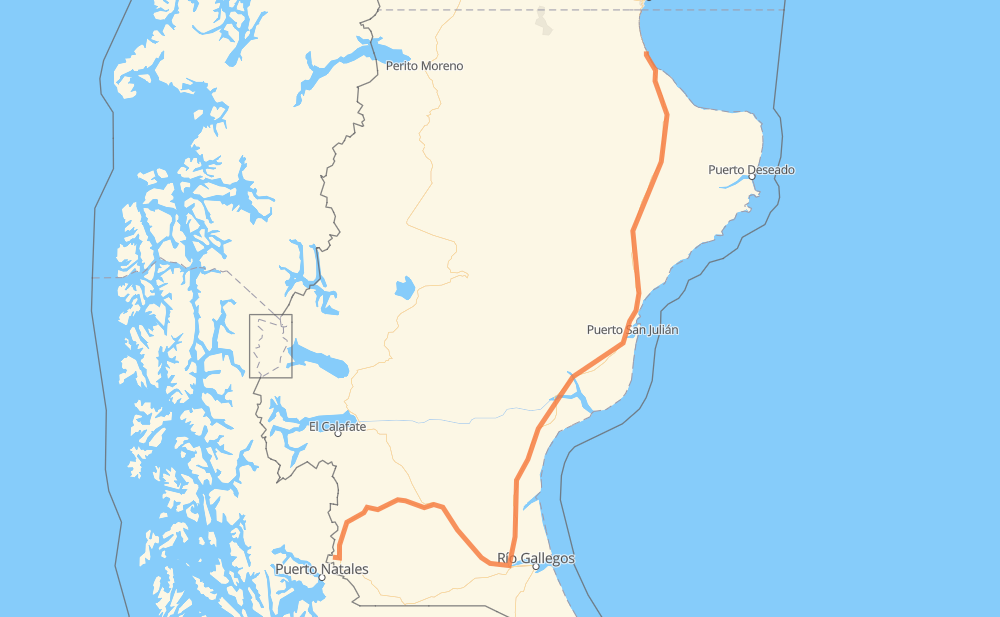
The distance from Río Turbio to Caleta Olivia is 941 kilometers by road. Road takes approximately 11 hours and 13 minutes and goes through Los Mineros, Julia Dufour, Esperanza, Güer Aike, Ototel Aike, Lemarchand and Comandante Luis Piedrabuena.
| Shortest distance by air | 667 km ✈️ |
| Car route length | 941 km 🚗 |
| Driving time | 11 h 13 min |
| Fuel amount | 75.3 L |
| Fuel cost | 112.1 GBP |
| Point | Distance | Time | Fuel | |
| -51.53694, -72.33604 | 0 km | 00 min | 0.0 L | |
|
1 km, 00 min
|
||||
| Los Mineros | 1 km | 00 min | 0.0 L | |
|
10 km, 08 min
|
||||
| Julia Dufour | 11 km | 08 min | 0.1 L | |
|
RN40 137 km, 1 h 45 min
|
||||
| Esperanza | 148 km | 1 h 54 min | 6.4 L | |
|
RN40 RP5 106 km, 1 h 34 min
|
||||
| Güer Aike | 255 km | 3 h 28 min | 17.6 L | |
|
RP5 RN3 93 km, 1 h 08 min
|
||||
| Ototel Aike | 347 km | 4 h 36 min | 26.1 L | |
|
RN3 51 km, 31 min
|
||||
| Lemarchand | 398 km | 5 h 08 min | 29.5 L | |
|
RN3 75 km, 47 min
|
||||
| Comandante Luis Piedrabuena | 473 km | 5 h 56 min | 37.3 L | |
|
RN3 295 km, 3 h 15 min
|
||||
| El Paso | 769 km | 9 h 11 min | 55.0 L | |
|
RN3 108 km, 1 h 19 min
|
||||
| Fitz Roy | 876 km | 10 h 30 min | 68.1 L | |
|
RN3 64 km, 42 min
|
||||
| Mercado de la Ciudad | 941 km | 11 h 12 min | 75.1 L | |
Frequently Asked Questions
How much does it cost to drive from Río Turbio to Caleta Olivia?
Fuel cost: 112.1 GBP
This fuel cost is calculated as: (Route length 941 km / 100 km) * (Fuel consumption 8 L/100 km) * (Fuel price 1.49 GBP / L)
You can adjust fuel consumption and fuel price here.
How long is a car ride from Río Turbio to Caleta Olivia?
Driving time: 11 h 13 min
This time is calculated for driving at the maximum permitted speed, taking into account traffic rules restrictions.
- 506 km with a maximum speed 96 km/h = 5 h 16 min
- 314 km with a maximum speed 80 km/h = 3 h 55 min
- 120 km with a maximum speed 60 km/h = 1 h 59 min
The calculated driving time does not take into account intermediate stops and traffic jams.
How far is Río Turbio to Caleta Olivia by land?
The distance between Río Turbio and Caleta Olivia is 941 km by road.
Precise satellite coordinates of highways were used for this calculation. The start and finish points are the centers of Río Turbio and Caleta Olivia respectively.
How far is Río Turbio to Caleta Olivia by plane?
The shortest distance (air line, as the crow flies) between Río Turbio and Caleta Olivia is 667 km.
This distance is calculated using the Haversine formula as a great-circle distance between two points on the surface of a sphere. The start and finish points are the centers of Río Turbio and Caleta Olivia respectively. Actual distance between airports may be different.
How many hours is Río Turbio from Caleta Olivia by plane?
Boeing 737 airliner needs 50 min to cover the distance of 667 km at a cruising speed of 800 km/h.
Small plane "Cessna 172" needs 3 h 1 min to flight this distance at average speed of 220 km/h.
This time is approximate and do not take into account takeoff and landing times, airport location and other real world factors.
How long is a helicopter ride from Río Turbio to Caleta Olivia?
Fast helicopter "Eurocopter AS350" or "Hughes OH-6 Cayuse" need 2 h 46 min to cover the distance of 667 km at a cruising speed of 240 km/h.
Popular "Robinson R44" needs 3 h 10 min to flight this distance at average speed of 210 km/h.
This time is approximate and do not take into account takeoff and landing times, aerodrome location and other real world factors.
What city is halfway between Río Turbio and Caleta Olivia?
The halfway point between Río Turbio and Caleta Olivia is Comandante Luis Piedrabuena. It is located about 3 km from the exact midpoint by road.
The distance from Comandante Luis Piedrabuena to Río Turbio is 473 km and driving will take about 5 h 56 min. The road between Comandante Luis Piedrabuena and Caleta Olivia has length 467 km and will take approximately 5 h 16 min.
The other cities located close to halfway point:
Where is Río Turbio in relation to Caleta Olivia?
Río Turbio is located 667 km south-west of Caleta Olivia.
Río Turbio has geographic coordinates: latitude -51.53694, longitude -72.33604.
Caleta Olivia has geographic coordinates: latitude -46.44212, longitude -67.51751.
Which highway goes from Río Turbio to Caleta Olivia?
The route from Río Turbio to Caleta Olivia follows RN3, RN40, RP5.
Other minor sections pass along the road:
- RN288: 9 km
- RP20: 7 km