Distance between Resende Costa and Jequitinhonha
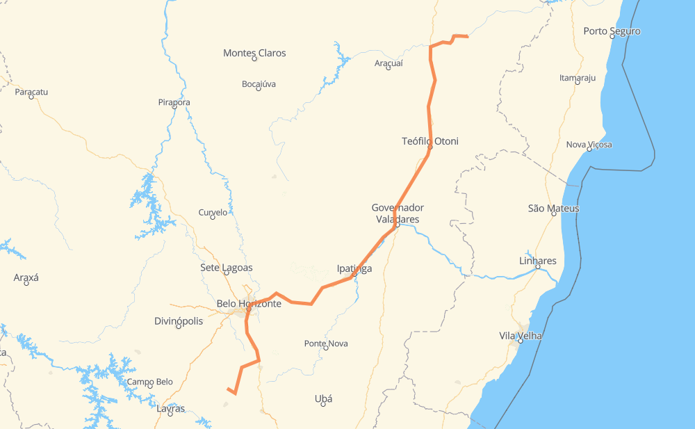
The distance from Resende Costa to Jequitinhonha is 855 kilometers by road including 29 kilometers on motorways. Road takes approximately 10 hours and 31 minutes and goes through Belo Horizonte, Coronel Fabriciano, Lagoa Dourada, Entre Rios de Minas, Aconchego da Serra, Alphaville and Vale do Sol.
| Shortest distance by air | 604 km ✈️ |
| Car route length | 855 km 🚗 |
| Driving time | 10 h 31 min |
| Fuel amount | 68.4 L |
| Fuel cost | 101.9 GBP |
| Point | Distance | Time | Fuel | |
| Resende Costa | 0 km | 00 min | 0.0 L | |
|
LMG-839 38 km, 30 min
|
||||
| Lagoa Dourada | 38 km | 30 min | 1.3 L | |
|
BR-383 29 km, 26 min
|
||||
| Entre Rios de Minas | 67 km | 57 min | 4.7 L | |
|
BR-383 BR-040 72 km, 52 min
|
||||
| Aconchego da Serra | 139 km | 1 h 50 min | 10.8 L | |
|
BR-040 10 km, 06 min
|
||||
| Alphaville | 149 km | 1 h 57 min | 11.7 L | |
|
BR-040 7 km, 04 min
|
||||
| Vale do Sol | 156 km | 2 h 01 min | 12.2 L | |
|
BR-040 BR-356 20 km, 13 min
|
||||
| Sion | 176 km | 2 h 14 min | 14.0 L | |
|
BR-356 3 km, 03 min
|
||||
| Belo Horizonte | 180 km | 2 h 17 min | 14.2 L | |
|
BR-381 202 km, 2 h 36 min
|
||||
| Coronel Fabriciano | 381 km | 4 h 53 min | 30.3 L | |
|
BR-381 BR-116 477 km, 5 h 37 min
|
||||
| Jequitinhonha | 858 km | 10 h 31 min | 66.0 L | |
Frequently Asked Questions
How much does it cost to drive from Resende Costa to Jequitinhonha?
Fuel cost: 101.9 GBP
This fuel cost is calculated as: (Route length 855 km / 100 km) * (Fuel consumption 8 L/100 km) * (Fuel price 1.49 GBP / L)
You can adjust fuel consumption and fuel price here.
How long is a car ride from Resende Costa to Jequitinhonha?
Driving time: 10 h 31 min
This time is calculated for driving at the maximum permitted speed, taking into account traffic rules restrictions.
- 19 km with a maximum speed 110 km/h = 10 min
- 416 km with a maximum speed 96 km/h = 4 h 20 min
- 288 km with a maximum speed 80 km/h = 3 h 36 min
- 1 km with a maximum speed 70 km/h = 1 min
- 112 km with a maximum speed 60 km/h = 1 h 51 min
- 3 km with a maximum speed 50 km/h = 3 min
- 18 km with a maximum speed 40 km/h = 27 min
The calculated driving time does not take into account intermediate stops and traffic jams.
How far is Resende Costa to Jequitinhonha by land?
The distance between Resende Costa and Jequitinhonha is 855 km by road including 29 km on motorways.
Precise satellite coordinates of highways were used for this calculation. The start and finish points are the centers of Resende Costa and Jequitinhonha respectively.
How far is Resende Costa to Jequitinhonha by plane?
The shortest distance (air line, as the crow flies) between Resende Costa and Jequitinhonha is 604 km.
This distance is calculated using the Haversine formula as a great-circle distance between two points on the surface of a sphere. The start and finish points are the centers of Resende Costa and Jequitinhonha respectively. Actual distance between airports may be different.
How many hours is Resende Costa from Jequitinhonha by plane?
Boeing 737 airliner needs 45 min to cover the distance of 604 km at a cruising speed of 800 km/h.
Small plane "Cessna 172" needs 2 h 44 min to flight this distance at average speed of 220 km/h.
This time is approximate and do not take into account takeoff and landing times, airport location and other real world factors.
How long is a helicopter ride from Resende Costa to Jequitinhonha?
Fast helicopter "Eurocopter AS350" or "Hughes OH-6 Cayuse" need 2 h 31 min to cover the distance of 604 km at a cruising speed of 240 km/h.
Popular "Robinson R44" needs 2 h 52 min to flight this distance at average speed of 210 km/h.
This time is approximate and do not take into account takeoff and landing times, aerodrome location and other real world factors.
What city is halfway between Resende Costa and Jequitinhonha?
The halfway point between Resende Costa and Jequitinhonha is Naque. It is located about 2 km from the exact midpoint by road.
The distance from Naque to Resende Costa is 429 km and driving will take about 5 h 25 min. The road between Naque and Jequitinhonha has length 426 km and will take approximately 5 h 6 min.
The other cities located close to halfway point:
Where is Resende Costa in relation to Jequitinhonha?
Resende Costa is located 604 km south-west of Jequitinhonha.
Resende Costa has geographic coordinates: latitude -20.92195, longitude -44.23778.
Jequitinhonha has geographic coordinates: latitude -16.43334, longitude -41.00306.
Which highway goes from Resende Costa to Jequitinhonha?
The route from Resende Costa to Jequitinhonha follows BR-381, BR-116.
Other minor sections pass along the road:
- BR-040: 75 km
- BR-383: 73 km
- BR-342: 71 km
- BR-367: 64 km
- MGC-367: 64 km
- BR-356: 27 km
- LMG-839: 16 km
- MGC-383: 15 km
- BR-262: 3 km
- MG-129: 1 km