Distance between Rio Verde de Mato Grosso and Cotriguaçu
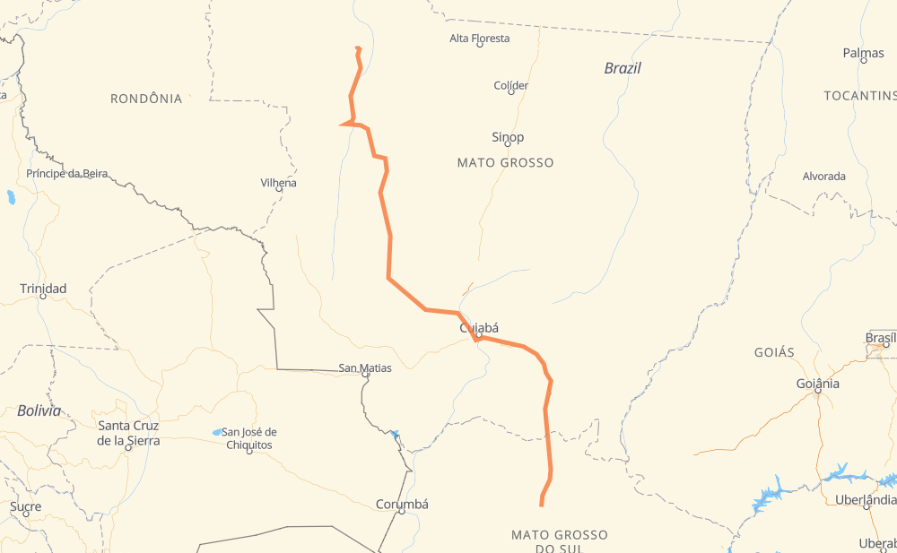
The distance from Rio Verde de Mato Grosso to Cotriguaçu is 1,448 kilometers by road including 119 kilometers on motorways. Road takes approximately 15 hours and 55 minutes and goes through Coxim, Vila Goulart, Jaciara and Novo Mundo.
| Shortest distance by air | 1,080 km ✈️ |
| Car route length | 1,448 km 🚗 |
| Driving time | 15 h 55 min |
| Fuel amount | 115.8 L |
| Fuel cost | 172.6 GBP |
| Point | Distance | Time | Fuel | |
| Rio Verde de Mato Grosso | 0 km | 00 min | 0.0 L | |
|
BR-163 68 km, 46 min
|
||||
| Coxim | 68 km | 46 min | 3.8 L | |
|
BR-163 114 km, 1 h 13 min
|
||||
| Ouro Branco do Sul | 182 km | 2 h 00 min | 14.4 L | |
|
BR-163 91 km, 57 min
|
||||
| Vila Goulart | 273 km | 2 h 57 min | 20.7 L | |
|
BR-163 106 km, 1 h 14 min
|
||||
| Jaciara | 379 km | 4 h 11 min | 28.6 L | |
|
BR-163 139 km, 1 h 31 min
|
||||
| Novo Mundo | 518 km | 5 h 42 min | 41.0 L | |
|
BR-364 MT-358 428 km, 4 h 34 min
|
||||
| Posto Norte | 946 km | 10 h 17 min | 71.6 L | |
|
BR-364 MT-170 482 km, 5 h 23 min
|
||||
| Ouro Verde dos Pioneiros | 1,429 km | 15 h 40 min | 113.1 L | |
|
MT-170 19 km, 14 min
|
||||
| -9.90347, -58.56588 | 1,448 km | 15 h 55 min | 115.8 L | |
Frequently Asked Questions
How much does it cost to drive from Rio Verde de Mato Grosso to Cotriguaçu?
Fuel cost: 172.6 GBP
This fuel cost is calculated as: (Route length 1,448 km / 100 km) * (Fuel consumption 8 L/100 km) * (Fuel price 1.49 GBP / L)
You can adjust fuel consumption and fuel price here.
How long is a car ride from Rio Verde de Mato Grosso to Cotriguaçu?
Driving time: 15 h 55 min
This time is calculated for driving at the maximum permitted speed, taking into account traffic rules restrictions.
- 88 km with a maximum speed 100 km/h = 52 min
- 952 km with a maximum speed 96 km/h = 9 h 55 min
- 405 km with a maximum speed 80 km/h = 5 h 3 min
- 2 km with a maximum speed 40 km/h = 3 min
The calculated driving time does not take into account intermediate stops and traffic jams.
How far is Rio Verde de Mato Grosso to Cotriguaçu by land?
The distance between Rio Verde de Mato Grosso and Cotriguaçu is 1,448 km by road including 119 km on motorways.
Precise satellite coordinates of highways were used for this calculation. The start and finish points are the centers of Rio Verde de Mato Grosso and Cotriguaçu respectively.
How far is Rio Verde de Mato Grosso to Cotriguaçu by plane?
The shortest distance (air line, as the crow flies) between Rio Verde de Mato Grosso and Cotriguaçu is 1,080 km.
This distance is calculated using the Haversine formula as a great-circle distance between two points on the surface of a sphere. The start and finish points are the centers of Rio Verde de Mato Grosso and Cotriguaçu respectively. Actual distance between airports may be different.
How many hours is Rio Verde de Mato Grosso from Cotriguaçu by plane?
Boeing 737 airliner needs 1 h 21 min to cover the distance of 1,080 km at a cruising speed of 800 km/h.
Small plane "Cessna 172" needs 4 h 54 min to flight this distance at average speed of 220 km/h.
This time is approximate and do not take into account takeoff and landing times, airport location and other real world factors.
How long is a helicopter ride from Rio Verde de Mato Grosso to Cotriguaçu?
Fast helicopter "Eurocopter AS350" or "Hughes OH-6 Cayuse" need 4 h 30 min to cover the distance of 1,080 km at a cruising speed of 240 km/h.
Popular "Robinson R44" needs 5 h 8 min to flight this distance at average speed of 210 km/h.
This time is approximate and do not take into account takeoff and landing times, aerodrome location and other real world factors.
What city is halfway between Rio Verde de Mato Grosso and Cotriguaçu?
The halfway point between Rio Verde de Mato Grosso and Cotriguaçu is Novo Mundo. It is located about 206 km from the exact midpoint by road.
The distance from Novo Mundo to Rio Verde de Mato Grosso is 518 km and driving will take about 5 h 42 min. The road between Novo Mundo and Cotriguaçu has length 929 km and will take approximately 10 h 12 min.
The other cities located close to halfway point:
Where is Rio Verde de Mato Grosso in relation to Cotriguaçu?
Rio Verde de Mato Grosso is located 1,080 km south-east of Cotriguaçu.
Rio Verde de Mato Grosso has geographic coordinates: latitude -18.91692, longitude -54.84107.
Cotriguaçu has geographic coordinates: latitude -9.90347, longitude -58.56588.
Which highway goes from Rio Verde de Mato Grosso to Cotriguaçu?
The route from Rio Verde de Mato Grosso to Cotriguaçu follows BR-163, MT-170, BR-364, MT-358.
Other minor sections pass along the road:
- BR-070: 87 km
- MT-246: 81 km
- MT-343: 24 km
- MT-344: 22 km
- MT-407: 16 km