Distance between Rodeio and Botelhos
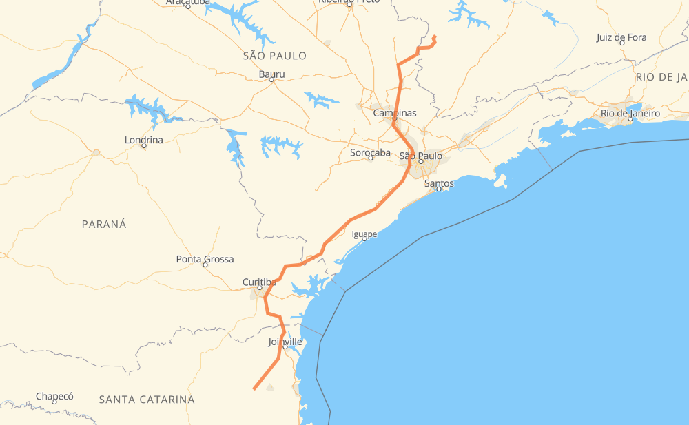
The distance from Rodeio to Botelhos is 893 kilometers by road including 731 kilometers on motorways. Road takes approximately 9 hours and 59 minutes and goes through Piraquara, Taboão da Serra, Barueri, Valinhos, Mogi Guaçu and Poços de Caldas.
| Shortest distance by air | 659 km ✈️ |
| Car route length | 893 km 🚗 |
| Driving time | 9 h 59 min |
| Fuel amount | 71.5 L |
| Fuel cost | 106.5 GBP |
| Point | Distance | Time | Fuel | |
| Rodeio | 0 km | 00 min | 0.0 L | |
|
SC-110 20 km, 15 min
|
||||
| Timbó | 20 km | 15 min | 1.0 L | |
|
SC-110 15 km, 12 min
|
||||
| Ribeirão Areia | 35 km | 27 min | 2.6 L | |
|
SC-110 BR-376 195 km, 2 h 21 min
|
||||
| Piraquara | 230 km | 2 h 49 min | 17.8 L | |
|
BR-116 381 km, 4 h 05 min
|
||||
| Taboão da Serra | 611 km | 6 h 54 min | 48.9 L | |
|
SP-230 SP-021 18 km, 11 min
|
||||
| Barueri | 630 km | 7 h 06 min | 50.1 L | |
|
SP-021 SP-348 79 km, 45 min
|
||||
| Valinhos | 709 km | 7 h 51 min | 56.4 L | |
|
SP-083 SP-340 71 km, 40 min
|
||||
| Mogi Guaçu | 779 km | 8 h 32 min | 61.7 L | |
|
SP-340 SP-342 100 km, 1 h 03 min
|
||||
| Poços de Caldas | 879 km | 9 h 35 min | 69.8 L | |
|
MG-877 BR-459 33 km, 23 min
|
||||
| Botelhos | 912 km | 9 h 59 min | 71.8 L | |
Frequently Asked Questions
How much does it cost to drive from Rodeio to Botelhos?
Fuel cost: 106.5 GBP
This fuel cost is calculated as: (Route length 893 km / 100 km) * (Fuel consumption 8 L/100 km) * (Fuel price 1.49 GBP / L)
You can adjust fuel consumption and fuel price here.
How long is a car ride from Rodeio to Botelhos?
Driving time: 9 h 59 min
This time is calculated for driving at the maximum permitted speed, taking into account traffic rules restrictions.
- 58 km with a maximum speed 112 km/h = 30 min
- 347 km with a maximum speed 110 km/h = 3 h 9 min
- 160 km with a maximum speed 100 km/h = 1 h 36 min
- 63 km with a maximum speed 96 km/h = 39 min
- 8 km with a maximum speed 90 km/h = 5 min
- 171 km with a maximum speed 80 km/h = 2 h 7 min
- 92 km with a maximum speed 60 km/h = 1 h 32 min
- 6 km with a maximum speed 50 km/h = 6 min
- 8 km with a maximum speed 40 km/h = 11 min
The calculated driving time does not take into account intermediate stops and traffic jams.
How far is Rodeio to Botelhos by land?
The distance between Rodeio and Botelhos is 893 km by road including 731 km on motorways.
Precise satellite coordinates of highways were used for this calculation. The start and finish points are the centers of Rodeio and Botelhos respectively.
How far is Rodeio to Botelhos by plane?
The shortest distance (air line, as the crow flies) between Rodeio and Botelhos is 659 km.
This distance is calculated using the Haversine formula as a great-circle distance between two points on the surface of a sphere. The start and finish points are the centers of Rodeio and Botelhos respectively. Actual distance between airports may be different.
How many hours is Rodeio from Botelhos by plane?
Boeing 737 airliner needs 49 min to cover the distance of 659 km at a cruising speed of 800 km/h.
Small plane "Cessna 172" needs 2 h 59 min to flight this distance at average speed of 220 km/h.
This time is approximate and do not take into account takeoff and landing times, airport location and other real world factors.
How long is a helicopter ride from Rodeio to Botelhos?
Fast helicopter "Eurocopter AS350" or "Hughes OH-6 Cayuse" need 2 h 44 min to cover the distance of 659 km at a cruising speed of 240 km/h.
Popular "Robinson R44" needs 3 h 8 min to flight this distance at average speed of 210 km/h.
This time is approximate and do not take into account takeoff and landing times, aerodrome location and other real world factors.
What city is halfway between Rodeio and Botelhos?
The halfway point between Rodeio and Botelhos is Jacupiranga. It is located about 23 km from the exact midpoint by road.
The distance from Jacupiranga to Rodeio is 424 km and driving will take about 5 h 3 min. The road between Jacupiranga and Botelhos has length 469 km and will take approximately 4 h 56 min.
The other cities located close to halfway point:
Where is Rodeio in relation to Botelhos?
Rodeio is located 659 km south-west of Botelhos.
Rodeio has geographic coordinates: latitude -26.92333, longitude -49.36854.
Botelhos has geographic coordinates: latitude -21.65, longitude -46.39472.
Which highway goes from Rodeio to Botelhos?
The route from Rodeio to Botelhos follows BR-116, SP-230.
Other minor sections pass along the road:
- SP-340: 85 km
- BR-376: 74 km
- SP-348: 59 km
- SC-110: 55 km
- BR-478: 48 km
- BR-101: 33 km
- SC-108: 28 km
- MG-877: 25 km
- SP-342: 25 km
- SP-021: 25 km
- SP-344: 24 km
- SP-083: 16 km
- BR-280: 10 km
- BR-277: 9 km
- SP-065: 4 km
- SC-477: 2 km
- AMG-1515: 1 km