Distance between San José Manzanitos and San Miguel de Cozumel
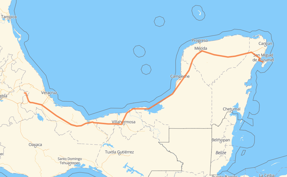
The distance from San José Manzanitos to San Miguel de Cozumel is 1,422 kilometers by road including 610 kilometers on motorways. Road takes approximately 16 hours and 25 minutes and goes through Fortín de las Flores, Mérida, Kanasín and Playa del Carmen.
| Shortest distance by air | 1,083 km ✈️ |
| Car route length | 1,422 km 🚗 |
| Driving time | 16 h 25 min |
| Fuel amount | 113.7 L |
| Fuel cost | 169.4 GBP |
| Toll roads cost | 674 + ? MXN |
| Point | Distance | Time | Fuel | |
| San José Manzanitos | 0 km | 00 min | 0.0 L | |
|
7 km, 05 min
|
||||
| Chilchotla | 7 km | 05 min | 0.5 L | |
|
51 km, 47 min
|
||||
| Coscomatepec de Bravo | 58 km | 53 min | 4.1 L | |
|
MEX 125 22 km, 16 min
|
||||
| Fortín de las Flores | 79 km | 1 h 09 min | 6.3 L | |
|
MEX 125 MEX 145D 421 km, 4 h 19 min
|
||||
| Heroica Cárdenas | 500 km | 5 h 29 min | 38.9 L | |
|
MEX 180 138 km, 1 h 31 min
|
||||
| Frontera | 638 km | 7 h 00 min | 49.8 L | |
|
MEX 180 461 km, 5 h 19 min
|
||||
| Mérida | 1,099 km | 12 h 19 min | 87.5 L | |
|
24 km, 17 min
|
||||
| Kanasín | 1,123 km | 12 h 37 min | 88.3 L | |
|
MEX 180 MEX 180D 267 km, 2 h 39 min
|
||||
| Playa del Carmen | 1,391 km | 15 h 16 min | 110.7 L | |
|
MEX 307 31 km, 1 h 08 min
|
||||
| San Miguel de Cozumel | 1,422 km | 16 h 25 min | 113.7 L | |
Hotels of San Miguel de Cozumel
Frequently Asked Questions
How many toll booths are there from San José Manzanitos to San Miguel de Cozumel?
There are 12 toll booths between San José Manzanitos and San Miguel de Cozumel: Cuitláhuac, Cosamaloapan, Acayucan, Antonio Dovali, Sánchez Magallanes, Villahermosa Nacajuca, Zacatal, Unidad, Seybaplaya, Pisté, El Tintal and El Tintal Zona 3.
How much does the toll booths cost from San José Manzanitos to San Miguel de Cozumel?
Toll roads cost: Cuitláhuac (114 MXN) + Cosamaloapan (229 MXN) + Acayucan (?) + Antonio Dovali (20 MXN) + Sánchez Magallanes (82 MXN) + Villahermosa Nacajuca (62 MXN) + Zacatal (90 MXN) + Unidad (?) + Seybaplaya (77 MXN) + Pisté (?) + El Tintal (?) + El Tintal Zona 3 (?) = 674 + ? MXN
How much does it cost to drive from San José Manzanitos to San Miguel de Cozumel?
Fuel cost: 169.4 GBP
This fuel cost is calculated as: (Route length 1,422 km / 100 km) * (Fuel consumption 8 L/100 km) * (Fuel price 1.49 GBP / L)
You can adjust fuel consumption and fuel price here.
Toll roads cost: 674 + ? MXN
How long is a car ride from San José Manzanitos to San Miguel de Cozumel?
Driving time: 16 h 25 min
This time is calculated for driving at the maximum permitted speed, taking into account traffic rules restrictions.
- 261 km with a maximum speed 110 km/h = 2 h 22 min
- 302 km with a maximum speed 100 km/h = 3 h
- 232 km with a maximum speed 96 km/h = 2 h 25 min
- 108 km with a maximum speed 90 km/h = 1 h 12 min
- 475 km with a maximum speed 80 km/h = 5 h 55 min
- 23 km with a maximum speed 50 km/h = 28 min
- 20 km with a maximum speed 20 km/h = 1 h
The calculated driving time does not take into account intermediate stops and traffic jams.
How far is San José Manzanitos to San Miguel de Cozumel by land?
The distance between San José Manzanitos and San Miguel de Cozumel is 1,422 km by road including 610 km on motorways.
Precise satellite coordinates of highways were used for this calculation. The start and finish points are the centers of San José Manzanitos and San Miguel de Cozumel respectively.
How far is San José Manzanitos to San Miguel de Cozumel by plane?
The shortest distance (air line, as the crow flies) between San José Manzanitos and San Miguel de Cozumel is 1,083 km.
This distance is calculated using the Haversine formula as a great-circle distance between two points on the surface of a sphere. The start and finish points are the centers of San José Manzanitos and San Miguel de Cozumel respectively. Actual distance between airports may be different.
How many hours is San José Manzanitos from San Miguel de Cozumel by plane?
Boeing 737 airliner needs 1 h 21 min to cover the distance of 1,083 km at a cruising speed of 800 km/h.
Small plane "Cessna 172" needs 4 h 55 min to flight this distance at average speed of 220 km/h.
This time is approximate and do not take into account takeoff and landing times, airport location and other real world factors.
How long is a helicopter ride from San José Manzanitos to San Miguel de Cozumel?
Fast helicopter "Eurocopter AS350" or "Hughes OH-6 Cayuse" need 4 h 30 min to cover the distance of 1,083 km at a cruising speed of 240 km/h.
Popular "Robinson R44" needs 5 h 9 min to flight this distance at average speed of 210 km/h.
This time is approximate and do not take into account takeoff and landing times, aerodrome location and other real world factors.
What city is halfway between San José Manzanitos and San Miguel de Cozumel?
The halfway point between San José Manzanitos and San Miguel de Cozumel is Zacatal. It is located about 12 km from the exact midpoint by road.
The distance from Zacatal to San José Manzanitos is 722 km and driving will take about 8 h 3 min. The road between Zacatal and San Miguel de Cozumel has length 699 km and will take approximately 8 h 22 min.
The other cities located close to halfway point:
Where is San José Manzanitos in relation to San Miguel de Cozumel?
San José Manzanitos is located 1,083 km west of San Miguel de Cozumel.
San José Manzanitos has geographic coordinates: latitude 19.2611, longitude -97.21472.
San Miguel de Cozumel has geographic coordinates: latitude 20.5096, longitude -86.94878.
Which highway goes from San José Manzanitos to San Miguel de Cozumel?
The route from San José Manzanitos to San Miguel de Cozumel follows MEX 180, MEX 180D, MEX 145D.
Other minor sections pass along the road:
- MEX 150D: 60 km
- MEX 305D: 44 km
- MEX 125: 22 km
- MEX 307: 6 km