Distance between San Pedro Tlaquepaque and Ejido Tanque de Emergencia
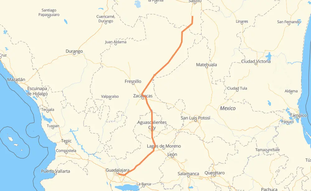
The distance from San Pedro Tlaquepaque to Ejido Tanque de Emergencia is 650 kilometers by road including 173 kilometers on motorways. Road takes approximately 7 hours and 5 minutes and goes through Tonalá, Aguascalientes, Pegueros, Valle de Guadalupe, Encarnación de Díaz, San Francisco de Los Romo and Pabellón de Arteaga.
| Shortest distance by air | 544 km ✈️ |
| Car route length | 650 km 🚗 |
| Driving time | 7 h 5 min |
| Fuel amount | 52 L |
| Fuel cost | 76.9 GBP |
| Toll roads cost | 630 + ? MXN |
| Point | Distance | Time | Fuel | |
| San Pedro Tlaquepaque | 0 km | 00 min | 0.0 L | |
|
MEX 80 12 km, 08 min
|
||||
| Tonalá | 12 km | 08 min | 0.3 L | |
|
MEX 15D MEX 80D 67 km, 40 min
|
||||
| Pegueros | 79 km | 49 min | 5.3 L | |
|
MEX 80D 17 km, 09 min
|
||||
| Valle de Guadalupe | 96 km | 58 min | 7.4 L | |
|
MEX 80D 76 km, 43 min
|
||||
| Encarnación de Díaz | 172 km | 1 h 42 min | 13.5 L | |
|
MEX 45D MEX 70 46 km, 32 min
|
||||
| Aguascalientes | 218 km | 2 h 15 min | 17.0 L | |
|
MEX 45 21 km, 14 min
|
||||
| San Francisco de Los Romo | 239 km | 2 h 29 min | 18.9 L | |
|
MEX 45 8 km, 05 min
|
||||
| Pabellón de Arteaga | 248 km | 2 h 35 min | 19.4 L | |
|
MEX 45 35 km, 24 min
|
||||
| San Pedro Piedra Gorda | 283 km | 2 h 59 min | 22.2 L | |
|
MEX 45D MEX 54 371 km, 4 h 05 min
|
||||
| Ejido Tanque de Emergencia | 654 km | 7 h 05 min | 52.1 L | |
Frequently Asked Questions
How many toll booths are there from San Pedro Tlaquepaque to Ejido Tanque de Emergencia?
There are 6 toll booths between San Pedro Tlaquepaque and Ejido Tanque de Emergencia: Veta Grande, Zacatecas, Encarnacion De Diaz, Jalostotitlan, Tepatitlan and La Joya.
How much does the toll booths cost from San Pedro Tlaquepaque to Ejido Tanque de Emergencia?
Toll roads cost: La Joya (?) + Tepatitlan (214 MXN) + Jalostotitlan (177 MXN) + Encarnacion De Diaz (150 MXN) + Zacatecas (41 MXN) + Veta Grande (48 MXN) = 630 + ? MXN
How much does it cost to drive from San Pedro Tlaquepaque to Ejido Tanque de Emergencia?
Fuel cost: 76.9 GBP
This fuel cost is calculated as: (Route length 650 km / 100 km) * (Fuel consumption 8 L/100 km) * (Fuel price 1.48 GBP / L)
You can adjust fuel consumption and fuel price here.
Toll roads cost: 630 + ? MXN
How long is a car ride from San Pedro Tlaquepaque to Ejido Tanque de Emergencia?
Driving time: 7 h 5 min
This time is calculated for driving at the maximum permitted speed, taking into account traffic rules restrictions.
- 106 km with a maximum speed 110 km/h = 57 min
- 46 km with a maximum speed 100 km/h = 27 min
- 146 km with a maximum speed 96 km/h = 1 h 31 min
- 298 km with a maximum speed 90 km/h = 3 h 18 min
- 38 km with a maximum speed 80 km/h = 28 min
- 13 km with a maximum speed 60 km/h = 12 min
- 5 km with a maximum speed 50 km/h = 5 min
- 1 km with a maximum speed 40 km/h = 1 min
The calculated driving time does not take into account intermediate stops and traffic jams.
How far is San Pedro Tlaquepaque to Ejido Tanque de Emergencia by land?
The distance between San Pedro Tlaquepaque and Ejido Tanque de Emergencia is 650 km by road including 173 km on motorways.
Precise satellite coordinates of highways were used for this calculation. The start and finish points are the centers of San Pedro Tlaquepaque and Ejido Tanque de Emergencia respectively.
How far is San Pedro Tlaquepaque to Ejido Tanque de Emergencia by plane?
The shortest distance (air line, as the crow flies) between San Pedro Tlaquepaque and Ejido Tanque de Emergencia is 544 km.
This distance is calculated using the Haversine formula as a great-circle distance between two points on the surface of a sphere. The start and finish points are the centers of San Pedro Tlaquepaque and Ejido Tanque de Emergencia respectively. Actual distance between airports may be different.
How many hours is San Pedro Tlaquepaque from Ejido Tanque de Emergencia by plane?
Boeing 737 airliner needs 40 min to cover the distance of 544 km at a cruising speed of 800 km/h.
Small plane "Cessna 172" needs 2 h 28 min to flight this distance at average speed of 220 km/h.
This time is approximate and do not take into account takeoff and landing times, airport location and other real world factors.
How long is a helicopter ride from San Pedro Tlaquepaque to Ejido Tanque de Emergencia?
Fast helicopter "Eurocopter AS350" or "Hughes OH-6 Cayuse" need 2 h 16 min to cover the distance of 544 km at a cruising speed of 240 km/h.
Popular "Robinson R44" needs 2 h 35 min to flight this distance at average speed of 210 km/h.
This time is approximate and do not take into account takeoff and landing times, aerodrome location and other real world factors.
What city is halfway between San Pedro Tlaquepaque and Ejido Tanque de Emergencia?
The halfway point between San Pedro Tlaquepaque and Ejido Tanque de Emergencia is Sauceda de la Borda. It is located about 9 km from the exact midpoint by road.
The distance from Sauceda de la Borda to San Pedro Tlaquepaque is 333 km and driving will take about 3 h 32 min. The road between Sauceda de la Borda and Ejido Tanque de Emergencia has length 316 km and will take approximately 3 h 33 min.
The other cities located close to halfway point:
Where is San Pedro Tlaquepaque in relation to Ejido Tanque de Emergencia?
San Pedro Tlaquepaque is located 544 km south-west of Ejido Tanque de Emergencia.
San Pedro Tlaquepaque has geographic coordinates: latitude 20.63965, longitude -103.31185.
Ejido Tanque de Emergencia has geographic coordinates: latitude 25.06834, longitude -101.0676.
Which highway goes from San Pedro Tlaquepaque to Ejido Tanque de Emergencia?
The route from San Pedro Tlaquepaque to Ejido Tanque de Emergencia follows MEX 54, MEX 80D.
Other minor sections pass along the road:
- MEX 45: 88 km
- MEX 45D: 83 km
- MEX 70: 70 km
- MEX 15D: 17 km
- ZAC 155: 6 km
- MEX 90D: 3 km
- MEX 80: 2 km