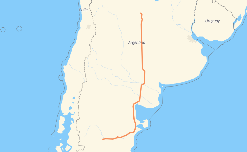
Distance between Santa Rosa de Calamuchita and Paso de Indios
The distance from Santa Rosa de Calamuchita to Paso de Indios is 1,703 kilometers by road. Road takes approximately 18 hours and 30 minutes and goes through Río Cuarto, Santa Rosa, Embalse, Vicuña Mackenna, Eduardo Castex, La Cuesta del Sur and Río Colorado.
| Shortest distance by air | 1,370 km ✈️ |
| Car route length | 1,703 km 🚗 |
| Driving time | 18 h 30 min |
| Fuel amount | 136.2 L |
| Fuel cost | 203 GBP |
| Point | Distance | Time | Fuel | |
| Santa Rosa de Calamuchita | 0 km | 00 min | 0.0 L | |
|
RP5 27 km, 20 min
|
||||
| Embalse | 27 km | 20 min | 1.8 L | |
|
RP5 RN36 114 km, 1 h 13 min
|
||||
| Río Cuarto | 141 km | 1 h 33 min | 10.5 L | |
|
RNA005 RN35 88 km, 58 min
|
||||
| Vicuña Mackenna | 229 km | 2 h 32 min | 15.3 L | |
|
RN35 238 km, 2 h 36 min
|
||||
| Eduardo Castex | 467 km | 5 h 08 min | 35.4 L | |
|
RN35 69 km, 47 min
|
||||
| Santa Rosa | 536 km | 5 h 55 min | 42.5 L | |
|
RN35 14 km, 10 min
|
||||
| La Cuesta del Sur | 550 km | 6 h 05 min | 43.5 L | |
|
RN35 RN154 262 km, 2 h 49 min
|
||||
| Río Colorado | 812 km | 8 h 55 min | 64.9 L | |
|
RN22 RN251 235 km, 2 h 29 min
|
||||
| El Empalme | 1,046 km | 11 h 24 min | 83.4 L | |
|
RN3 RN25 656 km, 7 h 05 min
|
||||
| Paso de Indios | 1,703 km | 18 h 30 min | 136.1 L | |
Frequently Asked Questions
How much does it cost to drive from Santa Rosa de Calamuchita to Paso de Indios?
Fuel cost: 203 GBP
This fuel cost is calculated as: (Route length 1,703 km / 100 km) * (Fuel consumption 8 L/100 km) * (Fuel price 1.49 GBP / L)
You can adjust fuel consumption and fuel price here.
How long is a car ride from Santa Rosa de Calamuchita to Paso de Indios?
Driving time: 18 h 30 min
This time is calculated for driving at the maximum permitted speed, taking into account traffic rules restrictions.
- 1,399 km with a maximum speed 96 km/h = 14 h 34 min
- 281 km with a maximum speed 80 km/h = 3 h 30 min
- 18 km with a maximum speed 60 km/h = 18 min
- 4 km with a maximum speed 40 km/h = 5 min
The calculated driving time does not take into account intermediate stops and traffic jams.
How far is Santa Rosa de Calamuchita to Paso de Indios by land?
The distance between Santa Rosa de Calamuchita and Paso de Indios is 1,703 km by road.
Precise satellite coordinates of highways were used for this calculation. The start and finish points are the centers of Santa Rosa de Calamuchita and Paso de Indios respectively.
How far is Santa Rosa de Calamuchita to Paso de Indios by plane?
The shortest distance (air line, as the crow flies) between Santa Rosa de Calamuchita and Paso de Indios is 1,370 km.
This distance is calculated using the Haversine formula as a great-circle distance between two points on the surface of a sphere. The start and finish points are the centers of Santa Rosa de Calamuchita and Paso de Indios respectively. Actual distance between airports may be different.
How many hours is Santa Rosa de Calamuchita from Paso de Indios by plane?
Boeing 737 airliner needs 1 h 42 min to cover the distance of 1,370 km at a cruising speed of 800 km/h.
Small plane "Cessna 172" needs 6 h 13 min to flight this distance at average speed of 220 km/h.
This time is approximate and do not take into account takeoff and landing times, airport location and other real world factors.
How long is a helicopter ride from Santa Rosa de Calamuchita to Paso de Indios?
Fast helicopter "Eurocopter AS350" or "Hughes OH-6 Cayuse" need 5 h 42 min to cover the distance of 1,370 km at a cruising speed of 240 km/h.
Popular "Robinson R44" needs 6 h 31 min to flight this distance at average speed of 210 km/h.
This time is approximate and do not take into account takeoff and landing times, aerodrome location and other real world factors.
What city is halfway between Santa Rosa de Calamuchita and Paso de Indios?
The halfway point between Santa Rosa de Calamuchita and Paso de Indios is Río Colorado. It is located about 40 km from the exact midpoint by road.
The distance from Río Colorado to Santa Rosa de Calamuchita is 812 km and driving will take about 8 h 54 min. The road between Río Colorado and Paso de Indios has length 891 km and will take approximately 9 h 35 min.
The other cities located close to halfway point:
Where is Santa Rosa de Calamuchita in relation to Paso de Indios?
Santa Rosa de Calamuchita is located 1,370 km north-east of Paso de Indios.
Santa Rosa de Calamuchita has geographic coordinates: latitude -32.06873, longitude -64.53755.
Paso de Indios has geographic coordinates: latitude -43.86445, longitude -69.0465.
Which highway goes from Santa Rosa de Calamuchita to Paso de Indios?
The route from Santa Rosa de Calamuchita to Paso de Indios follows RN35, RN25, RN3, RN251, RN154.
Other minor sections pass along the road:
- RN36: 85 km
- RP5: 46 km
- RN22: 32 km
- RNA005: 11 km
- RN8: 8 km
- RPE82: 2 km