Distance between Setor Galiléia and Ilha
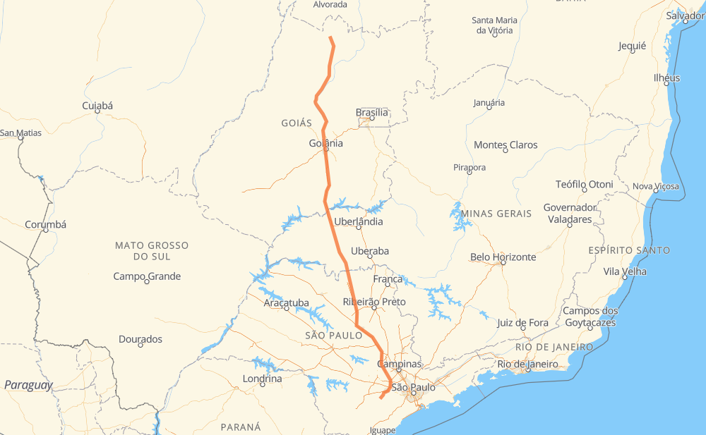
The distance from Setor Galiléia to Ilha is 1,306 kilometers by road including 639 kilometers on motorways. Road takes approximately 13 hours and 41 minutes and goes through Goiânia, Rio Claro, Piracicaba and Votorantim.
| Shortest distance by air | 1,156 km ✈️ |
| Car route length | 1,306 km 🚗 |
| Driving time | 13 h 41 min |
| Fuel amount | 104.5 L |
| Fuel cost | 154.7 GBP |
| Point | Distance | Time | Fuel | |
| Setor Galiléia | 0 km | 00 min | 0.0 L | |
|
BR-153 389 km, 4 h 20 min
|
||||
| Chácara Bom Retiro | 389 km | 4 h 20 min | 30.2 L | |
|
GO-080 21 km, 15 min
|
||||
| Goiânia | 409 km | 4 h 35 min | 32.6 L | |
|
BR-153 8 km, 05 min
|
||||
| Granjas Reunidas Nossa Senhora de Lourdes | 417 km | 4 h 40 min | 33.2 L | |
|
BR-153 226 km, 2 h 15 min
|
||||
| Centralina | 643 km | 6 h 55 min | 50.6 L | |
|
BR-153 82 km, 48 min
|
||||
| Prata | 724 km | 7 h 44 min | 57.4 L | |
|
BR-153 BR-364 410 km, 4 h 08 min
|
||||
| Rio Claro | 1,135 km | 11 h 53 min | 90.4 L | |
|
SP-310 SP-127 39 km, 23 min
|
||||
| Piracicaba | 1,174 km | 12 h 16 min | 93.5 L | |
|
SP-308 103 km, 1 h 01 min
|
||||
| Votorantim | 1,277 km | 13 h 17 min | 101.7 L | |
|
SP-270 SP-264 32 km, 23 min
|
||||
| Ilha | 1,310 km | 13 h 41 min | 104.3 L | |
Frequently Asked Questions
How much does it cost to drive from Setor Galiléia to Ilha?
Fuel cost: 154.7 GBP
This fuel cost is calculated as: (Route length 1,306 km / 100 km) * (Fuel consumption 8 L/100 km) * (Fuel price 1.48 GBP / L)
You can adjust fuel consumption and fuel price here.
How long is a car ride from Setor Galiléia to Ilha?
Driving time: 13 h 41 min
This time is calculated for driving at the maximum permitted speed, taking into account traffic rules restrictions.
- 4 km with a maximum speed 112 km/h = 2 min
- 452 km with a maximum speed 110 km/h = 4 h 6 min
- 95 km with a maximum speed 100 km/h = 56 min
- 489 km with a maximum speed 96 km/h = 5 h 5 min
- 13 km with a maximum speed 90 km/h = 8 min
- 240 km with a maximum speed 80 km/h = 2 h 59 min
- 2 km with a maximum speed 70 km/h = 2 min
- 5 km with a maximum speed 60 km/h = 5 min
- 10 km with a maximum speed 40 km/h = 14 min
The calculated driving time does not take into account intermediate stops and traffic jams.
How far is Setor Galiléia to Ilha by land?
The distance between Setor Galiléia and Ilha is 1,306 km by road including 639 km on motorways.
Precise satellite coordinates of highways were used for this calculation. The start and finish points are the centers of Setor Galiléia and Ilha respectively.
How far is Setor Galiléia to Ilha by plane?
The shortest distance (air line, as the crow flies) between Setor Galiléia and Ilha is 1,156 km.
This distance is calculated using the Haversine formula as a great-circle distance between two points on the surface of a sphere. The start and finish points are the centers of Setor Galiléia and Ilha respectively. Actual distance between airports may be different.
How many hours is Setor Galiléia from Ilha by plane?
Boeing 737 airliner needs 1 h 26 min to cover the distance of 1,156 km at a cruising speed of 800 km/h.
Small plane "Cessna 172" needs 5 h 15 min to flight this distance at average speed of 220 km/h.
This time is approximate and do not take into account takeoff and landing times, airport location and other real world factors.
How long is a helicopter ride from Setor Galiléia to Ilha?
Fast helicopter "Eurocopter AS350" or "Hughes OH-6 Cayuse" need 4 h 49 min to cover the distance of 1,156 km at a cruising speed of 240 km/h.
Popular "Robinson R44" needs 5 h 30 min to flight this distance at average speed of 210 km/h.
This time is approximate and do not take into account takeoff and landing times, aerodrome location and other real world factors.
What city is halfway between Setor Galiléia and Ilha?
The halfway point between Setor Galiléia and Ilha is Centralina. It is located about 10 km from the exact midpoint by road.
The distance from Centralina to Setor Galiléia is 643 km and driving will take about 6 h 55 min. The road between Centralina and Ilha has length 663 km and will take approximately 6 h 45 min.
The other cities located close to halfway point:
Where is Setor Galiléia in relation to Ilha?
Setor Galiléia is located 1,156 km north of Ilha.
Setor Galiléia has geographic coordinates: latitude -13.41943, longitude -49.13721.
Ilha has geographic coordinates: latitude -23.71102, longitude -47.63508.
Which highway goes from Setor Galiléia to Ilha?
The route from Setor Galiléia to Ilha follows BR-153, BR-364, SP-326, SP-310, GO-080.
Other minor sections pass along the road:
- SP-308: 60 km
- BR-267: 59 km
- BR-414: 35 km
- BR-455: 30 km
- SP-075: 29 km
- SP-127: 26 km
- LMG-810: 24 km
- SP-264: 19 km
- BR-262: 13 km
- SP-270: 12 km
- BR-272: 10 km
- SPI 162/308: 9 km
- SPI 091/270: 6 km
- MGC-455: 3 km