Distance between Timbó and Itaipé
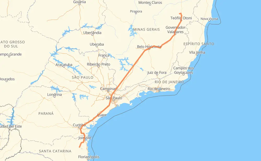
The distance from Timbó to Itaipé is 1,720 kilometers by road including 1,077 kilometers on motorways. Road takes approximately 19 hours and 26 minutes and goes through Piraquara, Taboão da Serra, Barueri, Atibaia, Betim and Coronel Fabriciano.
| Shortest distance by air | 1,308 km ✈️ |
| Car route length | 1,720 km 🚗 |
| Driving time | 19 h 26 min |
| Fuel amount | 137.6 L |
| Fuel cost | 203.6 GBP |
| Point | Distance | Time | Fuel | |
| Timbó | 0 km | 00 min | 0.0 L | |
|
SC-110 18 km, 15 min
|
||||
| Ribeirão Areia | 18 km | 15 min | 1.3 L | |
|
SC-110 9 km, 09 min
|
||||
| Rega III | 28 km | 25 min | 1.9 L | |
|
SC-110 BR-376 186 km, 2 h 11 min
|
||||
| Piraquara | 214 km | 2 h 36 min | 16.5 L | |
|
BR-116 381 km, 4 h 05 min
|
||||
| Taboão da Serra | 595 km | 6 h 41 min | 47.6 L | |
|
SP-230 SP-021 18 km, 11 min
|
||||
| Barueri | 613 km | 6 h 53 min | 48.8 L | |
|
SP-021 SP-354 74 km, 51 min
|
||||
| Atibaia | 687 km | 7 h 45 min | 53.9 L | |
|
SP-065 BR-381 491 km, 4 h 42 min
|
||||
| Betim | 1,179 km | 12 h 27 min | 93.9 L | |
|
BR-381 230 km, 2 h 55 min
|
||||
| Coronel Fabriciano | 1,408 km | 15 h 22 min | 112.5 L | |
|
BR-381 BR-116 332 km, 4 h 03 min
|
||||
| Itaipé | 1,740 km | 19 h 25 min | 139.2 L | |
Frequently Asked Questions
How much does it cost to drive from Timbó to Itaipé?
Fuel cost: 203.6 GBP
This fuel cost is calculated as: (Route length 1,720 km / 100 km) * (Fuel consumption 8 L/100 km) * (Fuel price 1.48 GBP / L)
You can adjust fuel consumption and fuel price here.
How long is a car ride from Timbó to Itaipé?
Driving time: 19 h 26 min
This time is calculated for driving at the maximum permitted speed, taking into account traffic rules restrictions.
- 671 km with a maximum speed 110 km/h = 6 h 6 min
- 156 km with a maximum speed 100 km/h = 1 h 33 min
- 244 km with a maximum speed 96 km/h = 2 h 32 min
- 56 km with a maximum speed 90 km/h = 37 min
- 438 km with a maximum speed 80 km/h = 5 h 28 min
- 5 km with a maximum speed 70 km/h = 4 min
- 140 km with a maximum speed 60 km/h = 2 h 20 min
- 4 km with a maximum speed 50 km/h = 4 min
- 25 km with a maximum speed 40 km/h = 38 min
The calculated driving time does not take into account intermediate stops and traffic jams.
How far is Timbó to Itaipé by land?
The distance between Timbó and Itaipé is 1,720 km by road including 1,077 km on motorways.
Precise satellite coordinates of highways were used for this calculation. The start and finish points are the centers of Timbó and Itaipé respectively.
How far is Timbó to Itaipé by plane?
The shortest distance (air line, as the crow flies) between Timbó and Itaipé is 1,308 km.
This distance is calculated using the Haversine formula as a great-circle distance between two points on the surface of a sphere. The start and finish points are the centers of Timbó and Itaipé respectively. Actual distance between airports may be different.
How many hours is Timbó from Itaipé by plane?
Boeing 737 airliner needs 1 h 38 min to cover the distance of 1,308 km at a cruising speed of 800 km/h.
Small plane "Cessna 172" needs 5 h 56 min to flight this distance at average speed of 220 km/h.
This time is approximate and do not take into account takeoff and landing times, airport location and other real world factors.
How long is a helicopter ride from Timbó to Itaipé?
Fast helicopter "Eurocopter AS350" or "Hughes OH-6 Cayuse" need 5 h 27 min to cover the distance of 1,308 km at a cruising speed of 240 km/h.
Popular "Robinson R44" needs 6 h 13 min to flight this distance at average speed of 210 km/h.
This time is approximate and do not take into account takeoff and landing times, aerodrome location and other real world factors.
What city is halfway between Timbó and Itaipé?
The halfway point between Timbó and Itaipé is Careaçu. It is located about 2 km from the exact midpoint by road.
The distance from Careaçu to Timbó is 858 km and driving will take about 9 h 21 min. The road between Careaçu and Itaipé has length 862 km and will take approximately 10 h 4 min.
The other cities located close to halfway point:
Where is Timbó in relation to Itaipé?
Timbó is located 1,308 km south-west of Itaipé.
Timbó has geographic coordinates: latitude -26.82827, longitude -49.27064.
Itaipé has geographic coordinates: latitude -17.40194, longitude -41.67028.
Which highway goes from Timbó to Itaipé?
The route from Timbó to Itaipé follows BR-381, BR-116, SP-230.
Other minor sections pass along the road:
- BR-376: 74 km
- BR-342: 63 km
- BR-478: 48 km
- SC-110: 42 km
- BR-262: 38 km
- SP-354: 38 km
- SP-010: 36 km
- BR-101: 33 km
- SC-108: 28 km
- SP-021: 22 km
- MG-211: 20 km
- BR-050: 15 km
- SP-330: 15 km
- SP-065: 13 km
- BR-280: 10 km
- BR-277: 9 km
- JAR-354: 9 km
- BR-040: 3 km
- BR-494: 2 km
- MG-129: 1 km