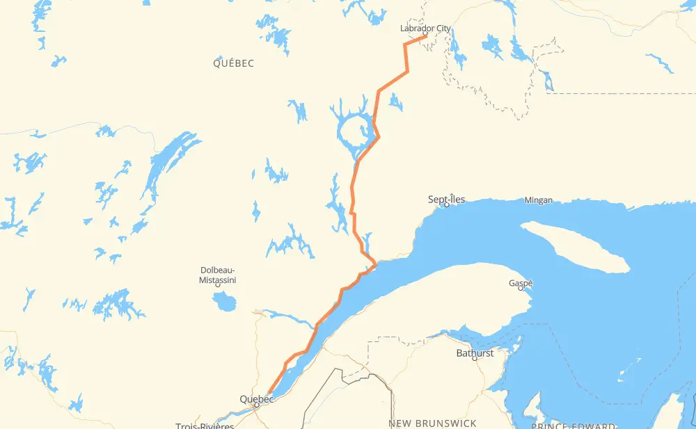
Distance between Wabush NL and Sainte-Anne-de-Beaupré QC
The distance from Wabush to Sainte-Anne-de-Beaupré is 965 kilometers by road. Road takes approximately 10 hours and 34 minutes and goes through Baie-Comeau, Labrador City, Hauterive, Forestville, Les Bergeronnes, Saint-Fidèle and La Malbaie.
| Shortest distance by air | 715 km ✈️ |
| Car route length | 965 km 🚗 |
| Driving time | 10 h 34 min |
| Fuel amount | 77.2 L |
| Fuel cost | 115.1 GBP |
| Point | Distance | Time | Fuel | |
| Wabush | 0 km | 00 min | 0.0 L | |
|
503 15 km, 11 min
|
||||
| Labrador City | 15 km | 11 min | 0.4 L | |
|
500 389 565 km, 5 h 56 min
|
||||
| Baie-Comeau | 580 km | 6 h 07 min | 45.4 L | |
|
389 138 16 km, 12 min
|
||||
| Hauterive | 596 km | 6 h 19 min | 47.5 L | |
|
138 96 km, 1 h 01 min
|
||||
| Forestville | 692 km | 7 h 20 min | 54.8 L | |
|
138 66 km, 44 min
|
||||
| Les Bergeronnes | 759 km | 8 h 05 min | 60.0 L | |
|
138 82 km, 1 h 01 min
|
||||
| Saint-Fidèle | 841 km | 9 h 07 min | 66.8 L | |
|
138 19 km, 13 min
|
||||
| La Malbaie | 860 km | 9 h 21 min | 68.6 L | |
|
138 49 km, 35 min
|
||||
| Baie-Saint-Paul | 910 km | 9 h 56 min | 72.3 L | |
|
138 56 km, 37 min
|
||||
| Sainte-Anne-de-Beaupré | 965 km | 10 h 34 min | 77.2 L | |
Hotels of Sainte-Anne-de-Beaupré
Frequently Asked Questions
How much does it cost to drive from Wabush to Sainte-Anne-de-Beaupré?
Fuel cost: 115.1 GBP
This fuel cost is calculated as: (Route length 965 km / 100 km) * (Fuel consumption 8 L/100 km) * (Fuel price 1.49 GBP / L)
You can adjust fuel consumption and fuel price here.
How long is a car ride from Wabush to Sainte-Anne-de-Beaupré?
Driving time: 10 h 34 min
This time is calculated for driving at the maximum permitted speed, taking into account traffic rules restrictions.
- 687 km with a maximum speed 96 km/h = 7 h 9 min
- 147 km with a maximum speed 90 km/h = 1 h 37 min
- 104 km with a maximum speed 80 km/h = 1 h 17 min
- 19 km with a maximum speed 70 km/h = 16 min
- 7 km with a maximum speed 50 km/h = 8 min
- 2 km with a maximum speed 20 km/h = 4 min
The calculated driving time does not take into account intermediate stops and traffic jams.
How far is Wabush to Sainte-Anne-de-Beaupré by land?
The distance between Wabush and Sainte-Anne-de-Beaupré is 965 km by road.
Precise satellite coordinates of highways were used for this calculation. The start and finish points are the centers of Wabush and Sainte-Anne-de-Beaupré respectively.
How far is Wabush to Sainte-Anne-de-Beaupré by plane?
The shortest distance (air line, as the crow flies) between Wabush and Sainte-Anne-de-Beaupré is 715 km.
This distance is calculated using the Haversine formula as a great-circle distance between two points on the surface of a sphere. The start and finish points are the centers of Wabush and Sainte-Anne-de-Beaupré respectively. Actual distance between airports may be different.
How many hours is Wabush from Sainte-Anne-de-Beaupré by plane?
Boeing 737 airliner needs 53 min to cover the distance of 715 km at a cruising speed of 800 km/h.
Small plane "Cessna 172" needs 3 h 15 min to flight this distance at average speed of 220 km/h.
This time is approximate and do not take into account takeoff and landing times, airport location and other real world factors.
How long is a helicopter ride from Wabush to Sainte-Anne-de-Beaupré?
Fast helicopter "Eurocopter AS350" or "Hughes OH-6 Cayuse" need 2 h 58 min to cover the distance of 715 km at a cruising speed of 240 km/h.
Popular "Robinson R44" needs 3 h 24 min to flight this distance at average speed of 210 km/h.
This time is approximate and do not take into account takeoff and landing times, aerodrome location and other real world factors.
What city is halfway between Wabush and Sainte-Anne-de-Beaupré?
The halfway point between Wabush and Sainte-Anne-de-Beaupré is Baie-Comeau. It is located about 97 km from the exact midpoint by road.
The distance from Baie-Comeau to Wabush is 580 km and driving will take about 6 h 7 min. The road between Baie-Comeau and Sainte-Anne-de-Beaupré has length 385 km and will take approximately 4 h 27 min.
The other cities located close to halfway point:
Where is Wabush in relation to Sainte-Anne-de-Beaupré?
Wabush is located 715 km north-east of Sainte-Anne-de-Beaupré.
Wabush has geographic coordinates: latitude 52.89999, longitude -66.87017.
Sainte-Anne-de-Beaupré has geographic coordinates: latitude 47.02614, longitude -70.92533.
Which highway goes from Wabush to Sainte-Anne-de-Beaupré?
The route from Wabush to Sainte-Anne-de-Beaupré follows 389, 138.
Other minor sections pass along the road:
- 500: 21 km
- 503: 4 km
- 360: 3 km