Distance between Yining and Beihai
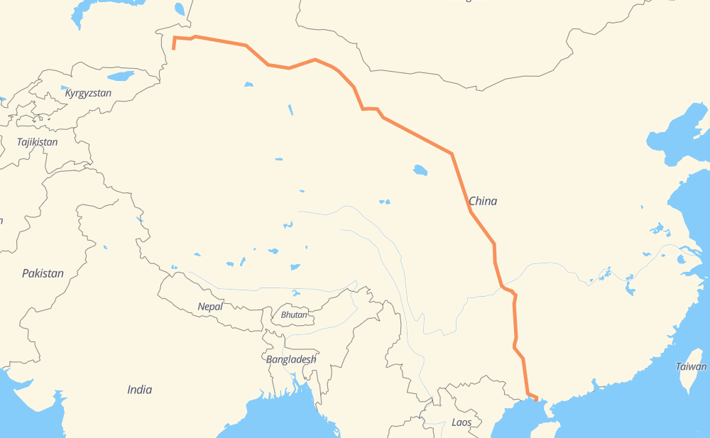
The distance from Yining to Beihai is 4,705 kilometers by road including 4,437 kilometers on motorways. Road takes approximately 50 hours and 57 minutes and goes through Wusu, Kuitun, Sandaohezi, Shihezi, Yumen, Linze and Zhangye.
| Shortest distance by air | 3,574 km ✈️ |
| Car route length | 4,705 km 🚗 |
| Driving time | 50 h 57 min |
| Fuel amount | 376.4 L |
| Fuel cost | 560.9 GBP |
| Point | Distance | Time | Fuel | |
| Yining | 0 km | 00 min | 0.0 L | |
|
S313 G30 431 km, 4 h 32 min
|
||||
| Wusu | 431 km | 4 h 32 min | 33.8 L | |
|
G30 21 km, 14 min
|
||||
| Kuitun | 451 km | 4 h 46 min | 35.6 L | |
|
G30 70 km, 44 min
|
||||
| Sandaohezi | 521 km | 5 h 30 min | 39.4 L | |
|
G30 30 km, 18 min
|
||||
| Shihezi | 551 km | 5 h 49 min | 44.0 L | |
|
G30 1,198 km, 12 h 26 min
|
||||
| Yumen | 1,749 km | 18 h 15 min | 139.5 L | |
|
G30 307 km, 3 h 13 min
|
||||
| Linze | 2,056 km | 21 h 29 min | 164.2 L | |
|
G30 38 km, 24 min
|
||||
| Zhangye | 2,094 km | 21 h 53 min | 166.9 L | |
|
G30 169 km, 1 h 56 min
|
||||
| Yongchang | 2,263 km | 23 h 50 min | 180.0 L | |
|
G30 119 km, 1 h 20 min
|
||||
| Gulang | 2,382 km | 25 h 10 min | 190.1 L | |
|
G30 75 km, 50 min
|
||||
| Huazangsi | 2,458 km | 26 h 01 min | 196.3 L | |
|
G30 33 km, 23 min
|
||||
| Yongdeng | 2,491 km | 26 h 24 min | 198.6 L | |
|
G30 G75 520 km, 5 h 58 min
|
||||
| Longnan | 3,011 km | 32 h 23 min | 240.7 L | |
|
G75 279 km, 3 h 04 min
|
||||
| Langzhong | 3,290 km | 35 h 28 min | 262.9 L | |
|
G75 638 km, 7 h 07 min
|
||||
| Yongyang | 3,928 km | 42 h 35 min | 313.8 L | |
|
G69 44 km, 30 min
|
||||
| Fuquan | 3,972 km | 43 h 05 min | 317.3 L | |
|
S35 G75 734 km, 7 h 51 min
|
||||
| Beihai | 4,706 km | 50 h 57 min | 375.9 L | |
Frequently Asked Questions
How much does it cost to drive from Yining to Beihai?
Fuel cost: 560.9 GBP
This fuel cost is calculated as: (Route length 4,705 km / 100 km) * (Fuel consumption 8 L/100 km) * (Fuel price 1.49 GBP / L)
You can adjust fuel consumption and fuel price here.
How long is a car ride from Yining to Beihai?
Driving time: 50 h 57 min
This time is calculated for driving at the maximum permitted speed, taking into account traffic rules restrictions.
- 124 km with a maximum speed 112 km/h = 1 h 6 min
- 2,902 km with a maximum speed 100 km/h = 29 h 1 min
- 106 km with a maximum speed 96 km/h = 1 h 6 min
- 1,566 km with a maximum speed 80 km/h = 19 h 34 min
- 4 km with a maximum speed 60 km/h = 4 min
- 3 km with a maximum speed 50 km/h = 3 min
- 1 km with a maximum speed 40 km/h = 1 min
The calculated driving time does not take into account intermediate stops and traffic jams.
How far is Yining to Beihai by land?
The distance between Yining and Beihai is 4,705 km by road including 4,437 km on motorways.
Precise satellite coordinates of highways were used for this calculation. The start and finish points are the centers of Yining and Beihai respectively.
How far is Yining to Beihai by plane?
The shortest distance (air line, as the crow flies) between Yining and Beihai is 3,574 km.
This distance is calculated using the Haversine formula as a great-circle distance between two points on the surface of a sphere. The start and finish points are the centers of Yining and Beihai respectively. Actual distance between airports may be different.
How many hours is Yining from Beihai by plane?
Boeing 737 airliner needs 4 h 28 min to cover the distance of 3,574 km at a cruising speed of 800 km/h.
Small plane "Cessna 172" needs 16 h 14 min to flight this distance at average speed of 220 km/h.
This time is approximate and do not take into account takeoff and landing times, airport location and other real world factors.
How long is a helicopter ride from Yining to Beihai?
Fast helicopter "Eurocopter AS350" or "Hughes OH-6 Cayuse" need 14 h 53 min to cover the distance of 3,574 km at a cruising speed of 240 km/h.
Popular "Robinson R44" needs 17 h 1 min to flight this distance at average speed of 210 km/h.
This time is approximate and do not take into account takeoff and landing times, aerodrome location and other real world factors.
What city is halfway between Yining and Beihai?
The halfway point between Yining and Beihai is Huangyang. It is located about 14 km from the exact midpoint by road.
The distance from Huangyang to Yining is 2,367 km and driving will take about 24 h 57 min. The road between Huangyang and Beihai has length 2,339 km and will take approximately 25 h 59 min.
The other cities located close to halfway point:
Where is Yining in relation to Beihai?
Yining is located 3,574 km north-west of Beihai.
Yining has geographic coordinates: latitude 43.9052, longitude 81.27478.
Beihai has geographic coordinates: latitude 21.47991, longitude 109.10681.
Which highway goes from Yining to Beihai?
The route from Yining to Beihai follows G30, G75, G69, G212.
Other minor sections pass along the road:
- G65: 67 km
- G3016: 52 km
- G312: 36 km
- G2201: 32 km
- G78: 30 km
- G316: 30 km
- G7201: 26 km
- S35: 24 km
- G209: 19 km
- G80: 18 km
- S202: 15 km
- G6: 12 km
- G60: 12 km
- G325: 10 km
- G218: 6 km
- S313: 5 km
- G7211: 4 km
- G318: 4 km
- 312国道: 2 km
- 312国道: 1 km