Distance between Sutton-on-Sea and Mere
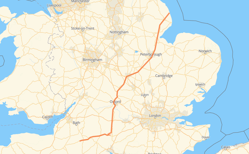
The distance from Sutton-on-Sea to Mere is 376 kilometers by road including 9 kilometers on motorways. Road takes approximately 4 hours and 6 minutes and goes through Alford, Spilsby, Boston, Skirbeck Quarter, Kirton, Spalding and Crowland.
| Shortest distance by air | 302 km ✈️ |
| Car route length | 376 km 🚗 |
| Driving time | 4 h 6 min |
| Fuel amount | 30 L |
| Fuel cost | 44.8 GBP |
| Point | Distance | Time | Fuel | |
| Sutton-on-Sea | 0 km | 00 min | 0.0 L | |
|
A1111 11 km, 08 min
|
||||
| Alford | 11 km | 08 min | 0.8 L | |
|
A1104 A16 12 km, 08 min
|
||||
| Spilsby | 24 km | 16 min | 1.7 L | |
|
A16 26 km, 20 min
|
||||
| Boston | 50 km | 37 min | 3.8 L | |
|
A16 6 km, 04 min
|
||||
| Kirton | 56 km | 41 min | 4.2 L | |
|
A16 17 km, 10 min
|
||||
| Spalding | 74 km | 52 min | 5.8 L | |
|
A16 15 km, 09 min
|
||||
| Crowland | 88 km | 1 h 01 min | 6.7 L | |
|
A16 A1139 16 km, 10 min
|
||||
| Old Fletton | 105 km | 1 h 12 min | 8.3 L | |
|
A1139 A605 20 km, 12 min
|
||||
| Oundle | 125 km | 1 h 24 min | 9.8 L | |
|
A605 A34 251 km, 2 h 41 min
|
||||
| Mere | 376 km | 4 h 06 min | 29.8 L | |
Frequently Asked Questions
How much does it cost to drive from Sutton-on-Sea to Mere?
Fuel cost: 44.8 GBP
This fuel cost is calculated as: (Route length 376 km / 100 km) * (Fuel consumption 8 L/100 km) * (Fuel price 1.49 GBP / L)
You can adjust fuel consumption and fuel price here.
How long is a car ride from Sutton-on-Sea to Mere?
Driving time: 4 h 6 min
This time is calculated for driving at the maximum permitted speed, taking into account traffic rules restrictions.
- 9 km with a maximum speed 112 km/h = 4 min
- 305 km with a maximum speed 96 km/h = 3 h 10 min
- 10 km with a maximum speed 80 km/h = 7 min
- 34 km with a maximum speed 80 km/h = 25 min
- 13 km with a maximum speed 64 km/h = 12 min
- 4 km with a maximum speed 48 km/h = 5 min
The calculated driving time does not take into account intermediate stops and traffic jams.
How far is Sutton-on-Sea to Mere by land?
The distance between Sutton-on-Sea and Mere is 376 km by road including 9 km on motorways.
Precise satellite coordinates of highways were used for this calculation. The start and finish points are the centers of Sutton-on-Sea and Mere respectively.
How far is Sutton-on-Sea to Mere by plane?
The shortest distance (air line, as the crow flies) between Sutton-on-Sea and Mere is 302 km.
This distance is calculated using the Haversine formula as a great-circle distance between two points on the surface of a sphere. The start and finish points are the centers of Sutton-on-Sea and Mere respectively. Actual distance between airports may be different.
How many hours is Sutton-on-Sea from Mere by plane?
Boeing 737 airliner needs 22 min to cover the distance of 302 km at a cruising speed of 800 km/h.
Small plane "Cessna 172" needs 1 h 22 min to flight this distance at average speed of 220 km/h.
This time is approximate and do not take into account takeoff and landing times, airport location and other real world factors.
How long is a helicopter ride from Sutton-on-Sea to Mere?
Fast helicopter "Eurocopter AS350" or "Hughes OH-6 Cayuse" need 1 h 15 min to cover the distance of 302 km at a cruising speed of 240 km/h.
Popular "Robinson R44" needs 1 h 26 min to flight this distance at average speed of 210 km/h.
This time is approximate and do not take into account takeoff and landing times, aerodrome location and other real world factors.
What city is halfway between Sutton-on-Sea and Mere?
The halfway point between Sutton-on-Sea and Mere is Towcester. It is located about 2 km from the exact midpoint by road.
The distance from Towcester to Sutton-on-Sea is 185 km and driving will take about 2 h 4 min. The road between Towcester and Mere has length 190 km and will take approximately 2 h 1 min.
The other cities located close to halfway point:
Where is Sutton-on-Sea in relation to Mere?
Sutton-on-Sea is located 302 km north-east of Mere.
Sutton-on-Sea has geographic coordinates: latitude 53.31343, longitude 0.28094.
Mere has geographic coordinates: latitude 51.08944, longitude -2.26844.