Distance between Xapuri and Setubinha
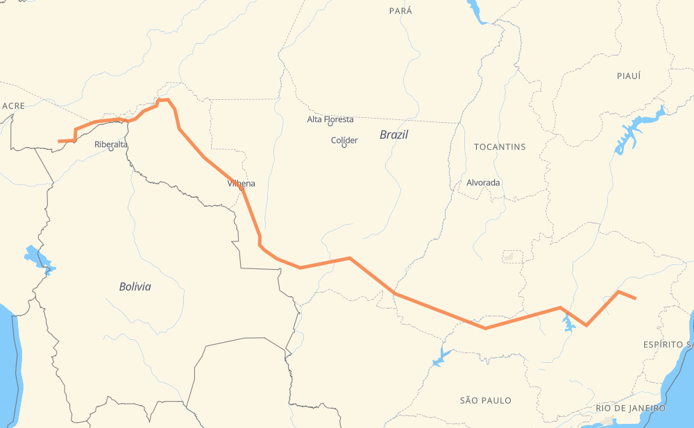
The distance from Xapuri to Setubinha is 4,119 kilometers by road including 235 kilometers on motorways. Road takes approximately 48 hours and 16 minutes and goes through Ariquemes, Senador Guiomard, Ouro Preto do Oeste, Presidente Médici, Cacoal, Pimenta Bueno and Vilhena.
| Shortest distance by air | 2,941 km ✈️ |
| Car route length | 4,119 km 🚗 |
| Driving time | 48 h 16 min |
| Fuel amount | 329.5 L |
| Fuel cost | 491 GBP |
| Point | Distance | Time | Fuel | |
| Xapuri | 0 km | 00 min | 0.0 L | |
|
BR-317 168 km, 2 h 26 min
|
||||
| Senador Guiomard | 168 km | 2 h 26 min | 12.3 L | |
|
BR-317 BR-364 706 km, 8 h 40 min
|
||||
| Ariquemes | 874 km | 11 h 07 min | 67.9 L | |
|
BR-364 118 km, 2 h 00 min
|
||||
| Ouro Preto do Oeste | 992 km | 13 h 07 min | 78.8 L | |
|
BR-364 60 km, 42 min
|
||||
| Presidente Médici | 1,052 km | 13 h 50 min | 82.9 L | |
|
BR-364 89 km, 58 min
|
||||
| Cacoal | 1,140 km | 14 h 48 min | 90.5 L | |
|
BR-364 66 km, 46 min
|
||||
| Pimenta Bueno | 1,207 km | 15 h 35 min | 93.7 L | |
|
BR-364 148 km, 1 h 46 min
|
||||
| Vilhena | 1,354 km | 17 h 22 min | 107.7 L | |
|
BR-364 BR-174 742 km, 8 h 28 min
|
||||
| Novo Mundo | 2,097 km | 25 h 51 min | 167.1 L | |
|
BR-070 BR-364 2,023 km, 22 h 24 min
|
||||
| Setubinha | 4,119 km | 48 h 15 min | 329.1 L | |
Frequently Asked Questions
How much does it cost to drive from Xapuri to Setubinha?
Fuel cost: 491 GBP
This fuel cost is calculated as: (Route length 4,119 km / 100 km) * (Fuel consumption 8 L/100 km) * (Fuel price 1.49 GBP / L)
You can adjust fuel consumption and fuel price here.
How long is a car ride from Xapuri to Setubinha?
Driving time: 48 h 16 min
This time is calculated for driving at the maximum permitted speed, taking into account traffic rules restrictions.
- 180 km with a maximum speed 110 km/h = 1 h 38 min
- 46 km with a maximum speed 100 km/h = 27 min
- 1,916 km with a maximum speed 96 km/h = 19 h 57 min
- 1,733 km with a maximum speed 80 km/h = 21 h 39 min
- 2 km with a maximum speed 70 km/h = 1 min
- 121 km with a maximum speed 60 km/h = 2 h 1 min
- 111 km with a maximum speed 50 km/h = 2 h 12 min
- 9 km with a maximum speed 40 km/h = 12 min
- 1 km with a maximum speed 20 km/h = 3 min
The calculated driving time does not take into account intermediate stops and traffic jams.
How far is Xapuri to Setubinha by land?
The distance between Xapuri and Setubinha is 4,119 km by road including 235 km on motorways.
Precise satellite coordinates of highways were used for this calculation. The start and finish points are the centers of Xapuri and Setubinha respectively.
How far is Xapuri to Setubinha by plane?
The shortest distance (air line, as the crow flies) between Xapuri and Setubinha is 2,941 km.
This distance is calculated using the Haversine formula as a great-circle distance between two points on the surface of a sphere. The start and finish points are the centers of Xapuri and Setubinha respectively. Actual distance between airports may be different.
How many hours is Xapuri from Setubinha by plane?
Boeing 737 airliner needs 3 h 40 min to cover the distance of 2,941 km at a cruising speed of 800 km/h.
Small plane "Cessna 172" needs 13 h 22 min to flight this distance at average speed of 220 km/h.
This time is approximate and do not take into account takeoff and landing times, airport location and other real world factors.
How long is a helicopter ride from Xapuri to Setubinha?
Fast helicopter "Eurocopter AS350" or "Hughes OH-6 Cayuse" need 12 h 15 min to cover the distance of 2,941 km at a cruising speed of 240 km/h.
Popular "Robinson R44" needs 14 h to flight this distance at average speed of 210 km/h.
This time is approximate and do not take into account takeoff and landing times, aerodrome location and other real world factors.
What city is halfway between Xapuri and Setubinha?
The halfway point between Xapuri and Setubinha is Novo Mundo. It is located about 37 km from the exact midpoint by road.
The distance from Novo Mundo to Xapuri is 2,097 km and driving will take about 25 h 50 min. The road between Novo Mundo and Setubinha has length 2,023 km and will take approximately 22 h 25 min.
The other cities located close to halfway point:
Where is Xapuri in relation to Setubinha?
Xapuri is located 2,941 km west of Setubinha.
Xapuri has geographic coordinates: latitude -10.65112, longitude -68.50179.
Setubinha has geographic coordinates: latitude -17.59951, longitude -42.16167.
Which highway goes from Xapuri to Setubinha?
The route from Xapuri to Setubinha follows BR-364, BR-174, BR-365, BR-070, MGC-367, BR-367, BR-452, BR-163, BR-317, BR-259, BR-040.
Other minor sections pass along the road:
- BR-060: 96 km
- MG-308: 94 km
- BR-153: 57 km
- MGC-259: 43 km
- LMG-721: 26 km
- MGC-451: 25 km
- BR-451: 25 km
- MT-407: 16 km
- AC-485: 10 km
- BR-120: 7 km
- MT-100: 7 km
- AC-040: 6 km
- BR-158: 5 km
- MGC-120: 5 km
- BR-050: 5 km
- CMG-120: 2 km