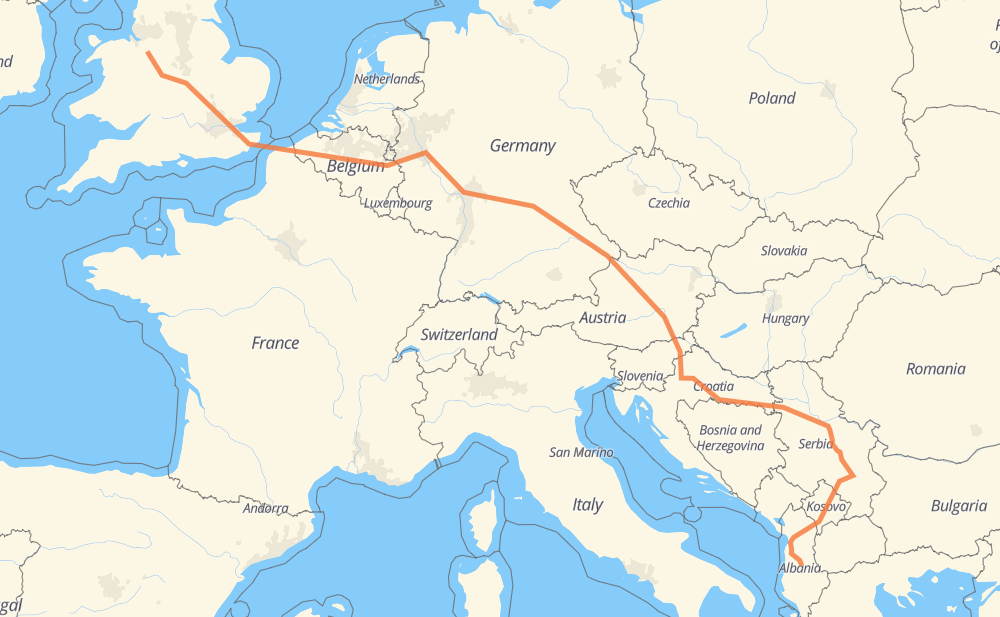
Distance between Nantwich and Bathës
The distance from Nantwich to Bathës is 2,985 kilometers by road including 2,651 kilometers on motorways. Road takes approximately 32 hours and 6 minutes and goes through Birmingham, St Albans, London, Calais, Dunkirk, Bruges and Ghent.
| Shortest distance by air | 2,155 km ✈️ |
| Car route length | 2,985 km 🚗 |
| Driving time | 32 h 6 min |
| Fuel amount | 238.8 L |
| Fuel cost | 355.9 GBP |
| Point | Distance | Time | Fuel | |
| Nantwich | 0 km | 00 min | 0.0 L | |
|
B5074 M6 93 km, 56 min
|
||||
| Birmingham | 93 km | 56 min | 6.9 L | |
|
M6 M1 152 km, 1 h 22 min
|
||||
| St Albans | 245 km | 2 h 19 min | 19.2 L | |
|
A414 M25 35 km, 19 min
|
||||
| London | 281 km | 2 h 38 min | 20.7 L | |
|
M25 M20 179 km, 4 h 07 min
|
||||
| Calais | 459 km | 6 h 45 min | 36.4 L | |
|
A 16 35 km, 20 min
|
||||
| Dunkirk | 494 km | 7 h 05 min | 39.2 L | |
|
A 16 E40 66 km, 36 min
|
||||
| Bruges | 560 km | 7 h 42 min | 44.6 L | |
|
E40 39 km, 20 min
|
||||
| Ghent | 599 km | 8 h 02 min | 47.4 L | |
|
E40 154 km, 1 h 23 min
|
||||
| Lieja | 753 km | 9 h 26 min | 59.8 L | |
|
E40 A 3 270 km, 2 h 44 min
|
||||
| Wiesbaden | 1,023 km | 12 h 10 min | 81.4 L | |
|
A 3 36 km, 22 min
|
||||
| Offenbach del Meno | 1,059 km | 12 h 32 min | 84.6 L | |
|
A 3 208 km, 2 h 14 min
|
||||
| Nuremberg | 1,268 km | 14 h 47 min | 101.0 L | |
|
A 3 491 km, 4 h 57 min
|
||||
| Graz | 1,758 km | 19 h 45 min | 140.1 L | |
|
A9 A2 177 km, 1 h 42 min
|
||||
| Zagreb | 1,935 km | 21 h 27 min | 154.1 L | |
|
A3 407 km, 3 h 43 min
|
||||
| Belgrade | 2,342 km | 25 h 11 min | 184.4 L | |
|
A1 345 km, 3 h 29 min
|
||||
| Pristina | 2,687 km | 28 h 41 min | 214.9 L | |
|
R 7 110 km, 1 h 09 min
|
||||
| Kukës | 2,798 km | 29 h 50 min | 223.5 L | |
|
A1 96 km, 59 min
|
||||
| Laç | 2,893 km | 30 h 50 min | 231.4 L | |
|
A1 46 km, 36 min
|
||||
| Tirana | 2,939 km | 31 h 26 min | 234.7 L | |
|
A3 37 km, 29 min
|
||||
| Elbasan | 2,976 km | 31 h 56 min | 237.8 L | |
|
SH3 SH70 9 km, 09 min
|
||||
| Bathës | 2,986 km | 32 h 06 min | 238.8 L | |
Frequently Asked Questions
How much does it cost to drive from Nantwich to Bathës?
Fuel cost: 355.9 GBP
This fuel cost is calculated as: (Route length 2,985 km / 100 km) * (Fuel consumption 8 L/100 km) * (Fuel price 1.49 GBP / L)
You can adjust fuel consumption and fuel price here.
How long is a car ride from Nantwich to Bathës?
Driving time: 32 h 6 min
This time is calculated for driving at the maximum permitted speed, taking into account traffic rules restrictions.
- 1,673 km with a maximum speed 112 km/h = 14 h 56 min
- 85 km with a maximum speed 110 km/h = 46 min
- 516 km with a maximum speed 100 km/h = 5 h 9 min
- 80 km with a maximum speed 96 km/h = 49 min
- 99 km with a maximum speed 90 km/h = 1 h 5 min
- 1 km with a maximum speed 85 km/h = 1 min
- 7 km with a maximum speed 80 km/h = 4 min
- 408 km with a maximum speed 80 km/h = 5 h 6 min
- 8 km with a maximum speed 70 km/h = 6 min
- 1 km with a maximum speed 64 km/h = 1 min
- 14 km with a maximum speed 60 km/h = 13 min
- 17 km with a maximum speed 50 km/h = 20 min
- 3 km with a maximum speed 48 km/h = 3 min
- 12 km with a maximum speed 40 km/h = 17 min
- 2 km with a maximum speed 32 km/h = 3 min
- 59 km with a maximum speed 20 km/h = 2 h 56 min
The calculated driving time does not take into account intermediate stops and traffic jams.
How far is Nantwich to Bathës by land?
The distance between Nantwich and Bathës is 2,985 km by road including 2,651 km on motorways.
Precise satellite coordinates of highways were used for this calculation. The start and finish points are the centers of Nantwich and Bathës respectively.
How far is Nantwich to Bathës by plane?
The shortest distance (air line, as the crow flies) between Nantwich and Bathës is 2,155 km.
This distance is calculated using the Haversine formula as a great-circle distance between two points on the surface of a sphere. The start and finish points are the centers of Nantwich and Bathës respectively. Actual distance between airports may be different.
How many hours is Nantwich from Bathës by plane?
Boeing 737 airliner needs 2 h 41 min to cover the distance of 2,155 km at a cruising speed of 800 km/h.
Small plane "Cessna 172" needs 9 h 47 min to flight this distance at average speed of 220 km/h.
This time is approximate and do not take into account takeoff and landing times, airport location and other real world factors.
How long is a helicopter ride from Nantwich to Bathës?
Fast helicopter "Eurocopter AS350" or "Hughes OH-6 Cayuse" need 8 h 58 min to cover the distance of 2,155 km at a cruising speed of 240 km/h.
Popular "Robinson R44" needs 10 h 15 min to flight this distance at average speed of 210 km/h.
This time is approximate and do not take into account takeoff and landing times, aerodrome location and other real world factors.
What city is halfway between Nantwich and Bathës?
The halfway point between Nantwich and Bathës is Asenham. It is located about 1 km from the exact midpoint by road.
The distance from Asenham to Nantwich is 1,494 km and driving will take about 17 h 13 min. The road between Asenham and Bathës has length 1,492 km and will take approximately 14 h 53 min.
The other cities located close to halfway point:
Where is Nantwich in relation to Bathës?
Nantwich is located 2,155 km north-west of Bathës.
Nantwich has geographic coordinates: latitude 53.06714, longitude -2.52212.
Bathës has geographic coordinates: latitude 41.05522, longitude 20.06741.
Which highway goes from Nantwich to Bathës?
The route from Nantwich to Bathës follows A 3, A3, A1, E40, A9, M6, R 7.
Other minor sections pass along the road:
- M1: 92 km
- 35: 80 km
- A8: 76 km
- A2: 75 km
- A 4: 69 km
- A 16: 56 km
- M25: 55 km
- M20: 47 km
- A4: 35 km
- M-25: 26 km
- M-9: 25 km
- R0: 16 km
- A500: 11 km
- A 44: 10 km
- SH60: 10 km
- A414: 9 km
- M2: 9 km
- A282: 8 km
- SH1: 7 km
- SH2: 7 km
- SH70: 7 km
- SH52: 6 km
- 158: 4 km
- A229: 4 km
- SH3: 3 km
- A1081: 2 km
- B5074: 1 km
- SH71: 1 km